

South Florida is in for a wet and unsettled day, with plenty of tropical moisture in place and a stalled front just to our north. Scattered to numerous showers and storms possible this afternoon and evening.
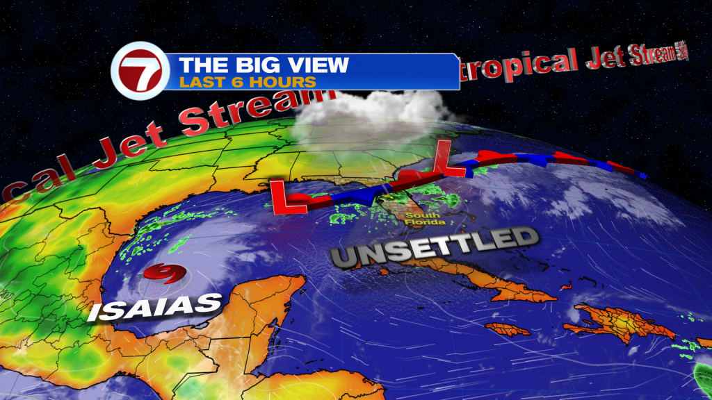
Heavy Downpours & Street Flooding
The main concern today will be heavy rainfall, rather than severe weather. Slow-moving storms could produce very high rainfall rates, with a few spots picking up 2 to 3 inches in a short period of time. With some areas already saturated, localized flooding will be possible, particularly across the East Coast metro and Lake Okeechobee region.
Highs will reach the upper 80’s to around 90 degrees, but it will feel closer to 100 before storms develop.
Another Active Day Thursday
The front remains stalled nearby Thursday, keeping plenty of moisture over South Florida. Expect another round of numerous showers and thunderstorms, especially during the afternoon. Slow-moving heavy downpours could once again lead to isolated areas of street flooding.
The unsettled pattern may linger into Friday and the first part of the weekend before rain chances begin trending closer to a more typical October pattern later in the weekend.
🌀 Isaias Forms in the Gulf
Meanwhile, Tropical Storm Isaias has formed in the Gulf of Mexico, with maximum sustained winds of 40mph as of the 5am advisory.
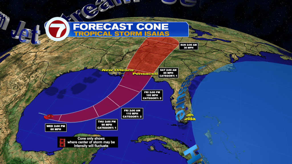
Isaias is forecast to move east-northeast Wednesday before turning northeast and eventually north Thursday and Friday. Rapid strengthening is forecast, with Isaias expected to become a hurricane Thursday and potentially reach Category 2 strength Friday before approaching the northern Gulf Coast.
Very warm Gulf waters will provide plenty of fuel for strengthening over the day or two. However, stronger southwesterly wind shear is expected closer to the northern Gulf Coast, which could cause Isaias to peak in strength before reaching land. It is still forecast to be a hurricane by the time it makes landfall.
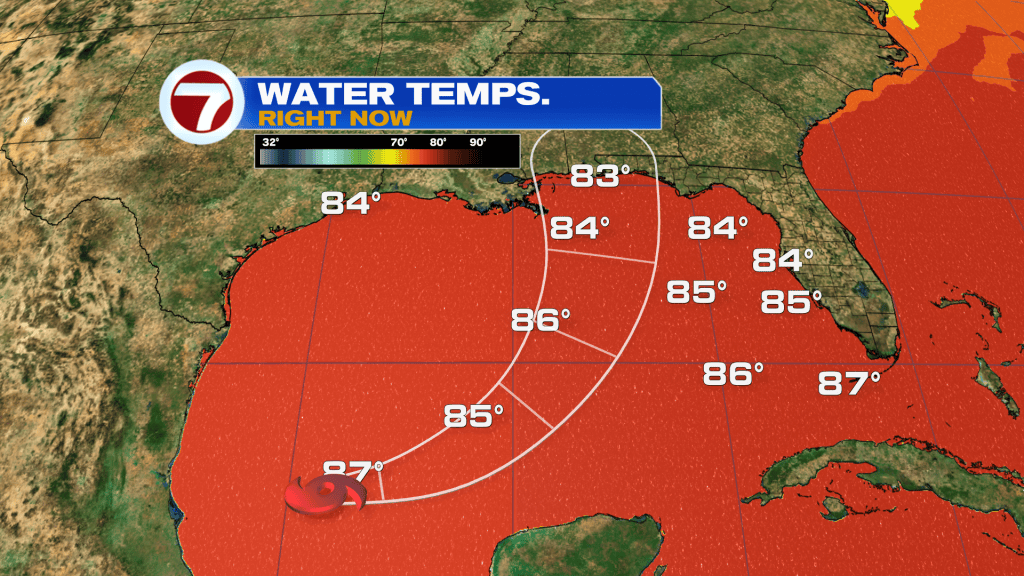
South Florida remains outside the forecast cone and no direct impacts are expected. Locally, our bigger concern remains the deep tropical moisture already in place, bringing rounds of heavy rain and the potential for flooding.
Have a wonderful day South Florida and make it a safe one!
Vivian Gonzalez
Meteorologist, AMS Certified
WSVN Channel 7