

South Florida’s weather pattern is about to take a much wetter turn as deep tropical moisture moves into the region beginning Thursday and lasting through the weekend.
Today still features a typical Summer-like setup with hot temperatures, breezy Southeast winds, and scattered afternoon storms mainly focused inland and across Southwest Florida. A few stronger storms could develop later today with gusty winds and frequent lightning possible.
Temperatures remain hot with highs climbing into the upper 80’s along the East coast and low 90’s inland and across Southwest Florida. Combined with the humidity, heat index values will once again rise into the upper 90’s and lower 100’s.
The bigger weather story arrives Thursday as winds shift more Southerly and tap into deep tropical moisture streaming North from the Caribbean and Gulf waters. Rain and thunderstorm coverage is expected to increase with more widespread coverage of showers and storms likely across South Florida.
We are monitoring the potential for heavy rainfall and possible street flooding issues beginning Thursday and continuing into the weekend. Some locations could see repeated rounds of storms and very heavy downpours over the same areas.
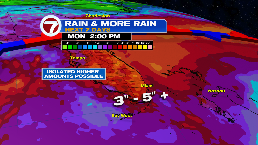
The unsettled pattern is expected to continue through the weekend and possibly into early next week. Model guidance showing 2 to 5 inches of rain with locally higher amounts possible during the next 7 days.
Stay tuned with your Storm Team for the latest.
Vivian Gonzalez
Meteorologist, AMS Certified
WSVN Channel 7