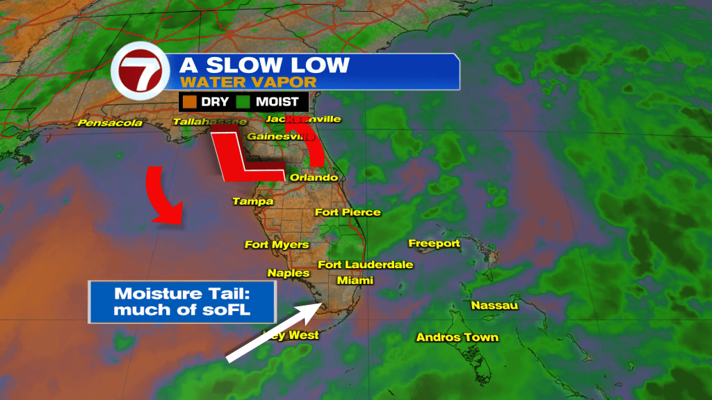
Where it rained, it rained hard Monday. The most persistent rainfall impacted central Broward County with 3 to 5 inches reported and numerous flood advisories. The pounding rain even prompted a rare Flash Flood Warning during the late afternoon. Places like Margate, Lauderhill, and Lauderdale Lakes received some of the strongest activity. Here’s what happened (shown below) as a spinning Upper Low pulled a “tail” of tropical moisture into the region. Broward County was a main target as storms moved northeast and slowed down.
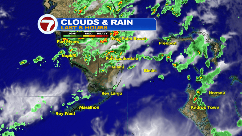
Storms hovered over the same spots as shown on the radar, below. This was the very start of the stormy period.
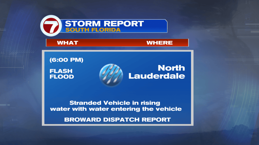
Light steering winds played a big role, keeping the biggest downpours across central Broward. The situation became so bad, in one North Lauderdale neighborhood, that a vehicle was stranded in the pooling waters.
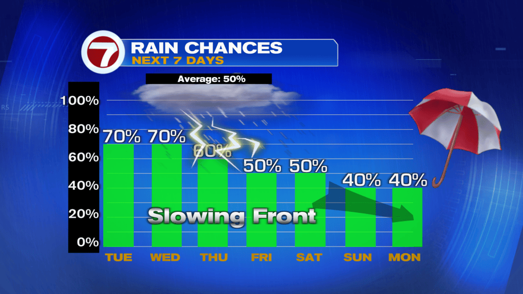
As Tuesday progresses we’ll still have reasons for rain. Yes, more scattered rain is expected.
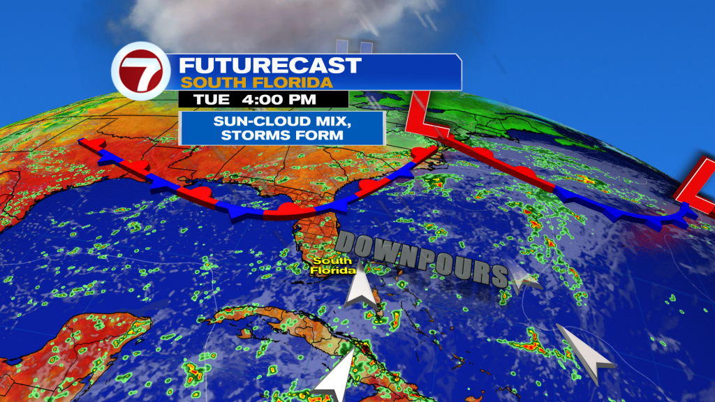
The next weather feature to follow is a Front that will dive southward. Most of the long range models show the boundary (in weak fashion) dropping into the south Florida vicinity. The big question becomes “will we finally dry out”? The rain chance will come down slightly, especially for areas north of Miami. However, southern locations probably won’t notice much of a difference as we go into the first weekend of fall, officially.