It’s a sizzling start to the month of June. On Monday, Miami peaked at 94-degrees, a new record for the date. Interestingly, Ft. Lauderdale was even hotter at 95-degrees (but came up a couple degrees shy of a record in Broward).
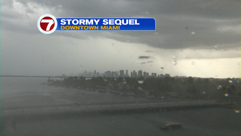
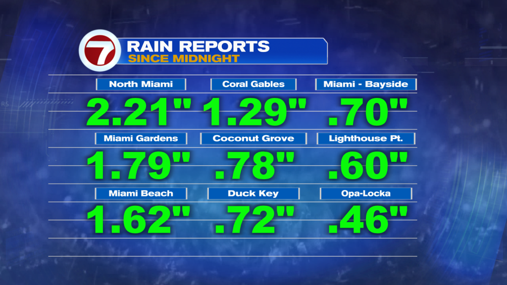
Strong sunshine held on through the start of the afternoon. That’s what allowed temperatures to spike before storm clouds rolled in. Above, you can see the dark clouds building over the Miami by late in the afternoon. As typical for this time of year, some areas picked up a lot more rain than others.
The Tuesday weather map looks very familiar. We remain south of a pair of Fronts that will weaken over time. Moisture will continue to spread our way (from the south and west). You may detect a hint of haze in the sky as a shallow layer of Saharan Dust shifts into the region.
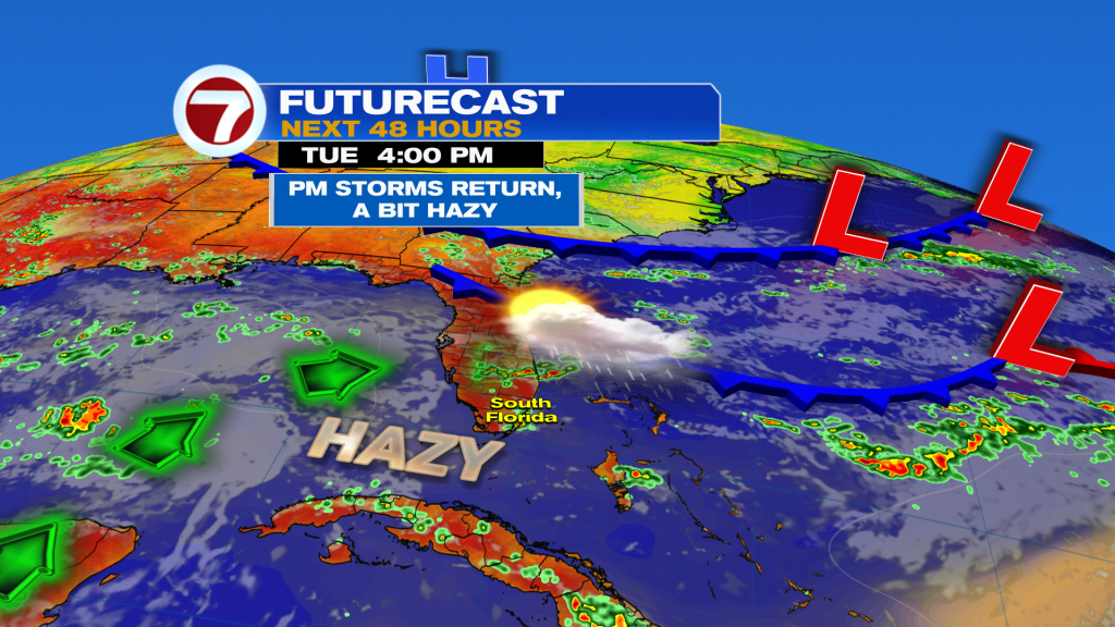
We’ll continue watching the Frontal boundaries into the midweek as they may merge (becoming one). Ultimately, they could settle close to south Florida before stalling out. The result? More wet weather.
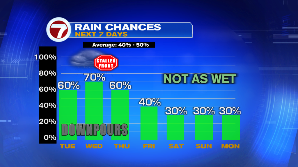
Overall, the forecast calls for unsettled days through Thursday, at least. The extent of the wet stretch will actually depend on the persistence of our “future Front” before it gradually fades away.