

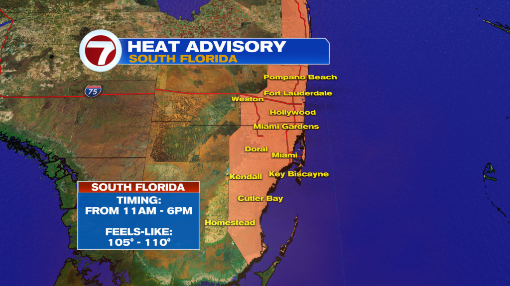
Another hot summer day is on tap across South Florida, with temperatures climbing into the low to mid 90’s and heat index values reaching 105 to 110 this afternoon. A Heat Advisory is in effect from 11am to 6pm for portions of the east coast metro of Broward and Miami-Dade Counties.
While the heat will be the main story, most neighborhoods will remain dry for much of the day thanks to lingering Saharan dust and drier air. Only isolated to scattered afternoon thunderstorms are expected, with the best chance of rain across the Lake Okeechobee region and northern Broward and Palm Beach Counties. A few storms may drift farther south later in the day since more moisture is moving into the area.
Any storm that develops could produce brief heavy rain, frequent lightning, and gusty winds.
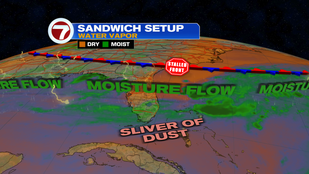
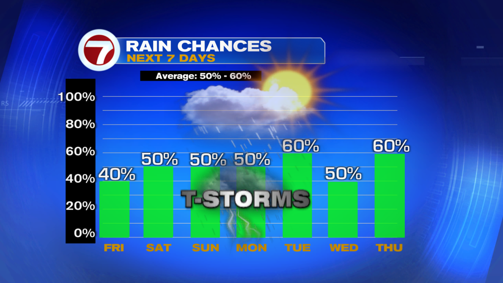
Rain chances will begin to increase this weekend as deeper tropical moisture returns to South Florida. Expect more widespread afternoon showers and thunderstorms Saturday through early next week, with locally heavy rain and gusty winds possible.
Have a wonderful day South Florida and make it a safe one!
Vivian Gonzalez
Meteorologist, AMS Certified
WSVN Channel 7