(WSVN) - It’s been a very warm and humid week so far and it’s going to get turned up another notch over the weekend into next week.
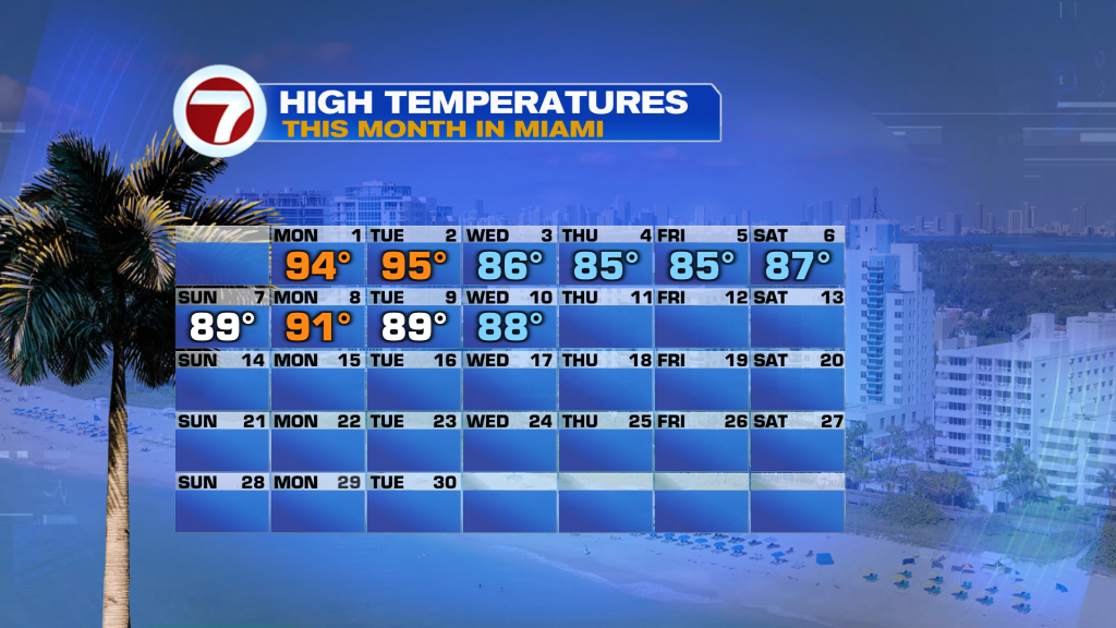
Highs so far this month of June have been near to slightly below average overall, but highs are forecast to switch to above average levels going forward.
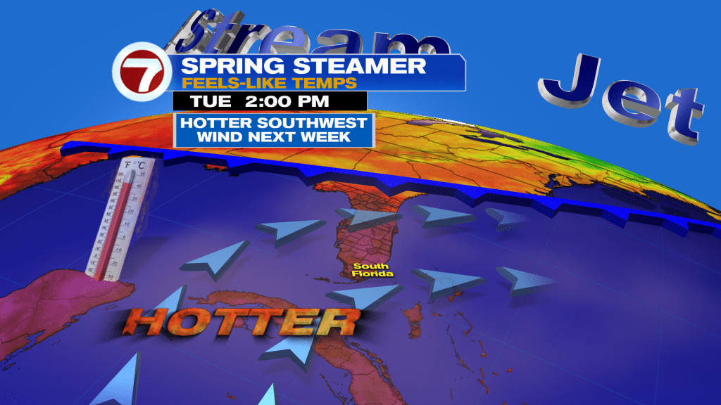
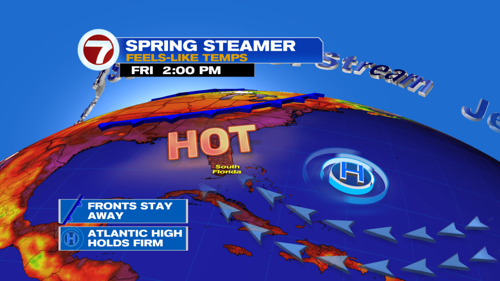
That will translate to highs late week and into the weekend around 90F and in the low to mid 90s during much of next week. However, with the high humidity it will feel like the triple digits each afternoon by the end of the weekend.
With no fronts and high pressure providing a hot, southerly flow for the foreseeable future, that will allow for this summer-like air to settle in.
Despite high pressure being our main weather player the next 7 days for South Florida, we will notice moisture levels increase somewhat as the steering flow for storms shifts.
The result? Higher rain chances this weekend into at least the start of next week.
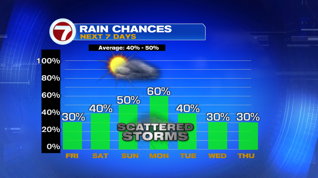
For Friday and Saturday, the majority of showers and storms that develop midday and into the afternoon hours will be inland and to our west but isolated activity will be possible for our more populated areas.

The steering direction for storms is expected to shift out of a general, westerly direction Sunday into next week, though, guiding the afternoon storms near or over the South Florida metro during this time frame.
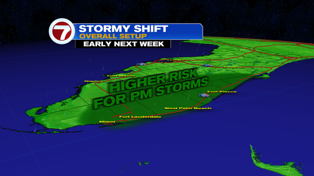
Lots of dry time is expected but that usual, summer storm chance will return early next week.
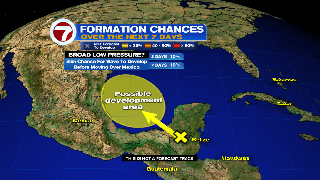
Tropical update
A tropical wave over the Yucatán Peninsula maintains a low, 10% chance of tropical development as it travels northwest toward Mexico. It is no threat to the US and little to no development is expected.
Copyright 2026 Sunbeam Television Corp. All rights reserved. This material may not be published, broadcast, rewritten or redistributed.