

After several days of heavy rain and flooding across South Florida, we’re finally catching a break! Drier air is moving in, bringing more sunshine, lighter winds and very little chance of rain through the weekend.
A Much Better Thursday & Friday
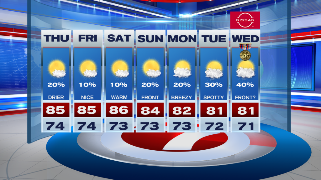
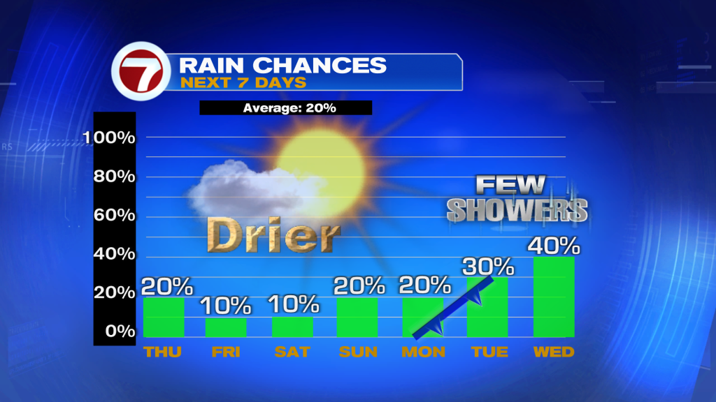
Expect mostly sunny skies with only a 10–20% chance of a passing shower. Temperatures will remain warm, with highs in the mid to upper 80’s.
This stretch of dry weather is especially welcome for neighborhoods still dealing with standing water and flooded roads. Conditions should gradually improve as the rain stays away.
A Beautiful Weekend Ahead!
Looking good for outdoor plans! Saturday and Sunday will feature plenty of sunshine, warm temperatures and rain chances in the single digits.
Minor coastal flooding may still occur around high tide, while beach conditions continue improving as winds and seas settle down.
A Refreshing Change Next Week?
A dry frontal passage and a shift to northerly winds could bring a noticeable temperature change early next week. Afternoon highs may drop into the upper 70’s to low 80’s!
A few showers could also return Monday or Tuesday, but rain chances remain relatively low at 20–30%.
Keeping an Eye on the Tropics
The National Hurricane Center continues monitoring a non-tropical low south of Bermuda that could acquire subtropical characteristics through the weekend. Development chances are 30% over the next 48 hours and 50% over the next seven days.
The system poses no immediate threat to South Florida.
Vivian Gonzalez
Meteorologist, AMS Certified
WSVN Channel 7