

South Florida stays hot, humid and unsettled as we head toward the long holiday weekend, with daily rounds of showers and thunderstorms.
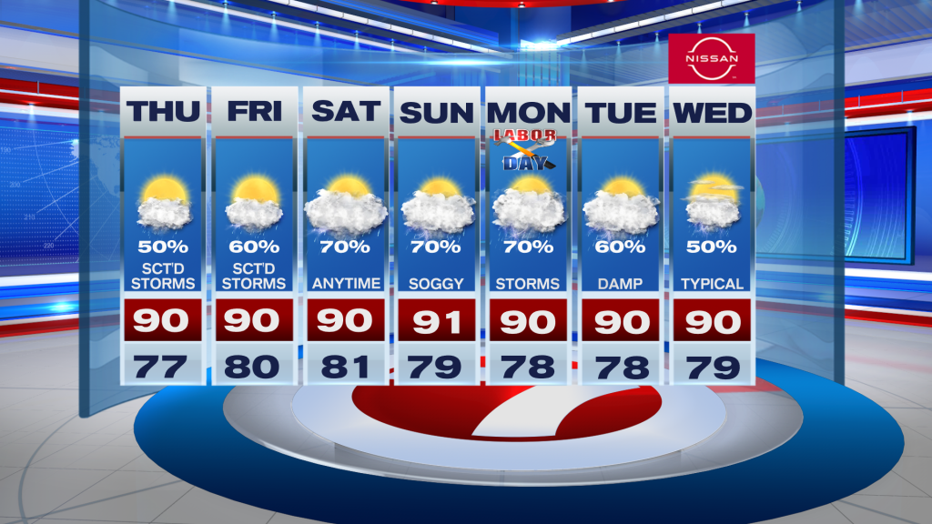
Thursday: Expect some dry time early before storms develop this afternoon and gradually push inland. Heavy downpours, lightning and gusty winds are possible, along with localized flooding. Highs will reach the lower 90s with feels-like temperatures around 100–105.
Friday: Storms may get a slightly later start, but scattered to numerous showers and thunderstorms will develop during the afternoon. Heavy rain and gusty winds remain possible.
Weekend: There’s no major drying trend. Plenty of moisture will keep scattered to numerous storms in the forecast each day. It won’t rain all day everywhere, so mornings and earlier hours should generally offer the better window for outdoor plans. Highs remain in the lower 90’s with heat indices potentially reaching 103–108.
Boating: Winds and seas look manageable overall, with seas around 2 feet or less through Friday. Thunderstorms will be the main concern, capable of producing lightning, sudden gusty winds and briefly rough seas.
Bottom line: Keep the umbrella handy and have a backup plan for outdoor activities as the stormy summertime pattern continues through the long weekend.
Vivian Gonzalez
Meteorologist, AMS Certified
WSVN Channel 7