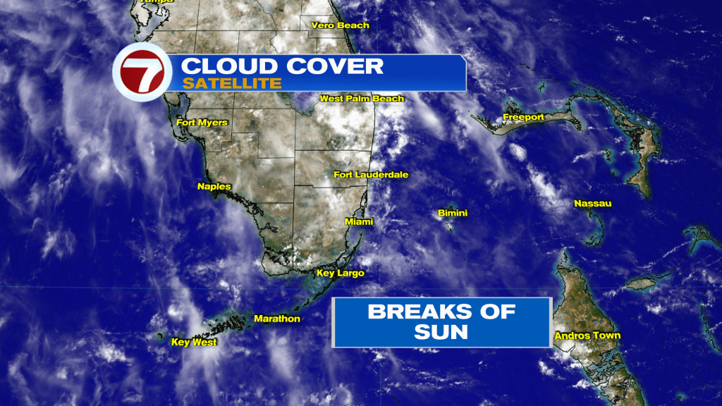
South Florida is in a holding pattern with a fair amount of clouds around. On Tuesday, the sun only “made a cameo appearance but didn’t steal the show.” That’s because high cirrus moved down from the north (thin, wispy looking clouds) while some cumulus came from the Atlantic. Often in June we’d see areas of rain breaking out, but there’s currently enough dry air which continues to minimize the extent of showers.
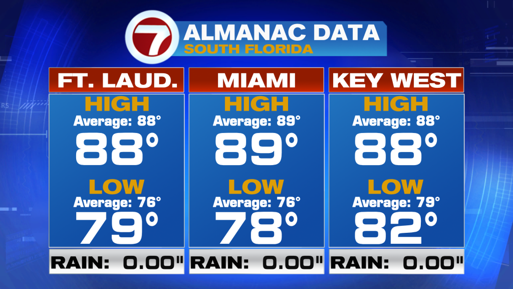
Even with struggling sunshine our temperatures warmed to near-90 degrees. Here’s a look at the official numbers from Tuesday including a comparison to what’s average.
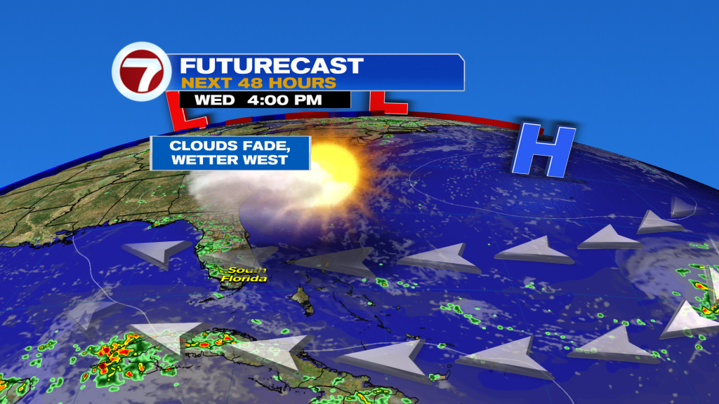
Our pattern is dominated by High Pressure. The center of the high is beginning to drift eastward and that will continue from Wednesday on. With the current position of the High we’re getting a direct easterly flow. It’s welcomed while helping us combat the heat! The ocean breeze will tend to pick up in the morning and afternoon before going lighter overnight.
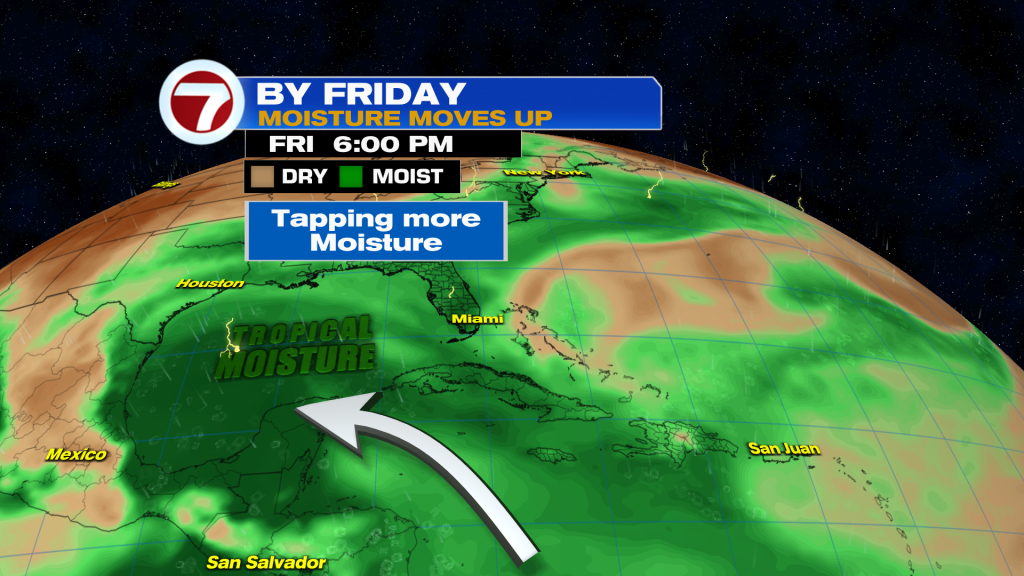
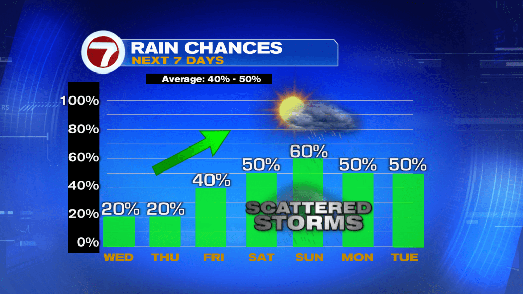
Fast forward to Friday because that’s when we’ll finally have a weather change. With the departing High, winds will turn more out of the south so moisture nudges north out of the tropics. The biggest plume of moist air, and future surplus of rain, will likely shift into the southern and western Gulf region (as shown below).
So, the late week pattern will promote more rain than we’ve seen in recent days. Showers and storms will include with the potential for heavy downpours, at times. It’s also a typical stretch heading into the weekend (seeing on-and-off activity on the radar). If the future flow of wind trends lighter, we may need to monitor for possible flooding. However, It would be more concerning if we didn’t have a dry stretch earlier in the week.
Copyright 2026 Sunbeam Television Corp. All rights reserved. This material may not be published, broadcast, rewritten or redistributed.