South Florida will continue to see above-normal temperatures through the rest of the week, along with scattered afternoon storms and a growing summertime weather pattern.
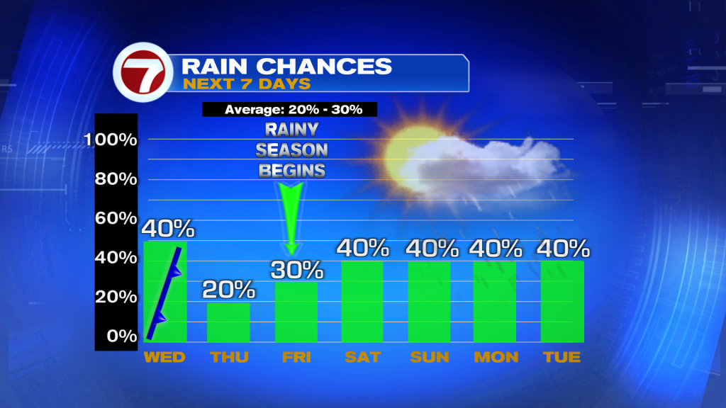
A weakening front remains draped across Central Florida today and will slowly move toward the Lake region before fading out by Thursday. While much of the morning should stay dry, scattered showers and thunderstorms are expected to develop this afternoon into the early evening, especially across inland areas and the East coast metro. Rain chances are slightly lower compared to the past few days, but a few storms could still produce heavy downpours, lightning, and gusty winds.
High temperatures today and Thursday will climb into the upper 80’s and low 90’s, keeping conditions hot and humid across South Florida.
By the weekend and into next week, the weather pattern turns more typical for May with sea breeze-driven storms developing during the afternoons and evenings. The highest rain chances will shift toward inland and Southwest Florida, while a few coastal showers may develop overnight at times.
Even with scattered rain in the forecast, temperatures remain above average through the upcoming week and at this point, any rainfall will be welcome as drought conditions continue across parts of South Florida.
Have a wonderful day South Florida and make it a safe one!
Vivian Gonzalez
Meteorologist, AMS Certified
WSVN Channel 7