

South Florida will experience another typical Summer day with plenty of sunshine, warm temperatures, and scattered afternoon storms.
A few spotty showers may move from south to north this morning, especially near the coast, but most locations will start the day dry with sunshine and temperatures quickly rising through the 80’s.
By this afternoon, highs will reach the low to mid 90’s with heat index values between 100 and 105 degrees. While below Heat Advisory criteria, the combination of heat and humidity can still lead to dehydration and heat-related illnesses. Be sure to stay hydrated and take breaks if spending time outdoors.
Scattered showers and storms are expected to develop during the afternoon, mainly across inland areas and Southwest Florida. A few storms could drift toward the East coast metro areas later in the day. While widespread severe weather is not expected, an isolated stronger storm could produce gusty winds, frequent lightning, and heavy downpours.

Tropics Update
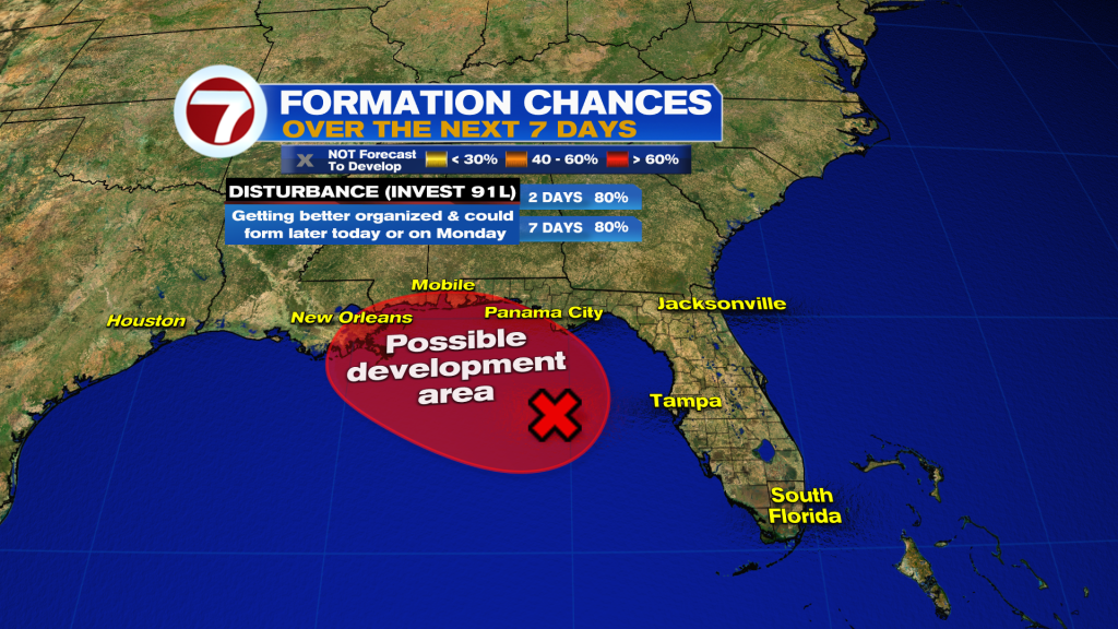
The National Hurricane Center continues to monitor a disturbance in the Gulf now designated Invest 91L. It has become a little better organized and now has a 80% chance of tropical development over the next couple of days.
Regardless of development, the primary impacts will remain along the Northern Gulf Coast where heavy rainfall is possible. No direct impacts are expected for South Florida.
Looking Ahead
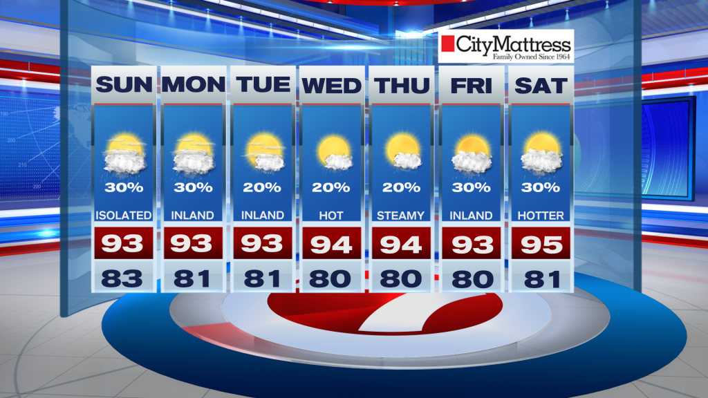
Monday brings a similar forecast with scattered afternoon storms and continued heat. Rain chances may decrease slightly through the middle of next week as drier air moves into the region, allowing temperatures to climb into the mid and upper 90’s.
Stay with Storm Team 7 for the latest forecast updates.
Have a wonderful weekend South Florida and make it a safe one!
Vivian Gonzalez
Meteorologist, AMS Certified
WSVN Channel 7