South Florida is heading into one of its hottest stretches so far this year, with Summer-like heat and mainly dry conditions continuing through the weekend.
Strong high pressure overhead will keep skies mostly sunny today and Saturday, with only a very small chance for a brief inland shower. Afternoon temperatures will climb into the upper 80’s to low 90’s along the coast, while inland communities could reach the mid 90’s.
But it’s the humidity and lack of overnight relief that will make this stretch especially uncomfortable. Heat index values are expected to climb into the upper 90’s today and could top the low 100’s this weekend. Overnight lows will struggle to fall below 80 degrees near the coast, creating warm and muggy nights with little relief from the heat.
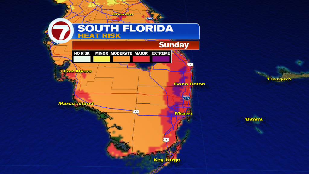
There is also a growing risk for heat-related illness, especially across metro Southeast Florida. A Major Heat Risk is expected this weekend, and some areas could even briefly approach Extreme Heat Risk levels. Anyone spending time outdoors should stay hydrated, take breaks in the shade or air conditioning, and avoid the midday sun.
Rain chances remain very low through Saturday, but moisture begins increasing on Sunday as the next cold front approaches from the north. That front could bring a better chance for showers and storms Monday into Tuesday, along with slightly cooler temperatures behind it.

Have a wonderful day South Florida and make it a safe one!
Vivian Gonzalez
Meteorologist, AMS Certified
WSVN Channel 7