

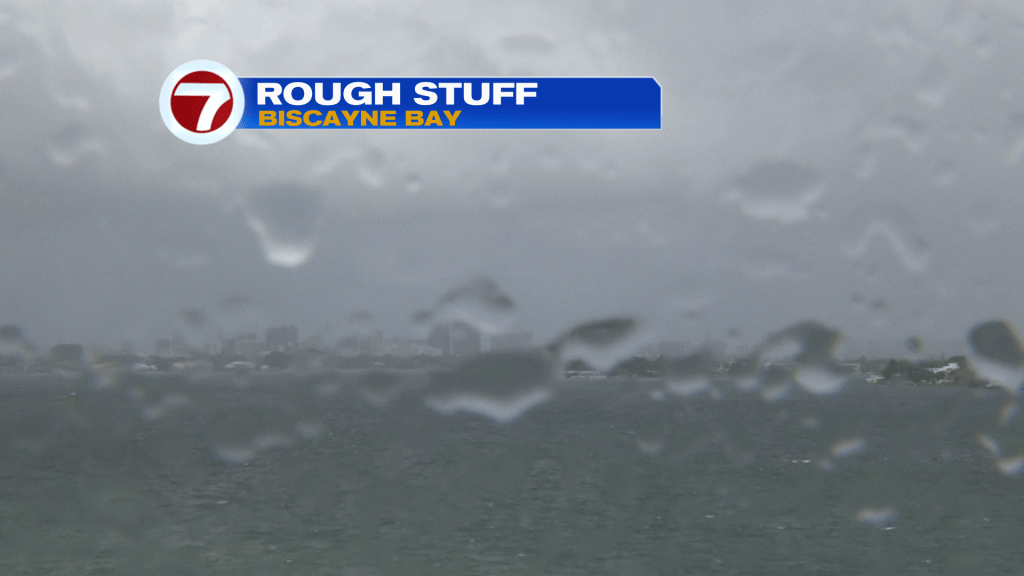
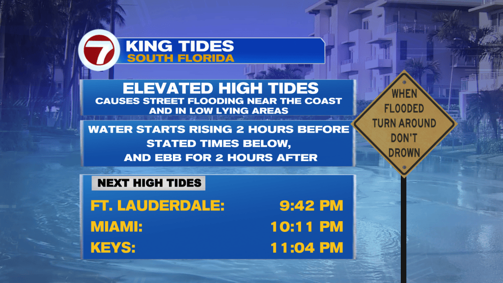
It’s taken awhile but we finally reached the peak of recent King Tides, as well as the windy pattern in south Florida. It’s a big relief following a rough set of days (including Tuesday, as shown along Biscayne Bay).
In addition to the strongest Tides of the year, a Low Pressure disturbance centered over the Bahamas kept the weather stirring. A lengthy Wind Advisory expired at 8 pm Tuesday.
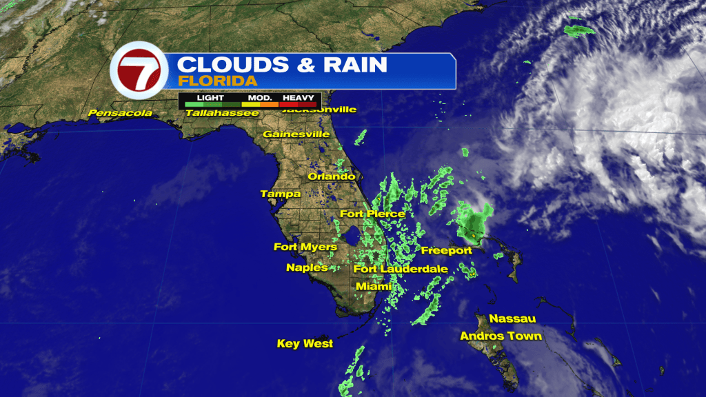
Along with everything else, fast-flying rain squalls continued to swing-in from the Atlantic. That allowed for damp and gloomy weather as winds pulsed high, at times.
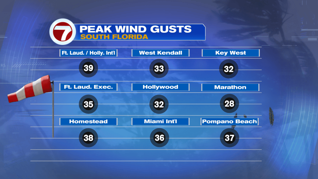
For the second day in a row, winds peaked around 40 mph (gusts). Some more isolated locations and offshore reports even had higher wind tallies Tuesday. The overlapping of windy weather and rising tides mean coastal flooding concerns. There’s still a “major risk” for tidal troubles for the next couple of high tide cycles, well into Wednesday. After that, conditions should gradually improve.
It always takes longer for local waters to subside, compared to land areas once winds decrease, as the forecast calls for. Here’s a check on Wednesday’s weather.
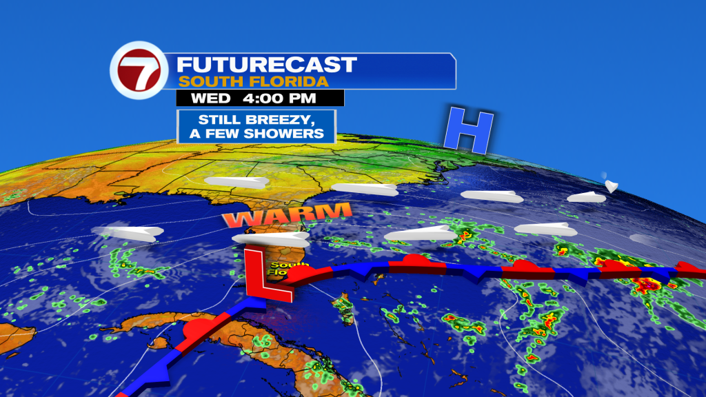
While the weather map may look “unsettling” at first glance (with a Low nearby) we’ll actually find a better setup taking shape. We’ll find less windy and not-as-wet conditions even as a Low Pressure disturbance drifts closer from the Bahamas. Wednesday will turn out to be a transition day, as general activity ramps down.
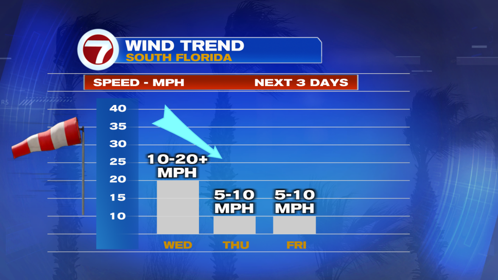
The wind trend, above, depicts calmer stuff ahead. The flow will be easterly, off the Atlantic. While still tapping into ocean air, we’ll have some drying and a fairly quiet stretch of weather! However as October comes to a close, we’ll need to factor in more humidity and warmer temperatures. That means a steamy-feeling Halloween Saturday.