

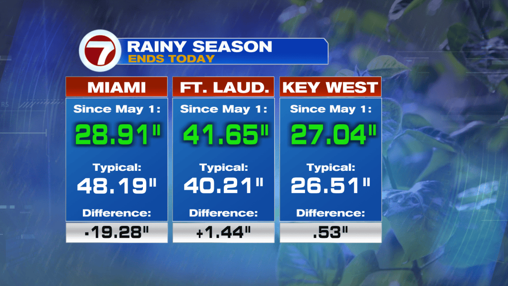
October 15 (today) marks the end of South Florida’s rainy season, which is often the time of the year when the region experiences fewer days with thunderstorms and tropical-like humidity.
This year’s rainy season ended up being quite typical for Fort Lauderdale and Key West but well below average for Miami.
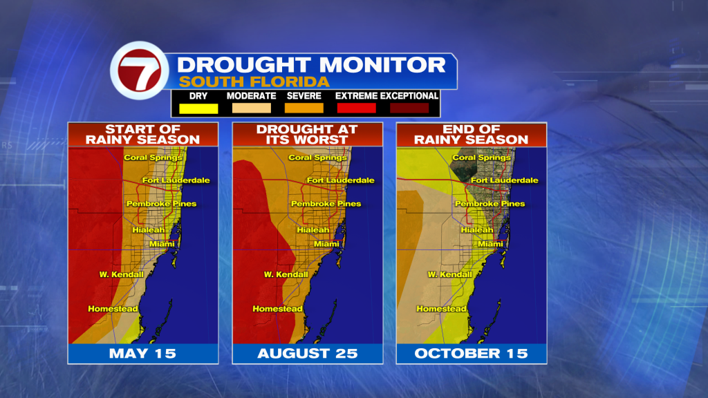
Regardless, this has allowed for a dramatic improvement to the drought situation, especially since the start of September when rainfall became more frequent and heavy.
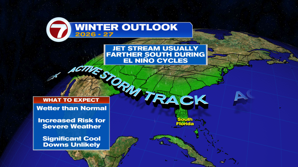
With that said, the winter outlook was also released today by NOAA and it calls for a wetter than normal winter due to El Nino.
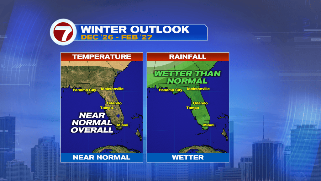
It also means there is an elevated risk for severe weather and a lower risk for significant cool downs.
No cooling or too much in the way of rain is ahead for our Friday. Expect a gradual increase in cloud cover with widely scattered showers and isolated storms possible, especially inland in the afternoons and then near the coast in the evening.
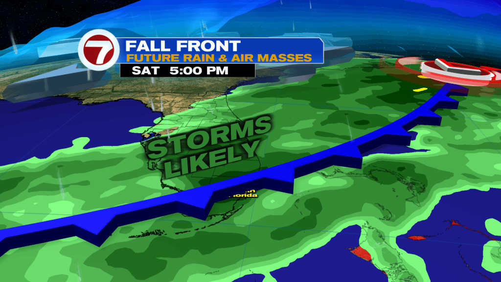
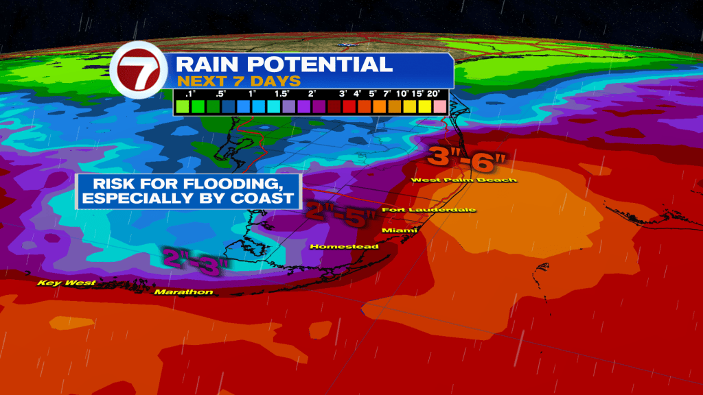
Storms then turn more widespread on Saturday as a front approaches from the north. Winds will be light while moisture levels will be high, thus enhancing the risk for areas of flooding and downpours.
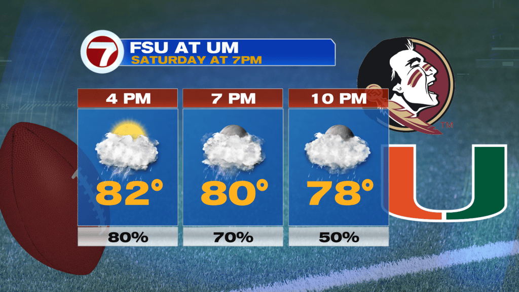
The highest odds for rain will be anytime during the afternoon and evening hours, which could be problematic at Hard Rock Stadium Saturday evening as the Miami Hurricanes takes on the Florida State Seminoles.
Then on Sunday, scattered to numerous passing showers are likely throughout the day, especially in the afternoon, as the front slowly moves to our south, after crossing through early in the day.
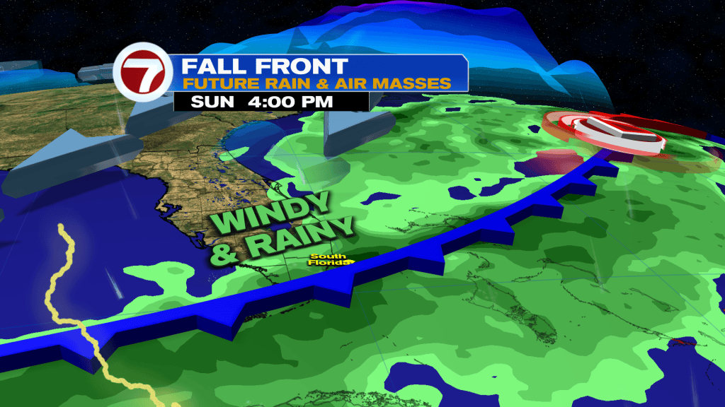
This will also be paired with windy conditions both Sunday and Monday with sustained winds up to 25 mph and gusts up to 30 mph as we’ll be placed between the front and a strong high over the eastern US.
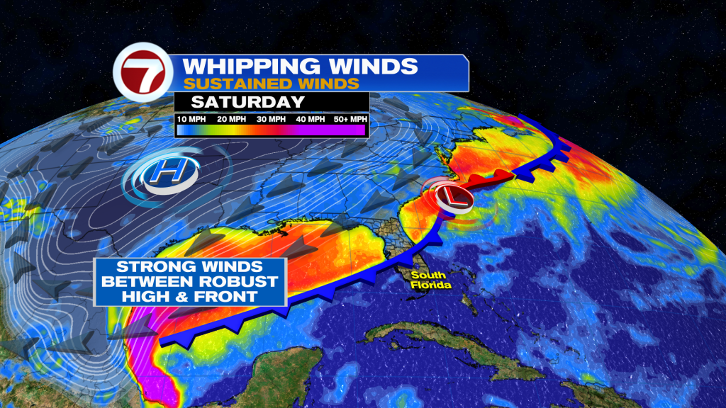
Monday will feature passing showers still possible in the forecast before drier air filters in for mid next week. This front will also bring in milder temperatures — mainly in the afternoons — with forecast highs in the mid 80s next week!