

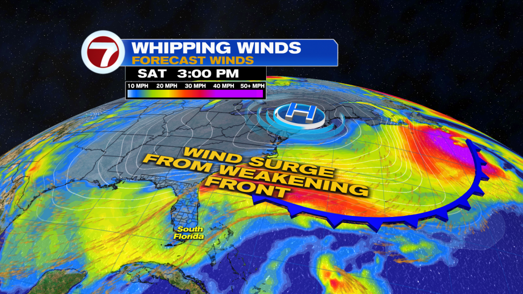
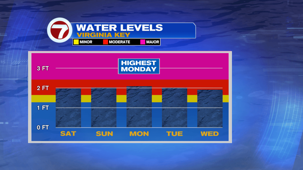
(WSVN) - King Tide flooding remains a growing concern heading into the last full weekend of October as the full moon peaks on Monday, which is when the highest water levels are predicted.
Water levels for many coastal communities have hit moderate flood stage this Friday and there is the potential for major flooding during high tide, especially on Sunday into Monday, as that will coincide with a strong onshore wind and the potential for downpours.
As of midday Friday, Coastal Flood Advisories are issued for the east coast and much of the Florida Keys, meaning moderate flooding is expected during high tide.
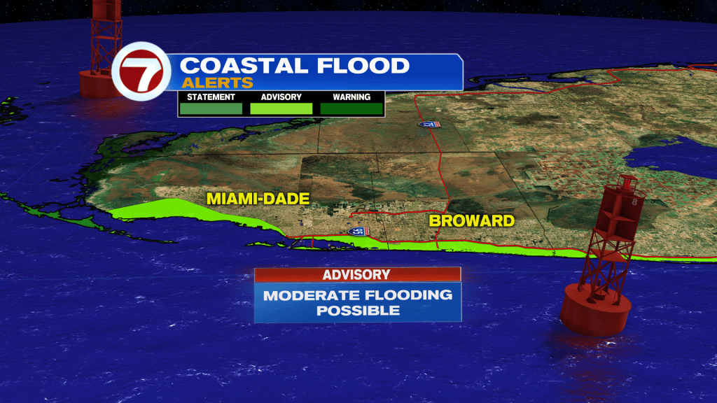
There is a Coastal Flood Warning for the upper Florida Keys, however, where major flooding is expected.
Out of the two days this weekend, Saturday will be the nicer half as it continues to trend drier courtesy of a dry slot flowing in.
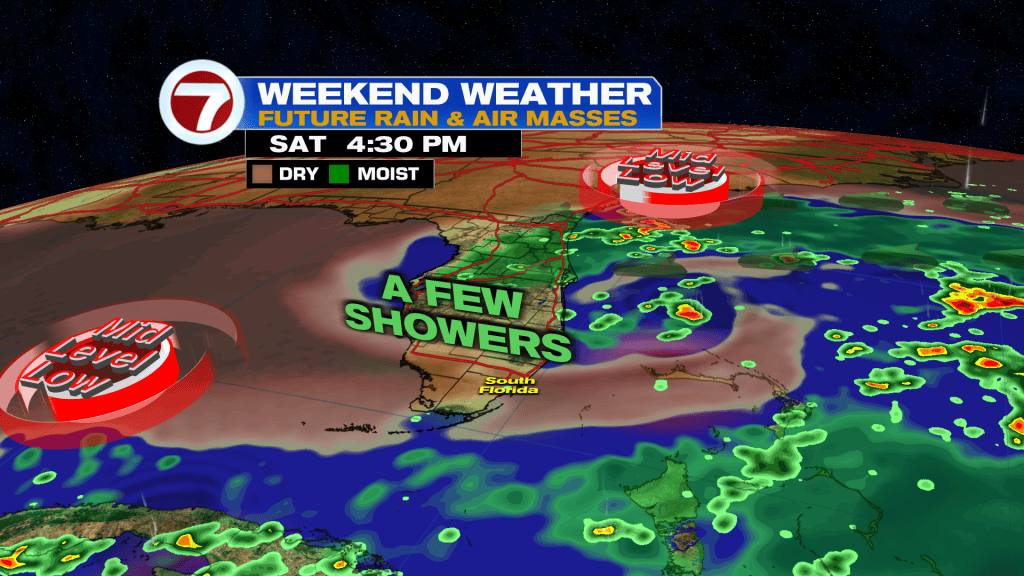
As a result, expect sunshine and passing clouds with only an isolated shower, especially late in the day. It will be breezy with winds up to 25 mph while temperatures top off into the low to mid 80s. The morning will be nice and mild again with lows mainly in the low 70s.
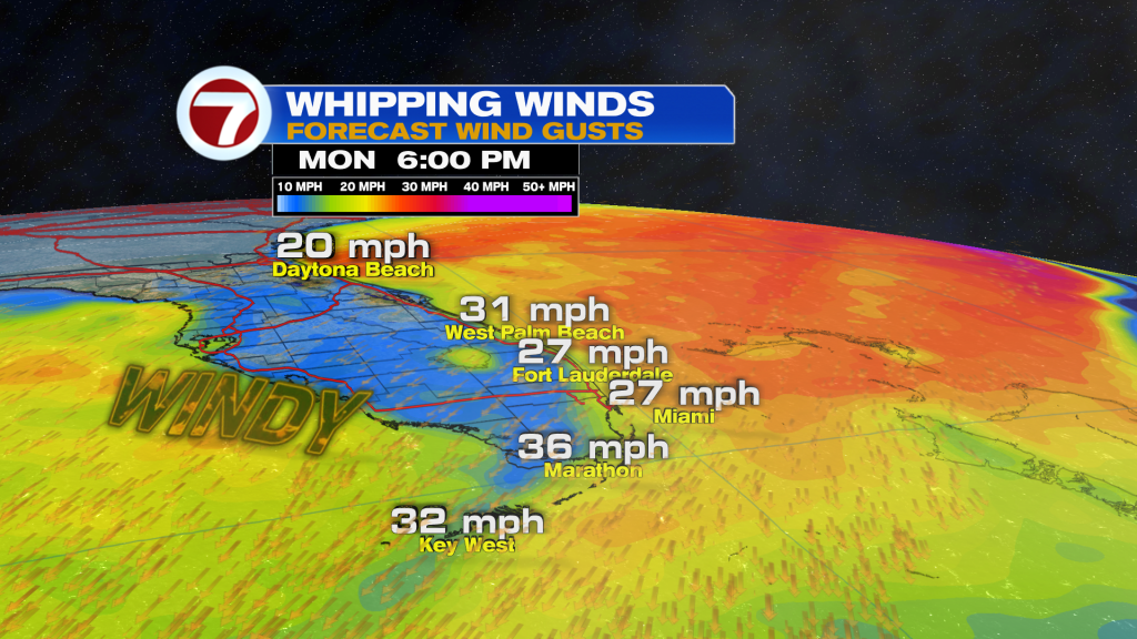
Then on Sunday, expect winds to increase some more with gusts up to 30 mph possible. Moisture levels will also increase as a mid-level low to our south draws in that moisture slot.
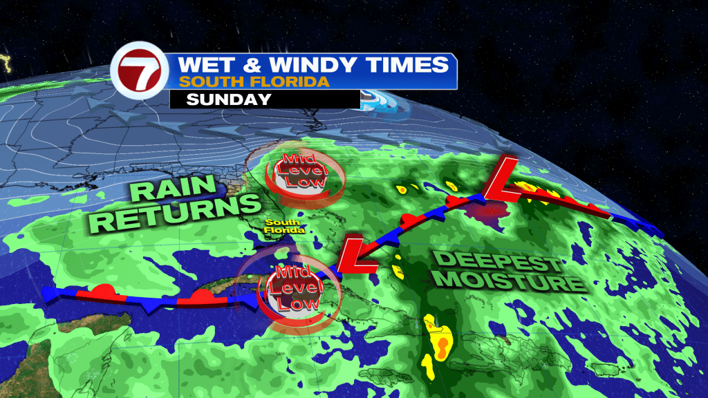
As a result, expect passing scattered to numerous showers and storms throughout the day, especially during the second half. There will be the potential for areas of flooding, especially by the coast, where rainfall totals are projected to be the highest.
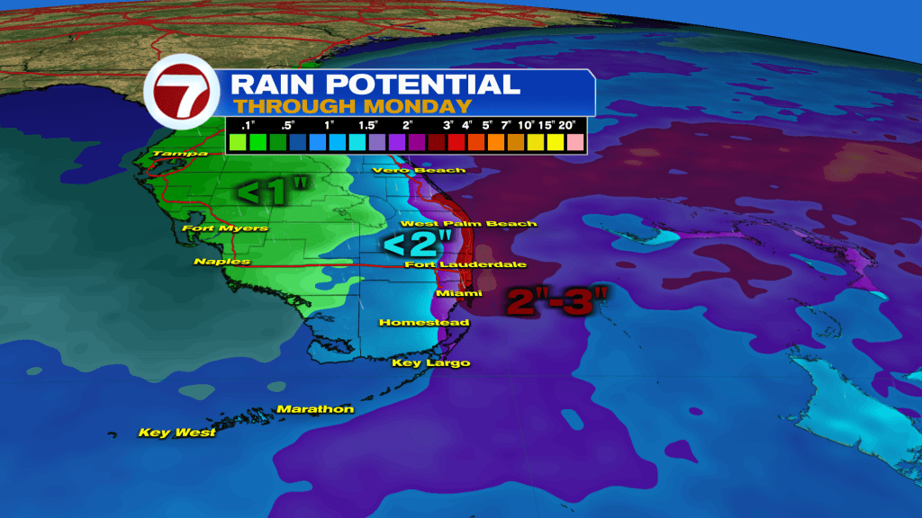
Rain chances remain high on Monday as moisture continues to linger as well as that strong, northeast wind.
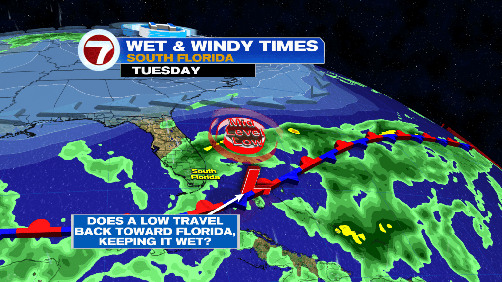
Then as the week progresses, rain chances should start to gradually drop as well as those wind speeds.
Copyright 2026 Sunbeam Television Corp. All rights reserved. This material may not be published, broadcast, rewritten or redistributed.