

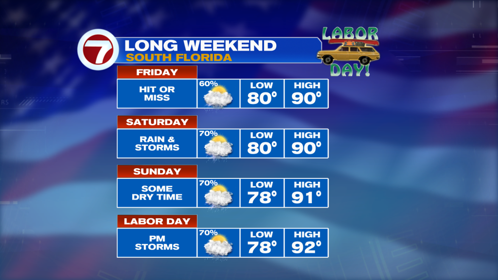
South Florida is heading into the holiday weekend with plenty of heat, humidity and daily thunderstorms. While it won’t be raining everywhere all day, keep the umbrella nearby and have a backup plan for outdoor activities.
Friday: Heavy Downpours Possible
Scattered to numerous showers and storms will develop as the sea breezes move inland. A southeast breeze should gradually push the greatest storm coverage toward the interior and Southwest Florida by mid to late afternoon.
Severe weather isn’t the main concern, but storms could produce heavy downpours and frequent lightning. With plenty of moisture in the atmosphere, high rainfall rates could also lead to localized flooding, especially in areas that have already received heavy rain.
Highs will reach the lower 90s, but the humidity will make it feel more like 103–108 at times.
Saturday: More of the Same
Saturday stays hot and unsettled with another round of scattered to numerous showers and thunderstorms. Storms will be slow-moving, increasing the potential for heavy rainfall and localized flooding.
Expect highs in the lower 90’s with feels-like temperatures again reaching 103–108.
Sunday & Labor Day: Keep the Radar Handy
Deep tropical moisture sticks around through the second half of the weekend. Afternoon and evening storms will favor the interior and East Coast metro areas, with heavy rain, lightning and localized flooding remaining the main concerns.
It won’t necessarily be a complete washout, but anyone with outdoor plans should be prepared to work around the storms.
Boating This Weekend
Outside of thunderstorms, boating conditions look fairly manageable. Seas should remain 2 feet or less through the weekend. The biggest concern will be thunderstorms producing lightning, sudden gusty winds and briefly rough seas.
Vivian Gonzalez
Meteorologist, AMS Certified
WSVN Channel 7