

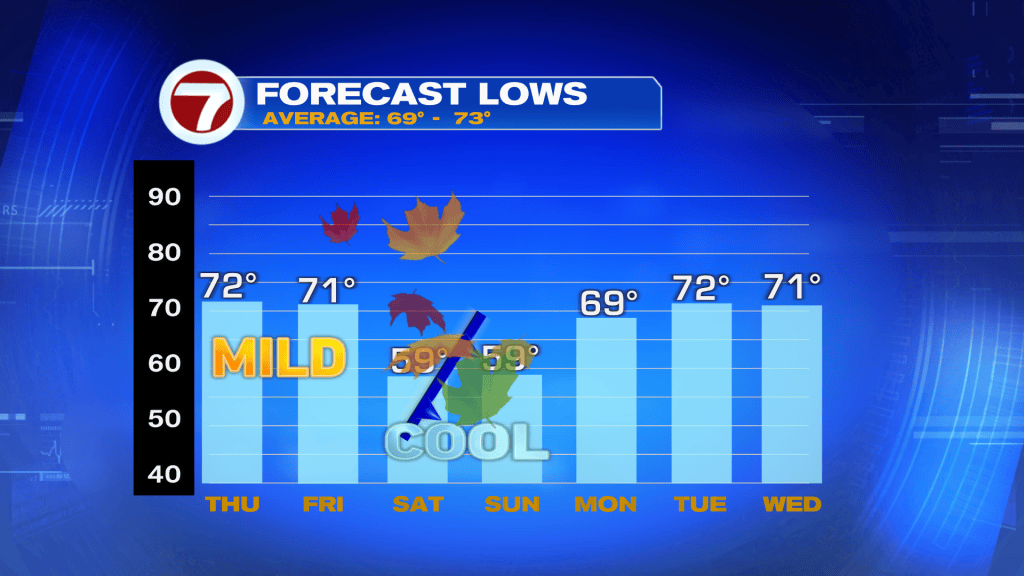
South Florida is in for a big weather change! Before the cooler air arrives, we’ll have to get through another cloudy day with scattered showers.
Showers Today, Cold Front Tonight
Thursday starts mainly dry, but scattered showers will develop during the afternoon and evening. Rain chances increase to 40%, with a few heavy downpours and an isolated storm possible. Highs will reach the low to mid 80’s.
A strong cold front will sweep through South Florida before daybreak Friday. A few showers are possible ahead of it, but most areas will dry out quickly. Expect gradual clearing, increasing northwest winds and noticeably cooler temperatures Friday afternoon.
Sweater Weather This Weekend!
Get those sweaters ready! The coolest air of the fall season so far arrives Saturday morning, with lows dropping into the 50’s across much of South Florida.
Saturday afternoon will feel refreshing, with highs only in the upper 60’s to lower 70’s, about 10 degrees below average! Expect plenty of sunshine, breezy winds and dry conditions.
Sunday morning stays chilly, especially inland, before temperatures gradually warm into the 70’s.
Have a wonderful day South Florida and make it a safe one!
Vivian Gonzalez
Meteorologist, AMS Certified
WSVN Channel 7