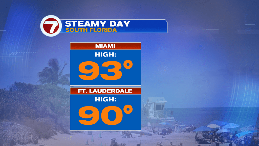
We’ll need to be “rain-ready” once again and prepared to battle heavy downpours as the week continues. On Tuesday, it was all about the late season heat. In Miami, the high peaked at 93-degrees. While it was short of a record, it was hotter than average (usually we’d peak in the upper 80’s).
The extended period of sun was a big reason for the high heat.
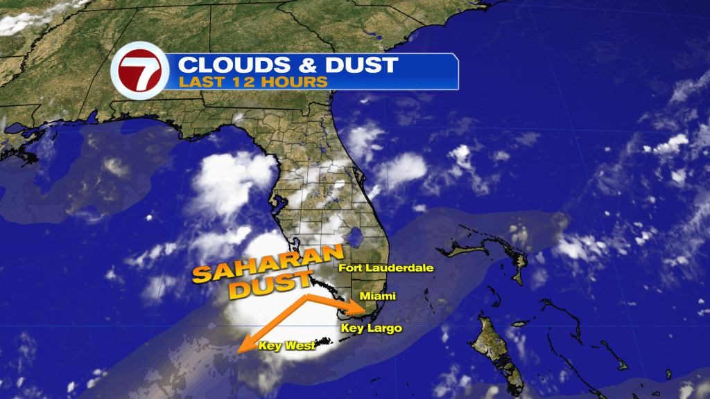
Notice on the satellite above, clouds were a lot more extensive along the Gulf side of the state. Having said that, we (in southeast Florida) need to watch out to the Atlantic Ocean for showers arriving in spurts. Rain bands will tend to move “in and out” for the remainder of the week while storms could become strong on Thursday and Friday. The reason?
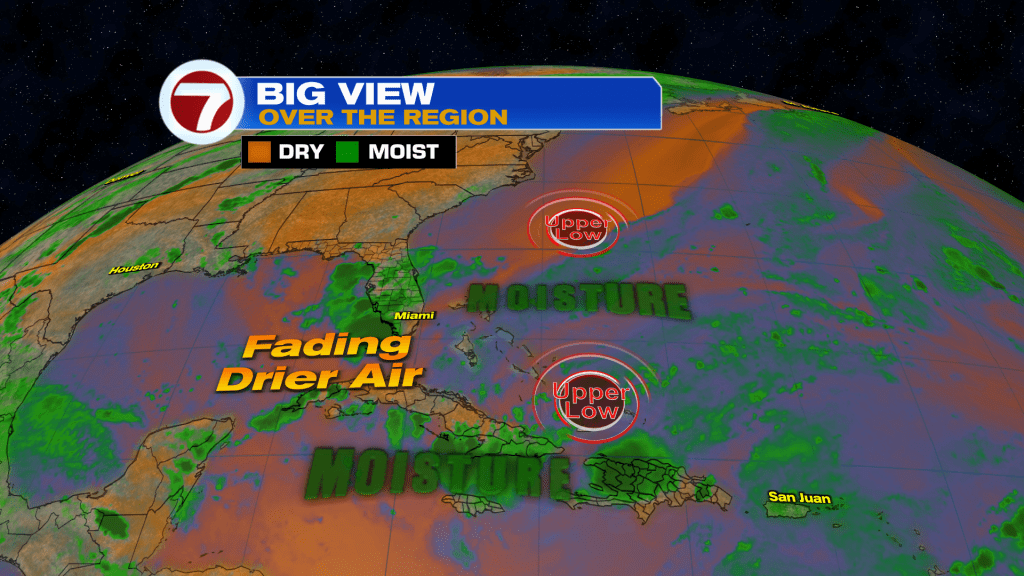
A couple of disturbances will draw closer to the region. First, comes the faster of two Upper Lows. It basically moves westward in the short term, cutting across Cuba. Then, a still-developing Upper Low (north of the Bahamas) will take its time moving to the southwest. The latest forecast models have it lumbering across south Florida from Thursday through Friday. At that time, we may see more widespread periods of rain and thunderstorms.
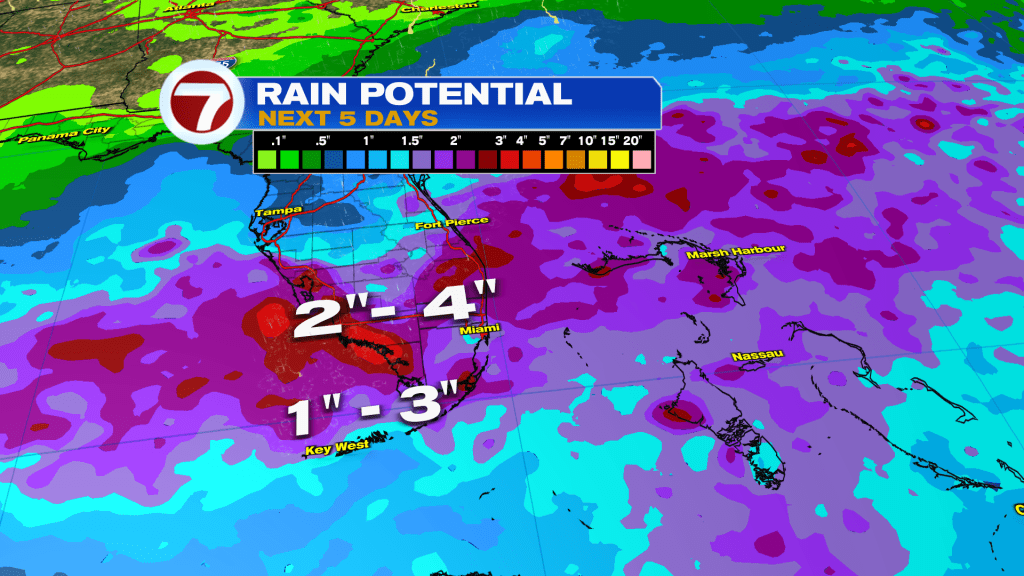
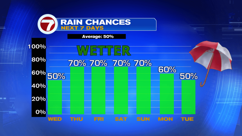
Depending on the exact track, south Florida could pick up substantial rainfall. Guidance currently suggests a wide swatch of 2 – 4″ rain amounts. We’re expecting a lot of that Thursday and Friday. It will be important, too, to consider decreasing winds at the end of the work week. As such, the threat of street flooding may come into play. Please keep in mind that even after the disturbance passes (into the weekend) leftover moisture could still pose problems. Here’s a look at the latest rain chances over the next several days.