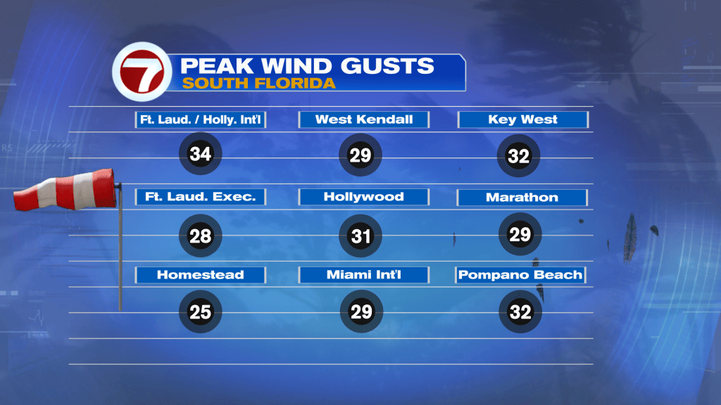
A refreshing change has taken shape across south Florida. Instead of steamy air “stealing the headlines” it’s a big and gusty breeze. Here’s a look (below) at peak wind gusts from Monday.
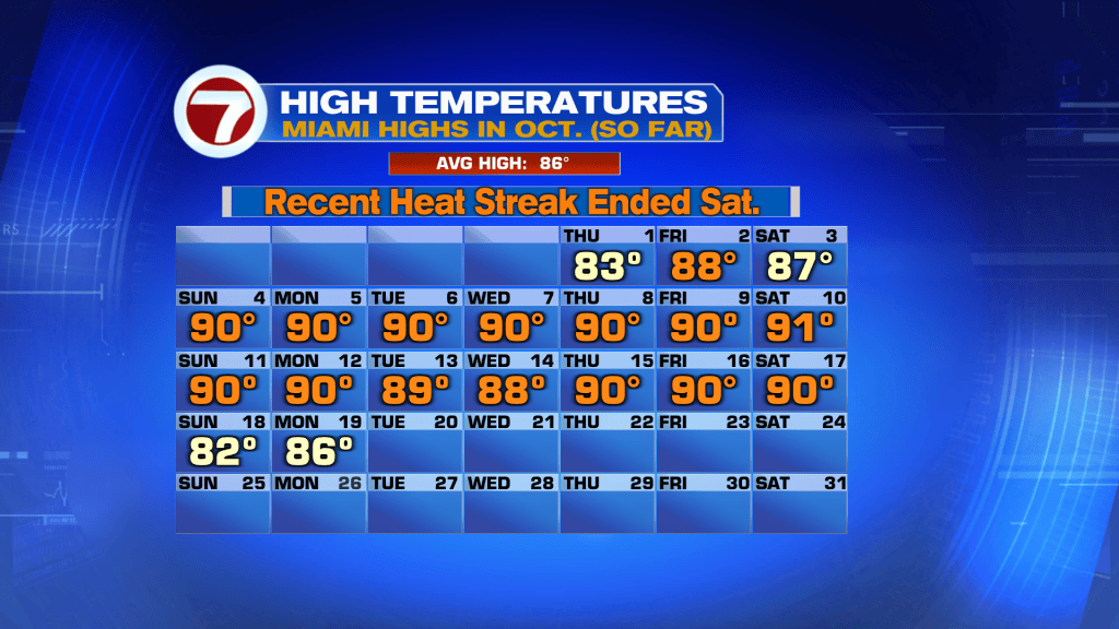
While it was seasonable and warm, the winds made it feel quite mild. Miami reached 86-degrees which seems like a bargain compared to recent hot days this October.
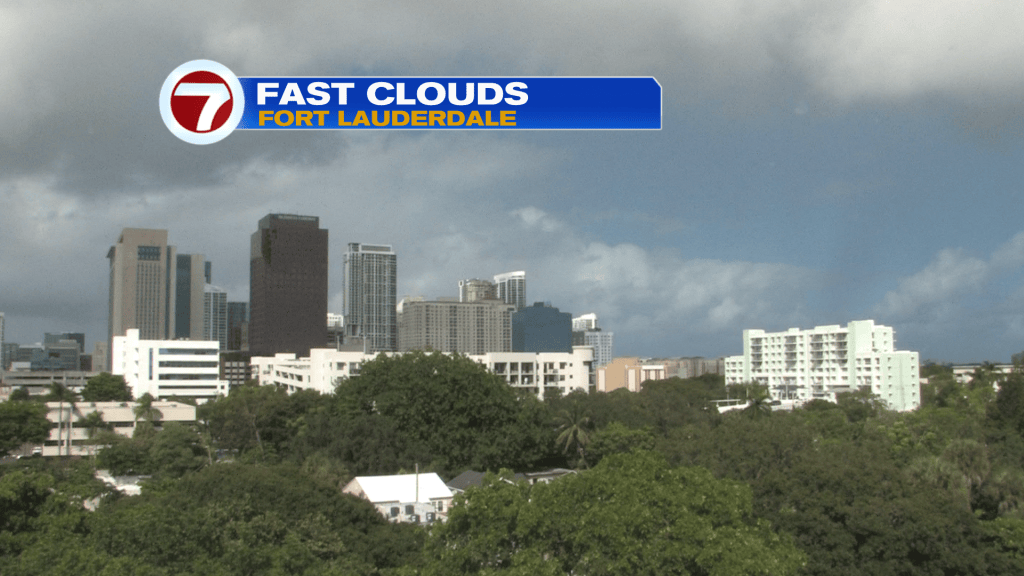
Sky conditions have been mostly mixed. For sun-lovers there’s a bright sky, at times. There’s also been some clouds arriving off the ocean, as seen from Ft. Lauderdale on Monday afternoon.
South and central Florida is between much drier air north and deep moisture south. As shown below, you can see the solid clouds from the Bahamas to the FL Straits. That’s along a lingering stationary Front.
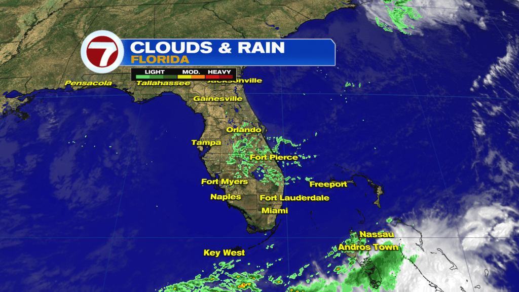
The main rain and unsettled weather will stay away as we get into Tuesday. The stalled Front even nudges farther south.
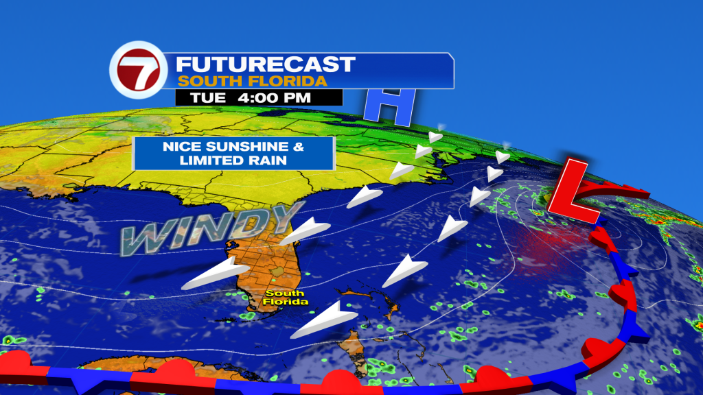
Throughout the midweek, don’t look for many weather changes. We’re basically stuck in this setup featuring “breezy to windy” days and only dotted showers arriving off the ocean.
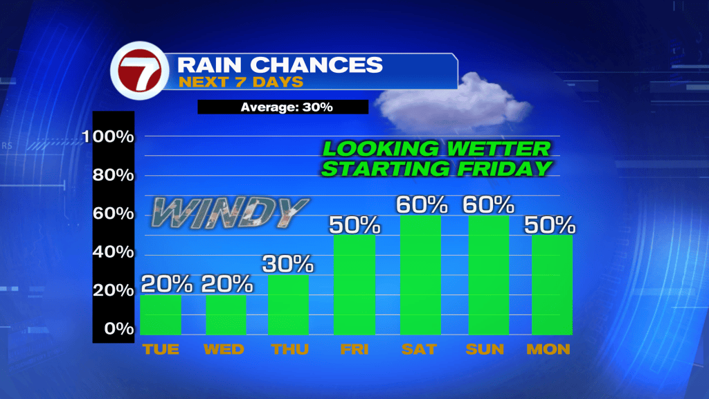
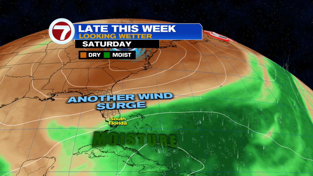
Rain Chances will be minimal through Wednesday with just a slight bump coming Thursday. Then, a moisture increase is expected as the weekend gets closer. At this point, Saturday and Sunday are forecast to become unsettled. We’ll have the combination of strong winds (as High Pressure strengthens to our north) rainy periods and even King Tides. Coastal Flooding will be a concern around high tide cycles so we’ll need to pay attention to those times and act accordingly.