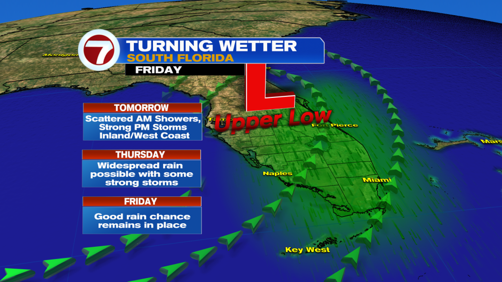
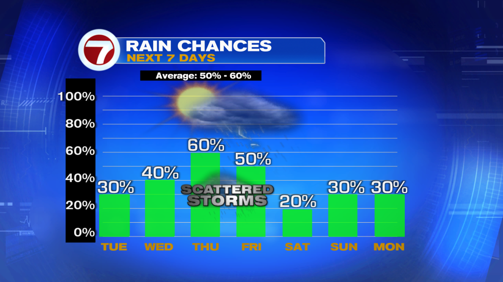
Upper low emerges from the Bahamas into the area early Wednesday. This will increase the potential for heavy rain & storms. Although typical rain chances are expected on Thursday, scattered to numerous showers & storms possible. A few could be strong.
Today in the Tropics
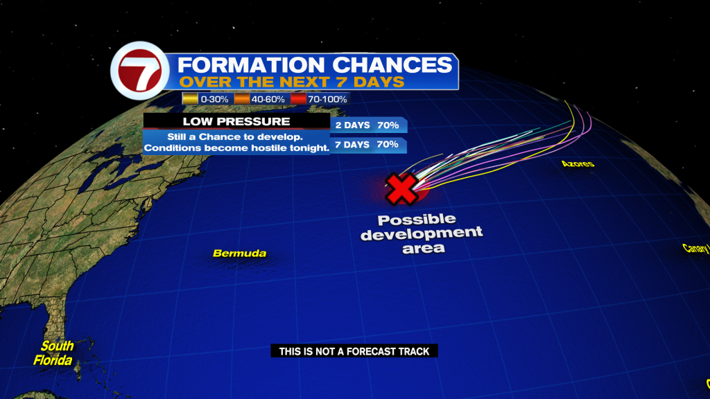
Satellite images indicate that shower & storm activity has become better organized with a small gale-force low pressure system (INVEST 90L) about 900 mi. E/NE of Bermuda. It now has a high chance to form into a short-lived tropical storm later today.
Have a wonderful day South Florida and make it a safe one!
Vivian Gonzalez
Meteorologist, AMS Certified
WSVN Channel 7