A late-season front is moving into South Florida today, bringing cooler temperatures, gusty winds, and the potential for periods of heavy rain.
Unlike the recent stretch of hot weather, temperatures this afternoon will remain in the low to mid 80’s for much of the region thanks to increased cloud cover, showers, and strengthening Northeast winds. While the cooler weather may be a welcome change, the focus shifts to the possibility of heavy rainfall and street flooding.
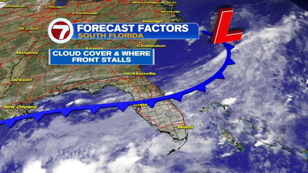
The front is expected to stall and settle across or just South of South Florida. At the same time, a deep plume of tropical moisture remains in place across the region. This combination could allow showers and thunderstorms to repeatedly move over the same areas, especially along the East coast metro areas.
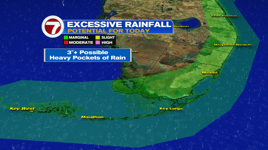
The exact rainfall totals remain uncertain. Some forecast models suggest relatively light rainfall, while others indicate widespread totals of 1 to 2 inches with isolated pockets receiving 3 to 5 inches or more.
The Weather Prediction Center continues to highlight portions of the East coast metro in a Marginal Risk for excessive rainfall today.
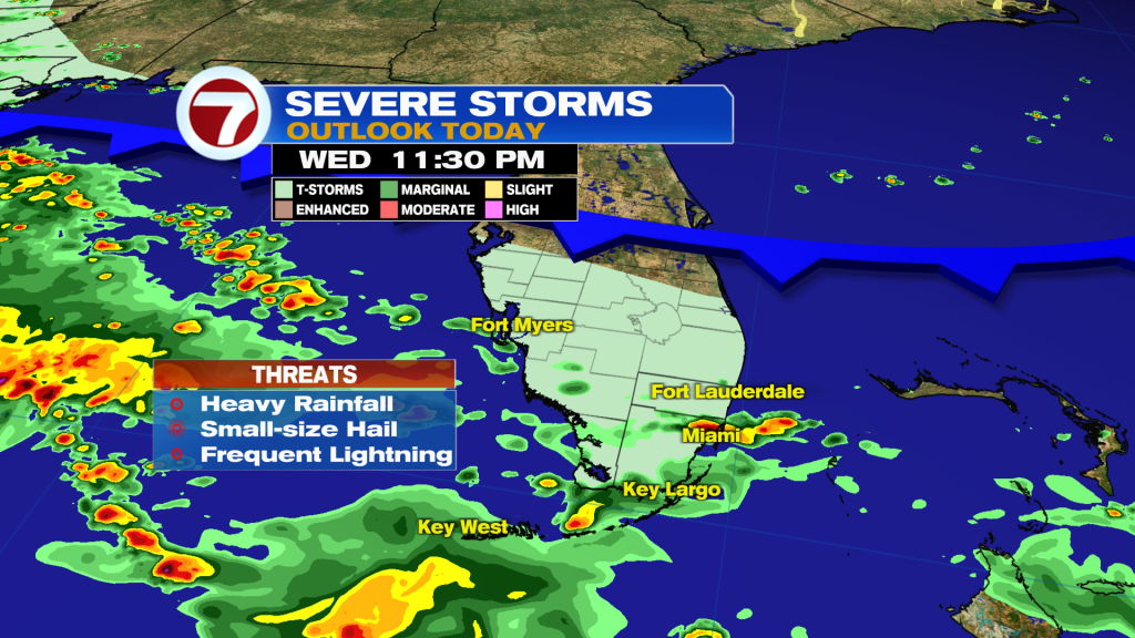
In addition to the flooding threat, some thunderstorms could produce frequent lightning and gusty winds.
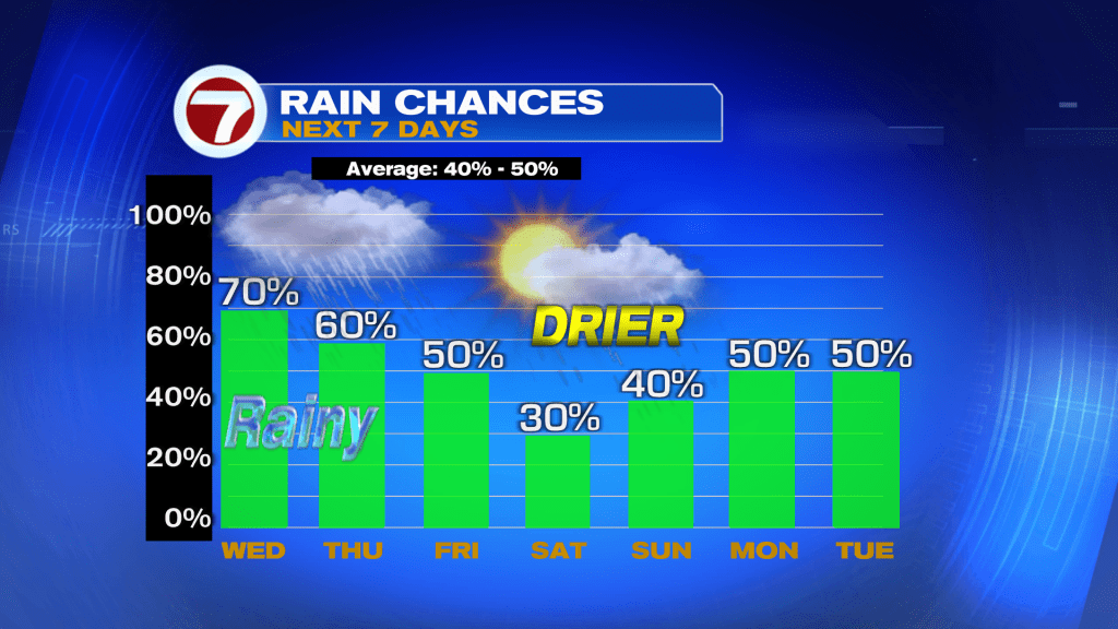
The unsettled weather pattern is expected to continue tonight and through Thursday as the stalled front remains nearby. Additional rounds of showers and thunderstorms will be possible, keeping rainfall chances high through the end of the work week.
Beachgoers and boaters should also be aware of deteriorating conditions. Gusty Northeast winds will increase through the day, creating rough surf, dangerous rip currents, and hazardous marine conditions.
Looking ahead to the weekend, temperatures gradually warm back into the upper 80’s and lower 90’s with more sunshine around, but daily rain chances will remain in the forecast as moisture lingers across South Florida.
Have a wonderful day South Florida and make it a safe one!
Vivian Gonzalez
Meteorologist, AMS Certified
WSVN Channel 7