South Florida is starting the week warm and mostly quiet as high pressure remains in control. Early this morning, a few leftover showers inland are fading, and aside from a stray coastal shower, most areas will stay dry.
As we head into the afternoon, the sea breeze will help spark a few scattered showers and storms across inland areas. These will mainly pop up from mid-afternoon through early evening before fading after sunset.
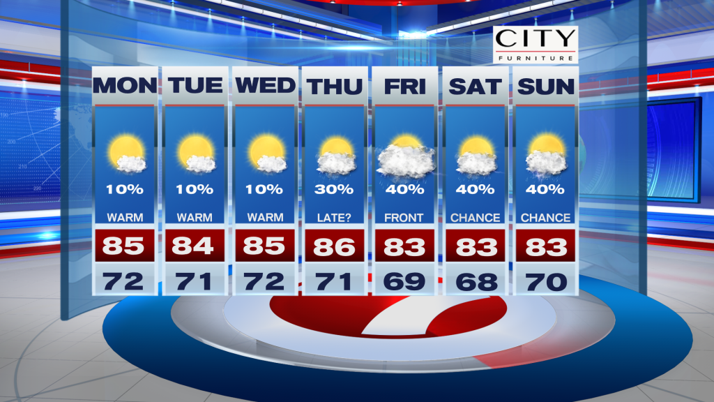
Tuesday looks drier overall with very limited rain chances. Temperatures will remain above normal both days, with highs in the low to mid 80’s along the East coast and upper 80’s to near 90 across inland Southwest Florida. Overnight lows stay mild in the upper 60’s and low 70s.
Looking ahead, the pattern stays warm through midweek. Rain chances increase a bit later in the week as a front approaches Florida, bringing scattered showers and a few storms toward the end of the work week and into the weekend. Rainfall amounts look light for now, but any rain will be welcome given the ongoing drought.
Have a wonderful day South Florida and make it a safe one!
Vivian Gonzalez
Meteorologist, AMS Certified
WSVN Channel 7