

South Florida is settling back into a more typical September weather pattern, with hot and humid conditions followed by scattered to numerous showers and storms. The main difference today is where most of those storms will end up.
Storms Shift West Today
A few showers and storms may move in along the East Coast during the morning, but as the Atlantic sea breeze pushes inland, the focus for storms will gradually shift toward the interior and Southwest Florida this afternoon and evening.
The strongest storms could produce frequent lightning, gusty winds and torrential downpours. Slow-moving storms could also produce isolated rainfall amounts of 2–3 inches or more, with the greatest flooding concern around urban Southwest Florida, including the Naples area.
Hot Before the Storms
Before storms provide some relief, temperatures will climb into the low to mid 90’s. With plenty of humidity, it will feel more like 100–105 degrees across much of South Florida.
More Storms Thursday
Thursday could turn a little more active. A surge of deeper moisture and a weak disturbance moving into the region may help increase shower and storm coverage.
Once again, expect the possibility of heavy rain, frequent lightning, gusty winds and street flooding, with storms eventually focusing inland and toward Southwest Florida.
King Tide Season Is Here
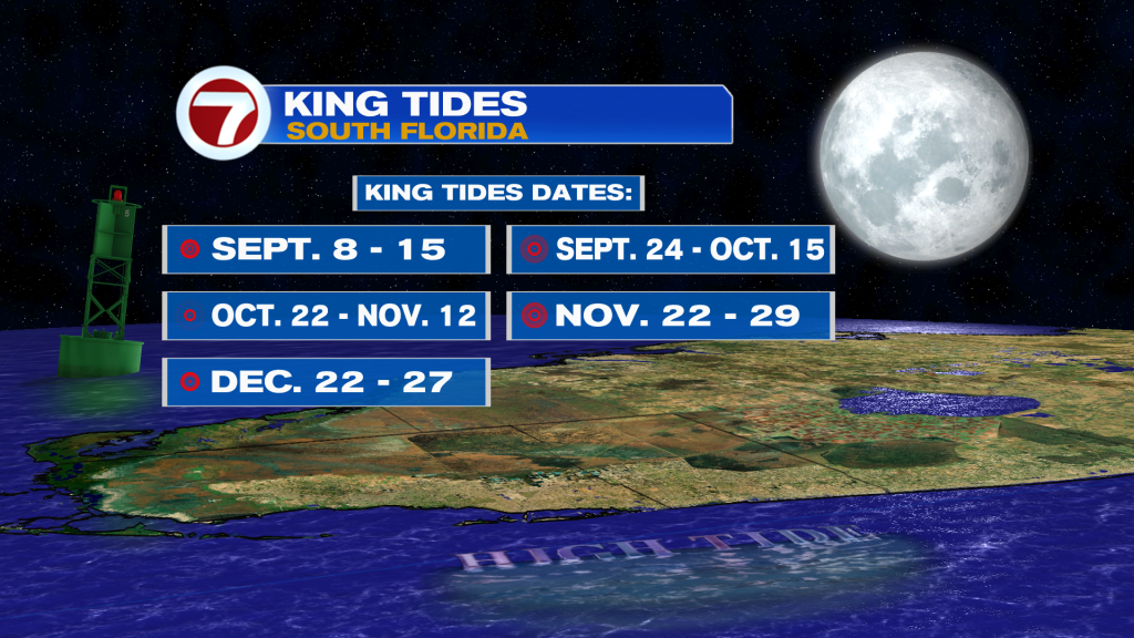
We’re also entering king tide season across South Florida, which generally runs from September through November.
Key upcoming periods include:
- Miami Beach: September 10–13
- Fort Lauderdale: September 10–13
- Key West: September 8–11
- Fort Lauderdale: September 10–13
Another round of higher-than-normal tides returns late this month.
King tides are predictable astronomical tides and are not caused by weather. However, onshore winds, heavy rain, higher seas or nearby storms can make coastal flooding worse in low-lying and vulnerable areas.
Looking Toward the Weekend
The typical wet-season pattern continues into the weekend, with early showers near the East Coast followed by afternoon storms shifting inland and toward Southwest Florida. Some Saharan dust and drier air may also approach the region, but there is still uncertainty over how much it will affect our rain chances.
The heat isn’t going anywhere either. Highs remain in the lower 90’s for most areas, with the potential for Major HeatRisk increasing into the weekend.
Have a wonderful day South Florida and make it a safe one!
Vivian Gonzalez
Meteorologist, AMS Certified
WSVN Channel 7