Happy Tuesday, South Florida!
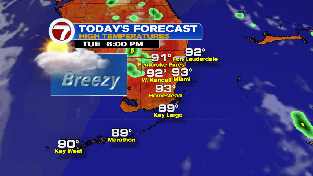
It’s looking like a hot and relatively dry day with high temperatures back in the lower-90s. The heat index will once again flirt with heat advisory criteria — climbing back into the triple digits. If there’s any rain around today, it’ll just be an isolated storm inland. It will be breezy out of the southeast today, winds could gust as high as 20 -25 MPH.
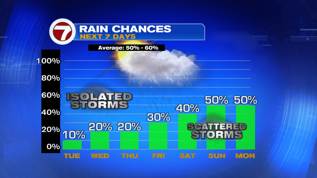
Looking ahead, rain chances will gradually make their return across South Florida this week.
We will be mostly dry today, as some drier air moves across Florida in Bertha’s wake.
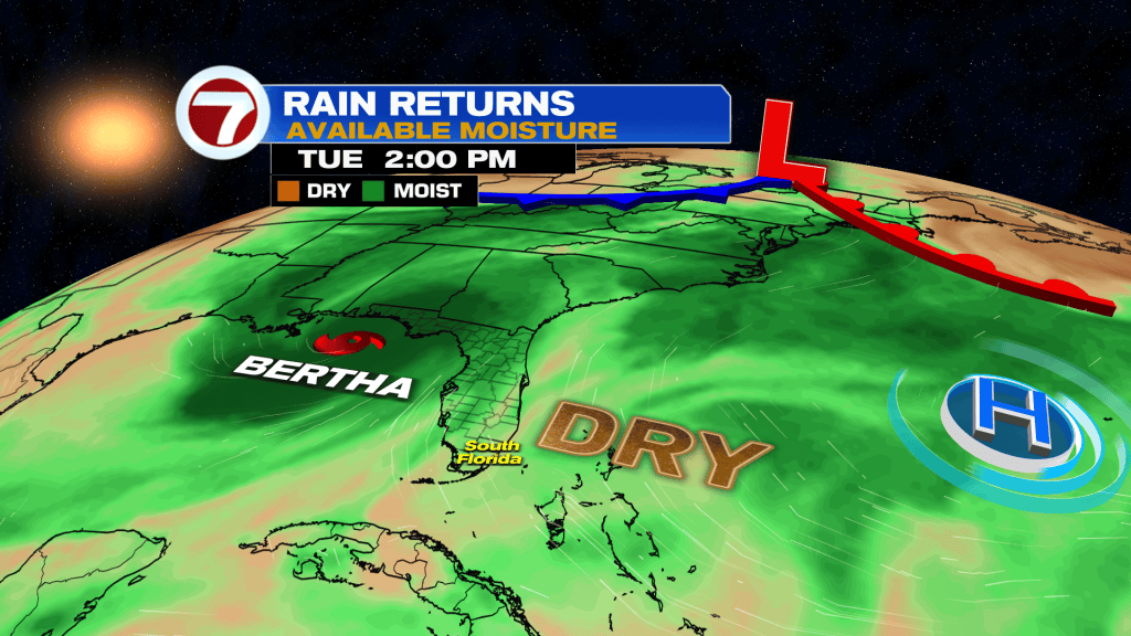
Rain chances will gradually climb later this week as an upper level low passes nearby over Cuba, which should lead to more typical sea-breeze storms. Rain chances should climb back to more typical levels by the weekend with afternoon scattered showers and storms. We really need the rain after another unusually dry rainy season.

TROPICAL UPDATE:
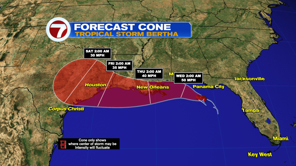
All eyes are on Tropical Storm Bertha in the Gulf of America.
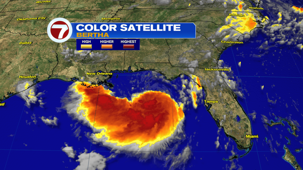
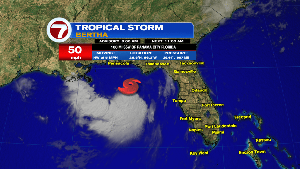
The hurricane hunters have been out investigating Bertha this morning. As of the 8AM advisory, Betha packs winds of 50 MPH and the pressure has fallen to 997mb.
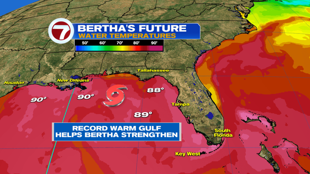
Bertha could get a little stronger today as it churns over the record warm Gulf, where water temperatures are in the upper-80s to lower-90s.
However, strong northerly wind shear is expected to weaken Bertha has it approaches the Gulf Coast tomorrow.

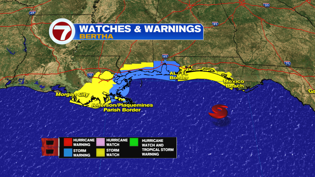
Either way, Tropical Storm Watches and Warnings are in effect for the Gulf Coast.
The National Hurricane Center calls for Bertha to make landfall tomorrow or by Thursday and quickly weaken later this week. The good news is the heaviest rain from Bertha is expected to stay in the Gulf, only bothering the fish.