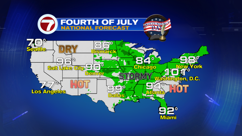
(WSVN) - The Fourth of July holiday weekend is just about here, and the weather will feature very summerlike conditions.
After a handful of dry days in June, storms have returned as the calendar flipped to July and it will remain that way for the weekend — go figure.
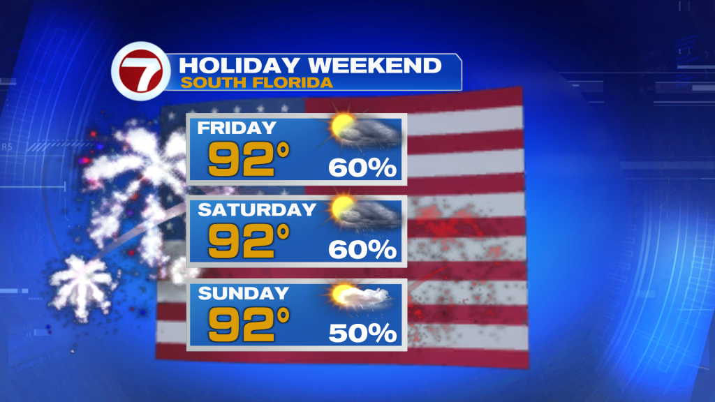
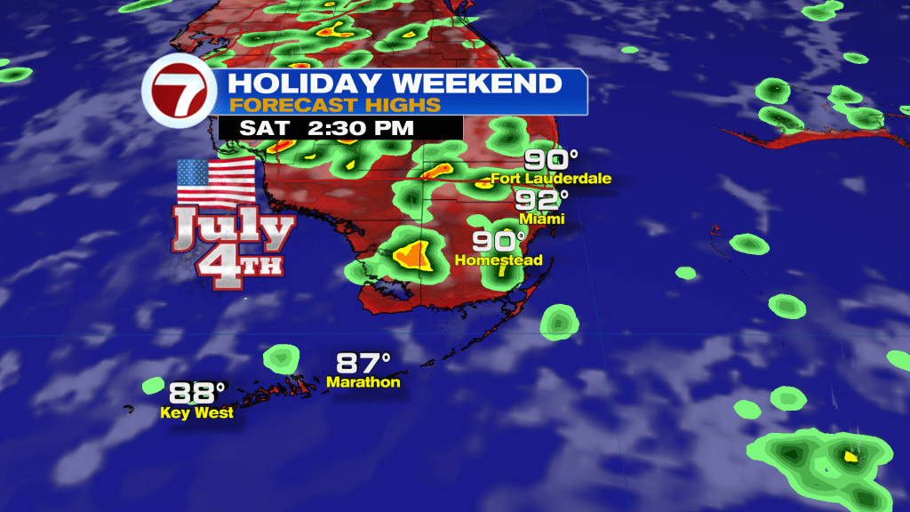
We’re not talking about a weekend washout, but expect times of sunshine, times of cloudier skies and times of rain. Otherwise when it’s dry, it’s going to be very warm and steamy with widespread highs in the low 90s and heat indices in the low 100s these next three days.
Before the weekend really gets started — for the rest of our Thursday into the overnight hours — expect activity to gradually dwindle down after pockets of heavy rain was seen across parts of the area. Clouds will breakup overnight and only a shower or two will be possible.
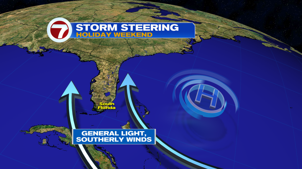
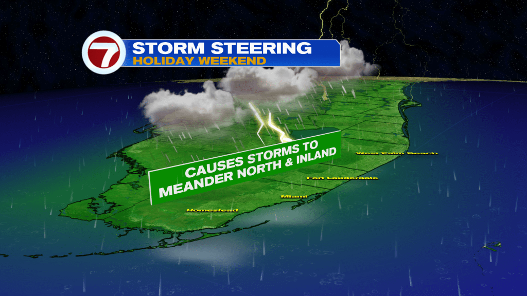
Then on Friday, expect scattered storms to drift inland and to the north, especially during the midday and afternoon hours, given a light, southerly steering wind. Therefore, the best bet for dry time will be at the bookends of the day.
The Fourth of July on Saturday is forecast to be a very similar setup with morning sunshine giving way to scattered storms by the second half of the day.
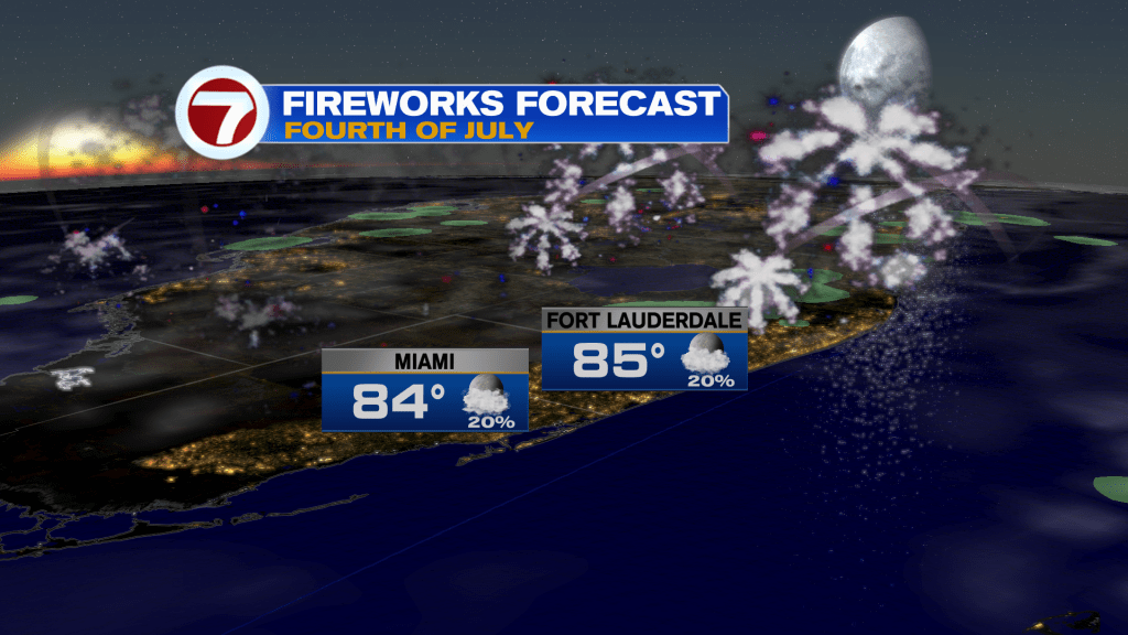
The good news is that by sundown, most activity should fade and clouds will gradually clear up, making for fairly good conditions to view the fireworks shows!
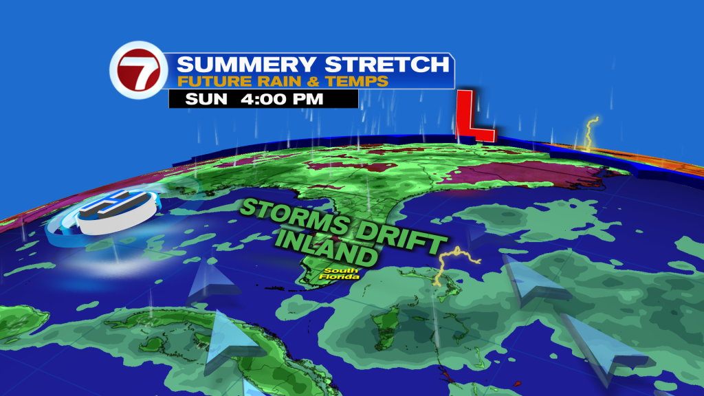
By Sunday and beyond, a slow drying trend is forecast to begin with rain chances stepping down day-by-day as moisture levels decrease across South Florida.
With that said, Sunday into early next week will still feature a period of passing showers and storms but a bit more of an onshore breeze will focus the activity farther west and inland.
Given more sunshine and dry time next week, temperatures are forecast to turn a bit hotter.
Tropical update
No tropical activity is expected within at least the next 7 days in the Atlantic basin.
Copyright 2026 Sunbeam Television Corp. All rights reserved. This material may not be published, broadcast, rewritten or redistributed.