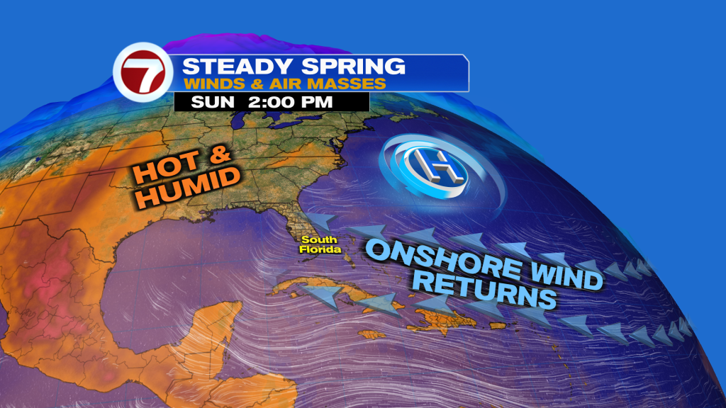
(WSVN) - Rainy season arrived on Friday but it hasn’t seemed like it these past couple days given the sunny and dry conditions. Changes are on the way starting Sunday, however, and it involves higher yet typical rain chances.
Sunday is starting off with areas of showers working onshore across South Florida, and these widely scattered downpours are expected to continue throughout today. The majority of the activity is expected to happen during the first half of the day.

Otherwise, we’re looking at a blend of sun and clouds, highs in the upper 80s and humid and breezy conditions.
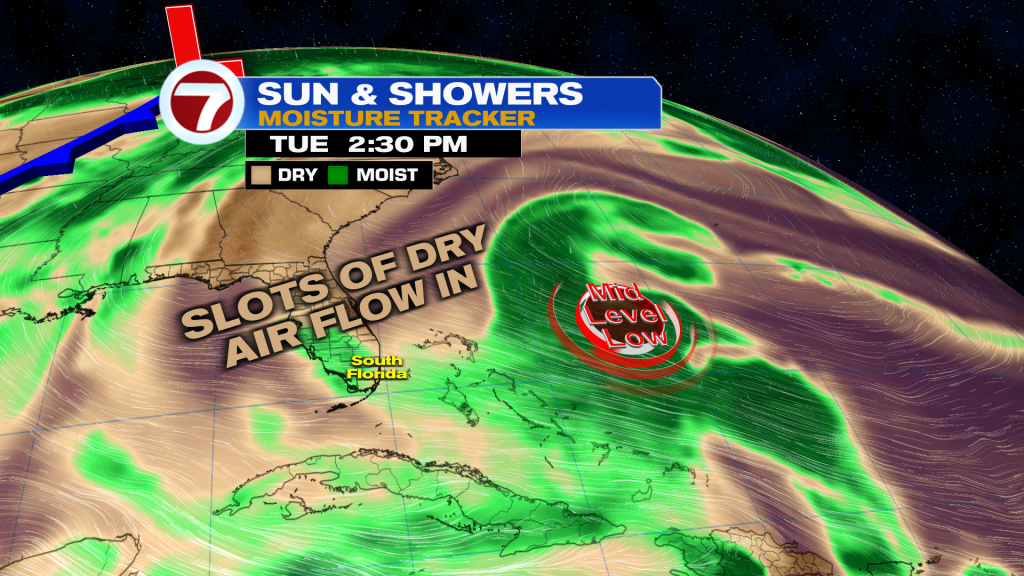
That stronger breeze through midweek, helping keep temperatures closer to normal in the upper 80s but with high humidity.
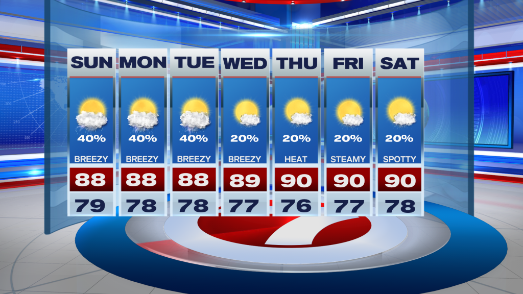
To begin the new week, the overall theme will remain unchanged with showers and storms tracking from east to west along that breeze. The highest rain chances for Miami-Dade and Broward will be during the morning hours before much of the rain pushes inland and toward the west coast. In other words, no wet and soggy days are expected but just have the rain gear!
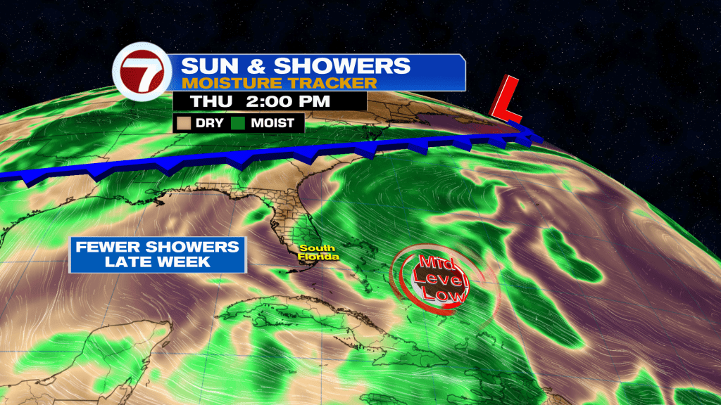
During the second half of the week, drier air will begin to sneak back in, resulting in lower rain chances and mostly sunny skies. As a result, temperatures will heat back up with highs around 90F.
Copyright 2026 Sunbeam Television Corp. All rights reserved. This material may not be published, broadcast, rewritten or redistributed.