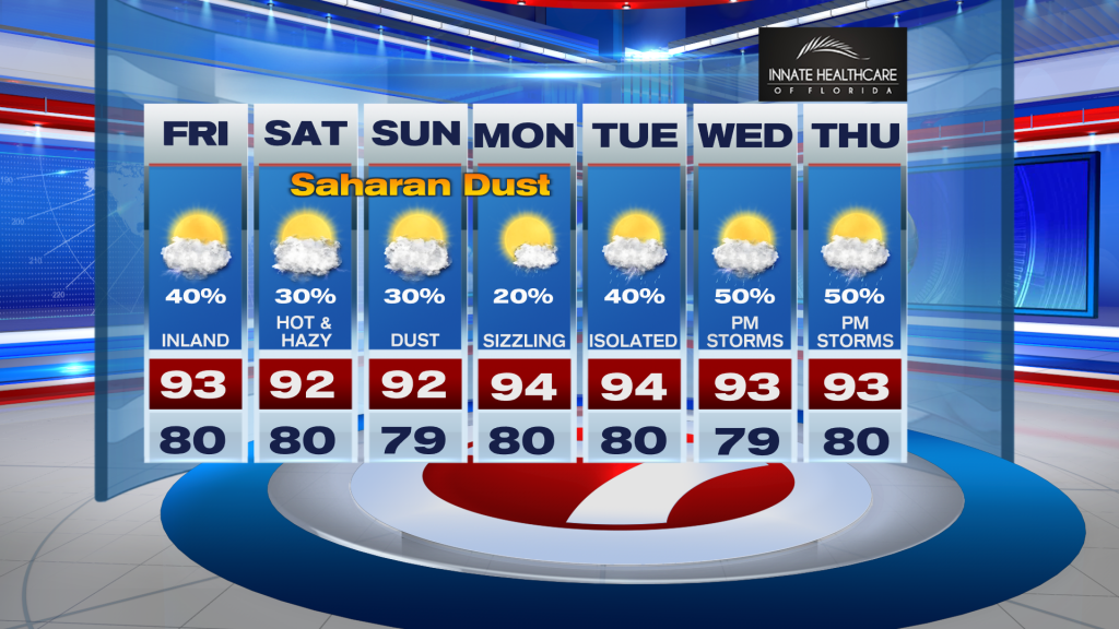
South Florida heads into the weekend with a familiar Summer weather pattern: hot, humid afternoons followed by scattered storms.
High temperatures will climb into the low 90’s today, while humidity pushes heat index values into the 101 to 107 degree range. Although no Heat Advisory is in effect, Moderate to Major HeatRisk continues across much of the region, meaning anyone spending extended time outdoors should stay hydrated, take frequent breaks, and limit strenuous activity during the hottest part of the day.
Scattered showers and storms will develop this afternoon and evening, with the greatest coverage across the interior and Southwest Florida as sea breezes collide inland. East coast metro areas will have a lower chance for rain, but an isolated storm cannot be ruled out. The strongest storms may produce gusty winds, frequent lightning, and locally heavy downpours.
Looking ahead, little change is expected through the weekend. Daily afternoon storms remain in the forecast, mainly inland and West of I-95, while temperatures stay in the low 90’s with tropical humidity keeping conditions steamy.
Another feature to watch is a Saharan Air Layer that will gradually move into South Florida this weekend. The drier air may trim storm coverage slightly while also creating hazier skies and more colorful sunrises and sunsets.
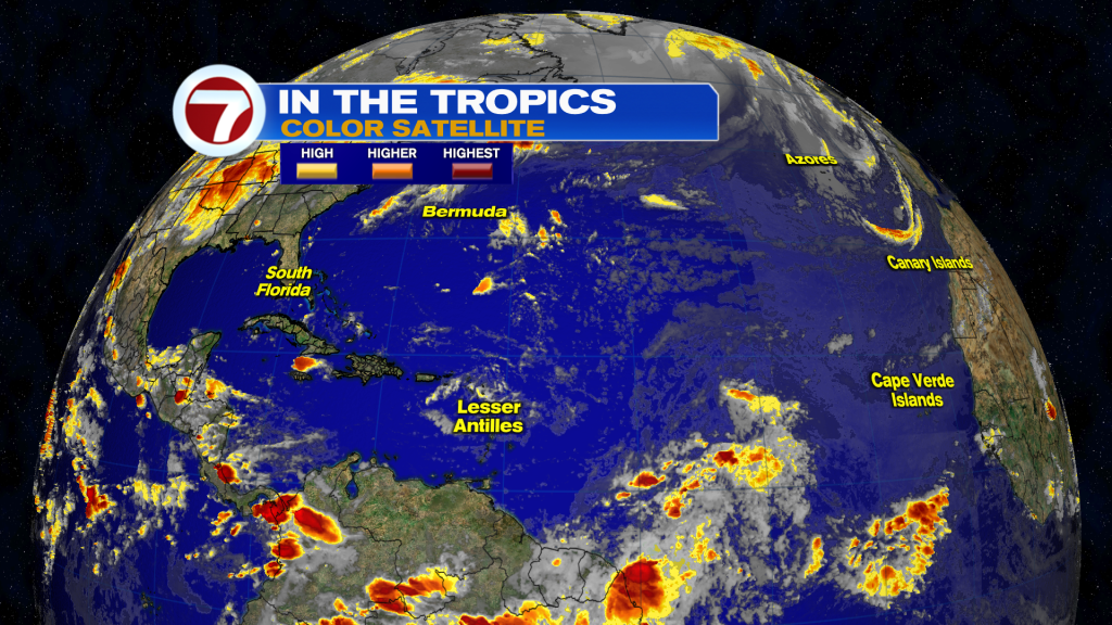
Today in the Tropics
The Atlantic Basin remains quiet, and there are currently no tropical systems expected to impact South Florida. Storm Team 7 will continue monitoring the tropics as we move deeper into the 2026 hurricane season.
Have a wonderful day South Florida and make it a safe one!
Vivian Gonzalez
Meteorologist, AMS Certified
WSVN Channel 7