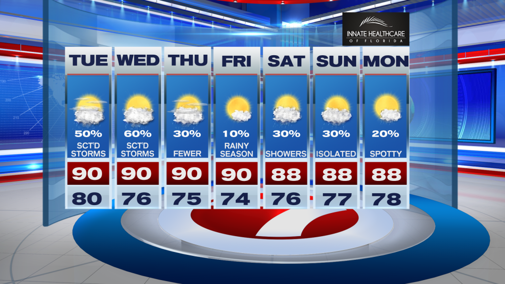
South Florida is in for another hot, humid, and stormy afternoon as an unsettled weather pattern continues across the region.
Temperatures will climb into the upper 80’s and low 90’s today, with heat index values once again feeling closer to 100 degrees. While much of the morning and early afternoon should stay quiet, scattered to numerous storms are expected to develop by mid to late afternoon, especially across inland areas and around Lake Okeechobee before drifting toward the East coast metro during the evening.
Some storms could become strong, capable of producing gusty winds, frequent lightning, and torrential downpours. Because storms will move slowly, areas of street flooding will also be possible, especially across the East coast metro areas.
The active weather pattern continues Wednesday as a front lingers near the region and an upper-level disturbance remains overhead. Additional afternoon and evening storms are expected with heavy rain and gusty winds remaining possible.
Conditions should gradually turn a bit drier heading toward the end of the week and into the weekend, although typical afternoon sea breeze storms will still remain possible. Temperatures will stay above average with highs continuing in the upper 80’s and low 90’s.
Vivian Gonzalez
Meteorologist, AMS Certified
WSVN Channel 7