Happy Friday, June 19, 2026, South Florida!
Hopefully everyone had a great week. South Florida has been stuck in a steamy weather pattern all week long with 5 consecutive heat advisories issued for coastal and Metro areas of Miami Dade and Broward County. And speaking of the heat alert, it will run from 12PM to 7PM today. While our high temperatures reached into the mid to low 90s each day, our feels like temperatures soared well into the triple digits each afternoon, making it feel quite unbearable across South Florida. And after a steamy week, this morning was no different as our temperatures started off in the mid 80s and the high humidity made it feel like the 90s.
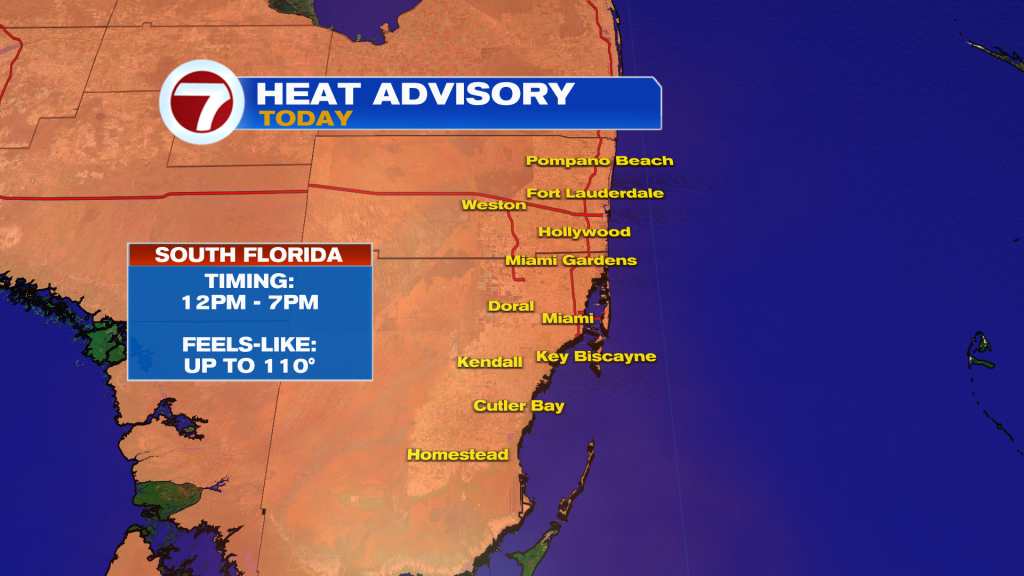
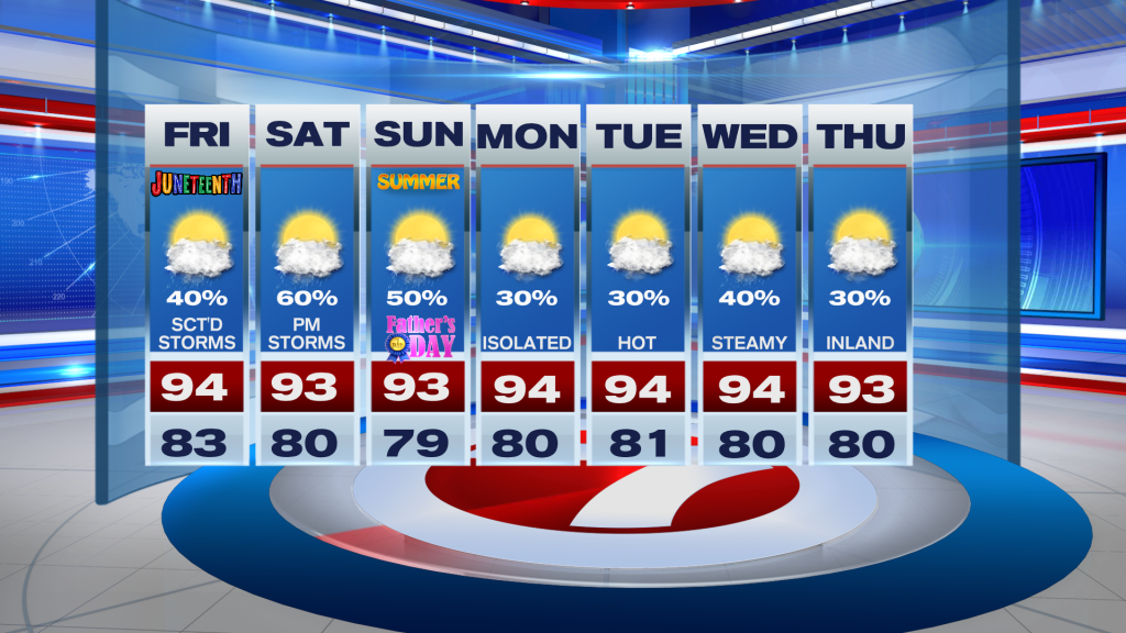
Today South Florida can expect another steamy summer-like day (I say ‘summer-like’ because summer doesn’t officially begin until this Sunday). A warm breeze out of the South/Southeast will continue to bring in high humidity while our afternoon high temperatures reach the mid to low 90s again. Feels like temperatures will once again soar into the triple digits for extended periods of time, which is what triggered the heat advisory. The one difference is that scattered showers and thunderstorms will return to the forecast this afternoon, hopefully bringing some brief relief from the heat.
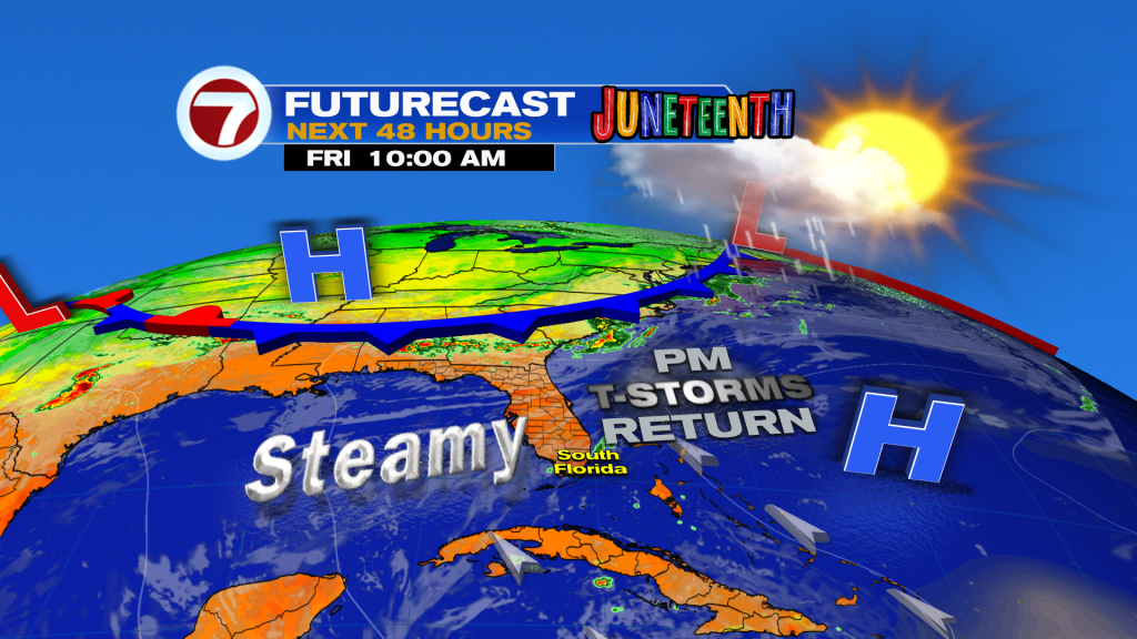
And speaking of relief, showers and storms are expected through the upcoming holiday weekend as South Florida can expect the daily dose of showers and storms each afternoon. This will not only bring brief relief on a daily basis, but will also hopefully help put out several of the wildfires across western Miami-Dade. But even with showers returning to the forecast, very light and variable winds across South Florida will help temperatures stay on the steamy side in the middle to low 90s. Unfortunately, it looks like the sweltering heat will stick around through at least the first half of next week.
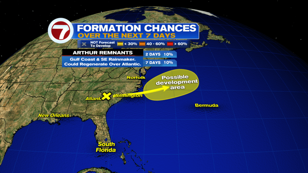
In the tropics, the National Hurricane Center is monitoring the remnants of what was Tropical Storm Arthur as it continues to dump heavy rain across the southeastern US and the Carolinas . And while no development or organization is expected while it remains over land, the leftover moisture from Arthur may actually regenerate into a tropical system once it moves over water off of the Mid-Atlantic coast. The rest of the Atlantic basin looks quiet!
Have a wonderful weekend. And happy Father’s day to all dads out there!
Erika Delgado / Meteorologist
WSVN / ABC Miami
Copyright 2026 Sunbeam Television Corp. All rights reserved. This material may not be published, broadcast, rewritten or redistributed.