

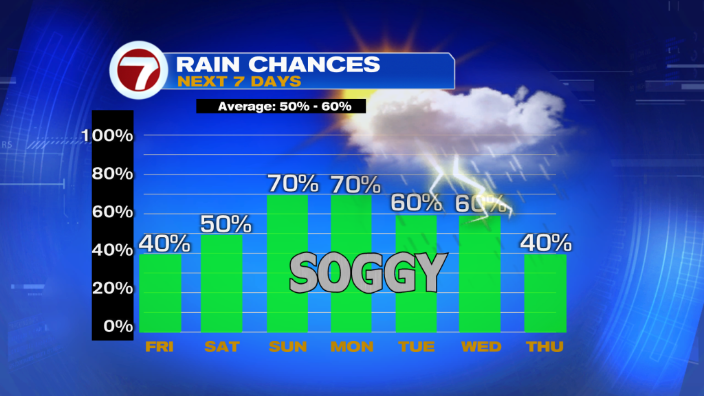
After a stretch of relatively drier weather, South Florida is heading into a wetter pattern for the weekend and early next week.
A few coastal showers are possible this morning along the Atlantic coast, but the main round of rain and thunderstorms will develop this afternoon and evening across inland communities and Southwest Florida. Temperatures will climb into the low to mid 90’s with heat index values topping 100 degrees.
While storms won’t be widespread today, any thunderstorm that develops could produce heavy downpours, frequent lightning, and gusty winds.
Rain Chances Increase This Weekend
Moisture levels continue to rise Saturday and Sunday, leading to a noticeable increase in shower and thunderstorm coverage.
Saturday’s activity will still favor interior South Florida and Southwest Florida, but by Sunday and into early next week, a shift in winds will push the focus of afternoon storms closer to the east coast metro areas, including Miami-Dade, Broward, and Palm Beach counties.
With a wetter pattern settling in, isolated areas of street flooding may become a concern in poor drainage and urban areas where repeated rounds of heavy rain occur.
Heat Remains a Concern
Even with more rain in the forecast, temperatures will stay above average with highs in the low to mid 90s. Heat index values will continue reaching the 100-105 degree range each afternoon.
Be sure to stay hydrated, take breaks if working outdoors, and never leave children or pets in a parked vehicle.
Tropics Update
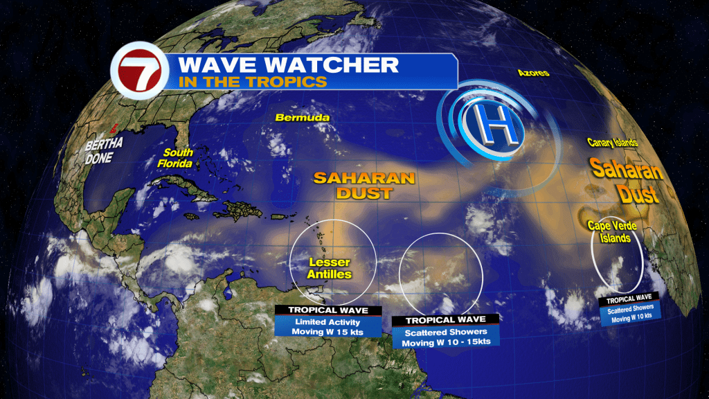
Bertha made landfall for a second time in the afternoon along the upper Texas coast and the last system has dissipated. Last advisory by NHC was written last night. The rest of the tropics are quiet for now.
Have a wonderful weekend South Florida and make it a safe one!
Vivian Gonzalez
Meteorologist, AMS Certified
WSVN Channel 7