

It was back to breezy on Wednesday with the breeze arriving off the ocean. Sustained winds were commonly in the 10 to 15 mph range with gusts above 20 mph. It was a warm flow and temperatures, once again, were running above what’s typical in October.
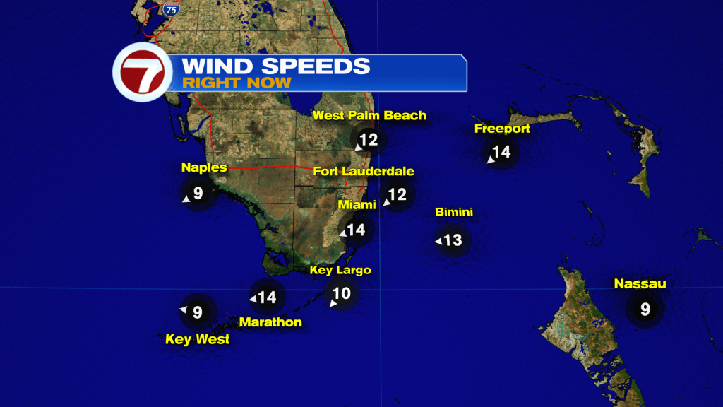
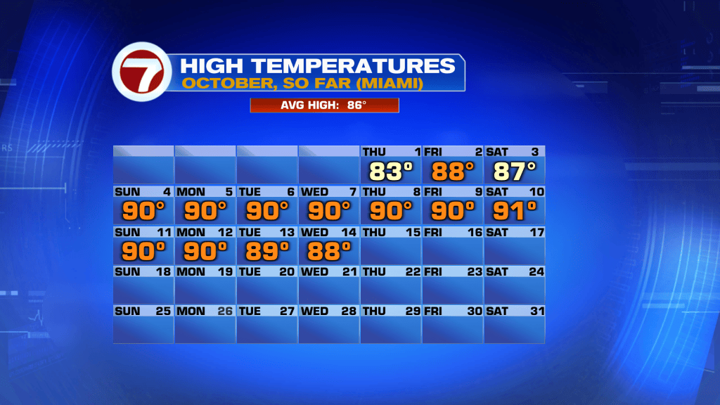
Of course, the breeze helped combat the heat and humidity and even made for pleasant beach weather (despite an elevated risk of rip currents).
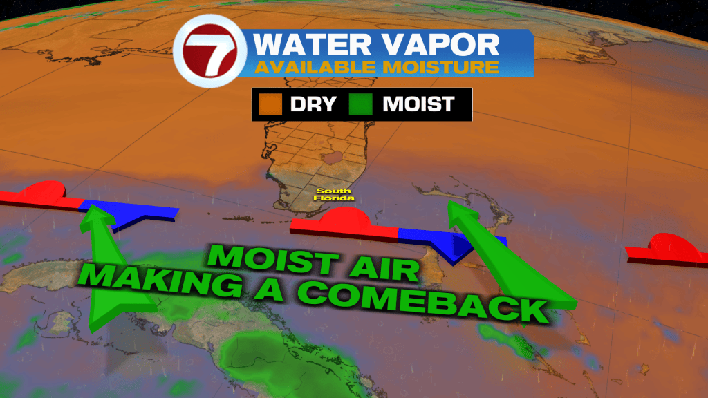
Also, you may have encountered a brief shower, here or there. It was a switch from the deep drying we had at the very start of the week! As shown above, there’s a moisture spread (northward) with the continued chance for occasional showers.
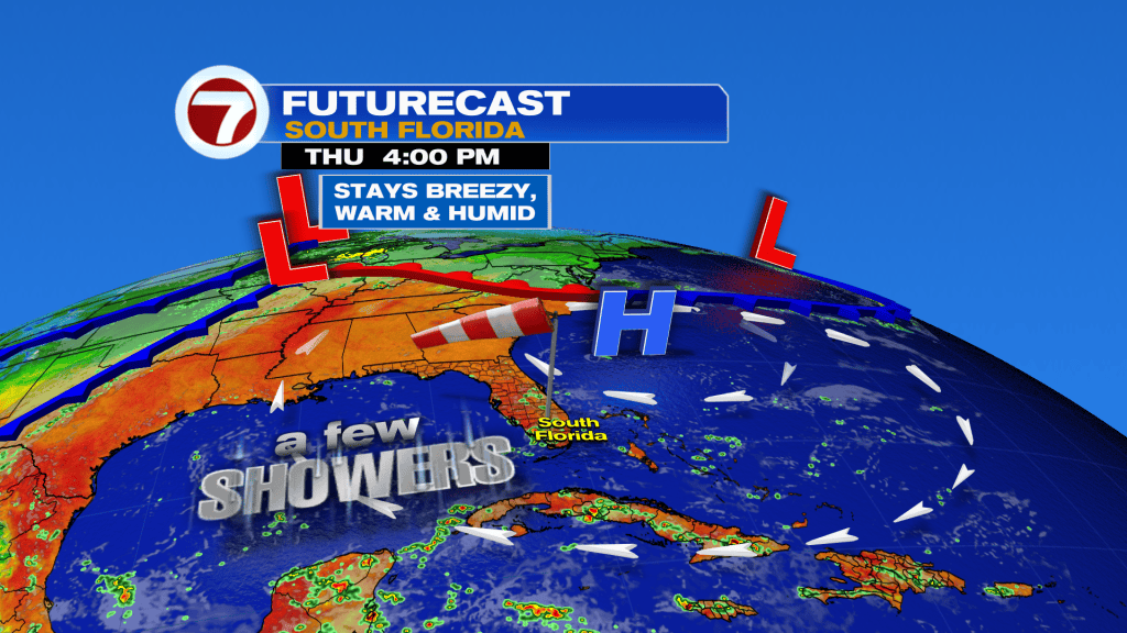
On Thursday, rain will return but mainly during the morning, shifting westward during the afternoon. That means added sunshine will take over and be strong during the second half of the day. Daytime highs will peak around 90-degrees.
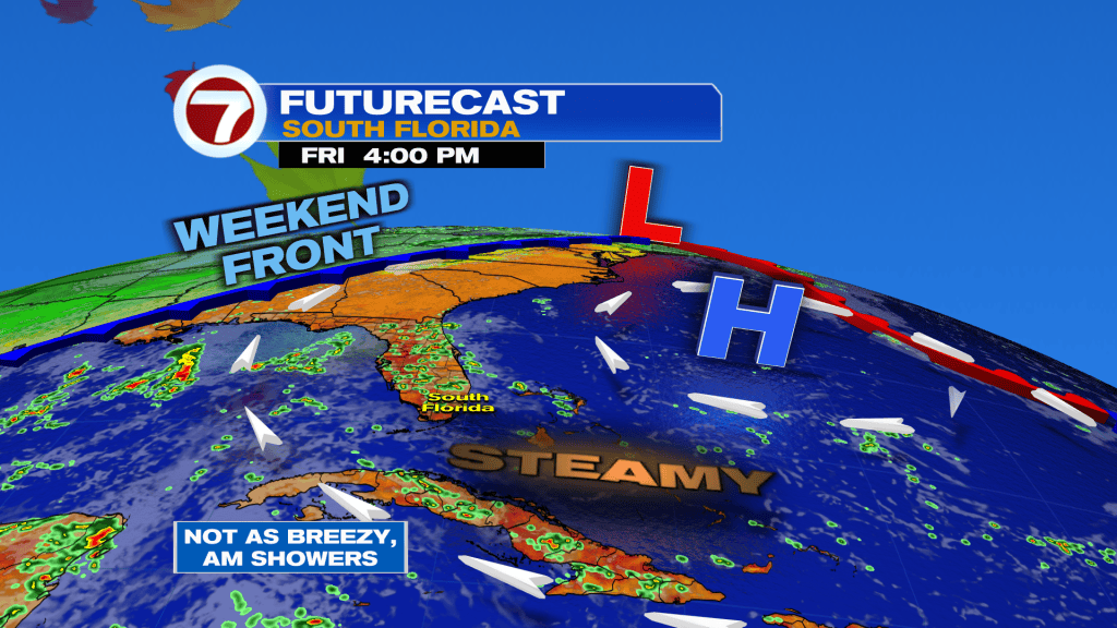
The steamy conditions will peak this week from Friday through Saturday. It’s a tropical flow as High Pressure begins to drift east, and away. It’s at this time we’ll turn our attention to an advancing Cold Front from the north and west. First of all, it won’t lead to colder air! Ultimately, though, it lead to windy and wet weather for south Florida for the upcoming weekend.
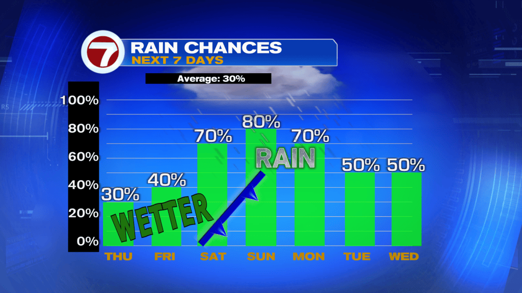
Here’s a check at the rain trend which depicts the weekend Front and higher chances for downpours. As the Front moves closer it is expected to stall. Then winds should ramp around a large High Pressure center, turning gusty by Sunday. Wind gusts are forecast to surge around 30-35 mph (or slightly higher) as the new week begins. The strong, onshore pattern will most certainly make for marine hazards including bumpy boating and dangerous waves. At this point, conditions should gradually improve by the middle of next week.