Happy Thursday, May 14, 2026, South Florida!
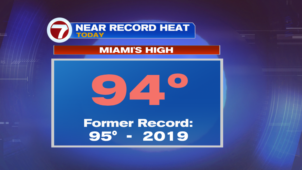
Hopefully the ‘Miami Heat’ we have been experiencing since last weekend hasn’t inconvenienced you too much! High temperatures each afternoon have reached the 90s and, at times, come close to tying records previously set. But this week had its added challenges because high heat in the 90s turned to stormy afternoons. Today was a bit different as drier air is starting to move in behind a weak front that came through the area. This helped lower our rain chances across the region and even brought back those sunny skies we love so much! And even though a front came through the area, our winds have not yet turned off the water so high temperatures remains on the steamy side and well above average.
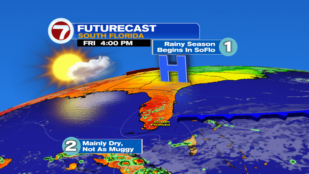
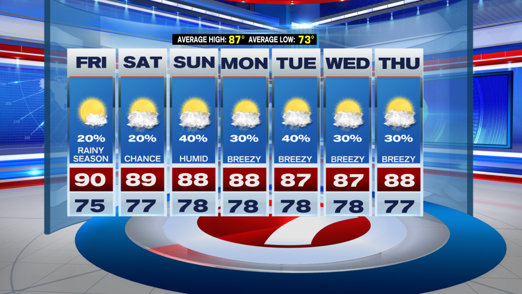
Looking ahead to the end of the week, tomorrow is the official start of the Rainy Season here in South Florida. Ironically, it will be far from what its name insinuates because rain chances will be on the lower end throughout the day. It will be an overall nice day, especially since it won’t feel *as* muggy as it did earlier in the week. High temperatures will still manage to reach the lower 90s since we will have warm winds to start before the breeze turns off the water later in the day. The afternoon may even turn a bit breezy for some of our coastal locations. And even though rain chances will remain below what is normal this time of year, a spotty shower or storm cannot be ruled out in the afternoon, especially across some of our inland locations.
Looking ahead, South Florida will transition to a more summer-like weather pattern starting this weekend. As high pressure builds in the Atlantic, our wind pattern will turn off the water. this means humidity levels will once again climb and we will have to reintroduce a chance for a few seabreeze driven showers. Late weekend and early next week promises to have a stronger onshore breeze, which should help keep those temperatures in the 90s away for a few days. This would keep our high temperatures in the 80s each afternoon through much of next week. One thing worth noting is that there will be a mid-level disturbance meandering in the Atlantic next week, which could result in a few more showers & thunderstorms. Again, with a strong breeze off the water, most activity should eventually push farther inland each afternoon.
Have a wonderful evening!
Erika Delgado
Meteorologist
WSVN / ABC Miami
Copyright 2026 Sunbeam Television Corp. All rights reserved. This material may not be published, broadcast, rewritten or redistributed.