

Isaias has been gaining strength over the Gulf waters. Through most of Wednesday the system was a tropical storm while recent updates have it closer to becoming the season’s first hurricane.

Tropical Storm Isaias is spinning over the western Gulf roughly 800 miles WSW of Miami (for reference). While still jogging east, a northward turn is forecast for Thursday.
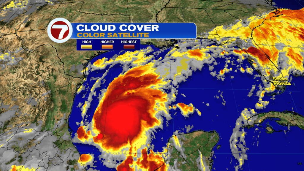
Recently, there’s been an explosion of convection (storms) near the center and just northwest. That’s just one indication the system is becoming better organized. The big question becomes “where is it heading?” Let’s first look at the forecast models known as spaghetti plots, shown below.
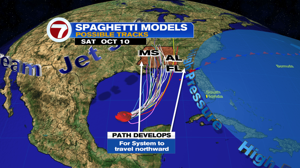
Each line represents a possible path. Where they cluster together provides decent consensus. Over time, the grouping tends to narrow with better data likely gathered. As for the all-important steering, High Pressure from the Atlantic will enable a turn to the north and act as a block away from south Florida.
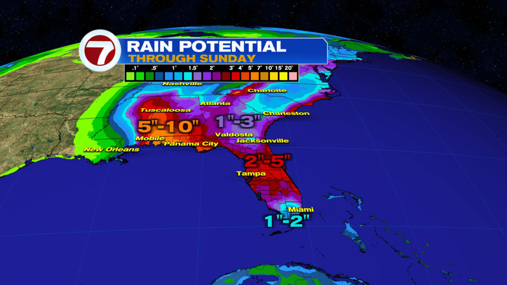
Isaias will pool a huge batch of moisture as it continues to track along. Flooding rainfall is likely, especially near its future landfall. At this point, a general swath of 5 – 10″ of rain (isolated higher amounts) is expected from Mobile, Alabama to the Florida panhandle and possibly even the Big Bend region.
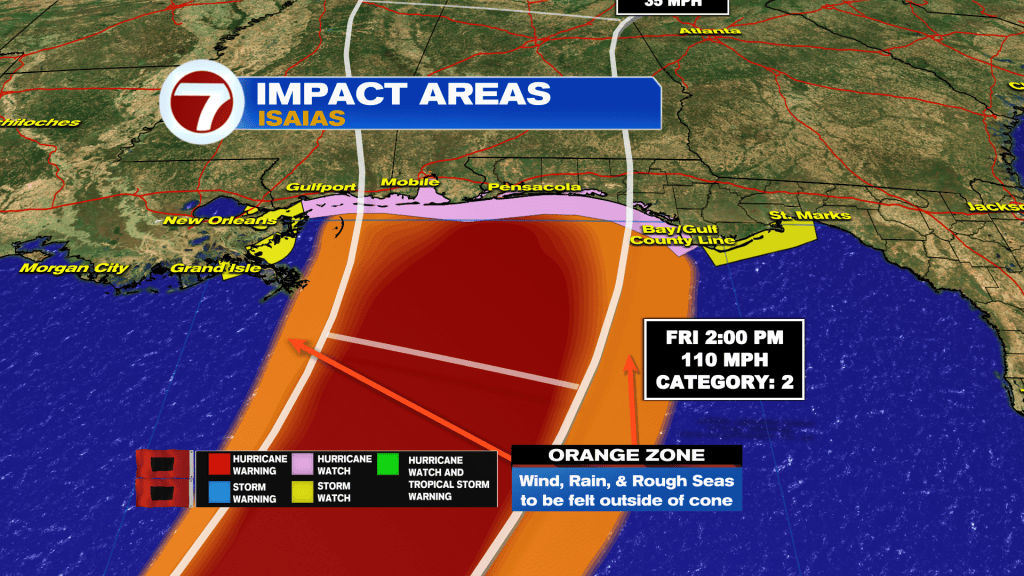
Watches and Warnings have been initiated by the National Hurricane Center stretching from waters near New Orleans to, Pensacola, Panama City (FL) and just beyond. In the pink area (including Gulfport and Mobile, AL) there’s currently a Hurricane Watch. Rough conditions will extend much farther away and Isaias is forecast to reach upper-end Cat 2 Hurricane Strength before landfall, Friday.
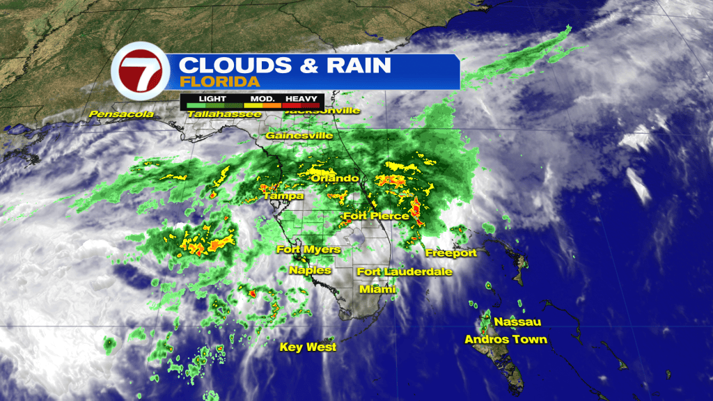
More than 800 miles from Isaias (on Wednesday) parts of Florida were already soggy due to a stationary Front.
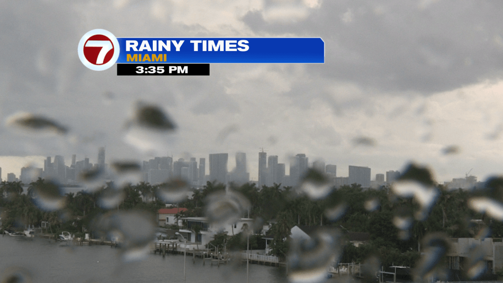
Miami experienced a few downpours, but not long lasting ones. Times of showers remain possible for the rest of the week with a moist flow in place. Additionally, “higher high tides” should be expected as King Tides are back.
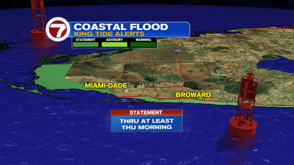
A Coastal Flood Statement is in effect through Thursday morning, at least. Also, minor saltwater flooding will continue around High Tide for the Florida Keys. Low-lying areas will be especially vulnerable for possible ponding.