Happy Sunday, South Florida!
The heat is the big story this upcoming week in Miami is the continuing its hot streak of 39 days in a row above 90 degrees.
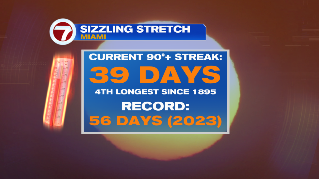
We may threaten the all-time record of 56 days in 2023 — with a seemingly endless streak of 90 degree days ahead. In fact, the heat will only worsen with highs trending into the mid-90s by the end of the week. The heat index will soar above 105 which means more advisories are likely coming.
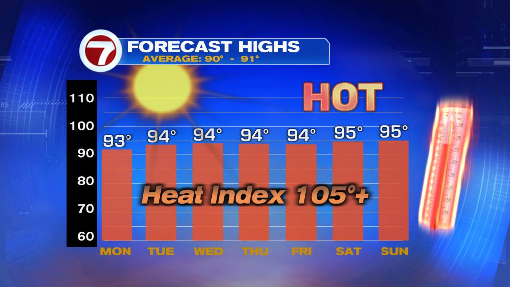
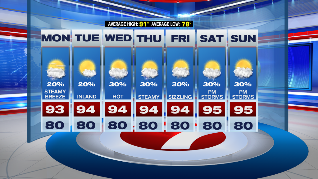
As far as the forecast goes, Monday looks drier with isolated storms staying mainly inland in the afternoon. Highs will be pretty close to average in the lower-90s with the heat index once again climbing into the triple digits. It stays hot and dry with below-average rain chances continuing throughout the week. There’s some signs that an upper disturbance could bring some higher rain chances by the weekend but it’s too early to speculate.
TROPICAL UPDATE:
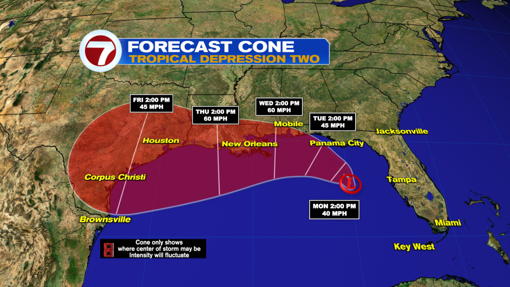
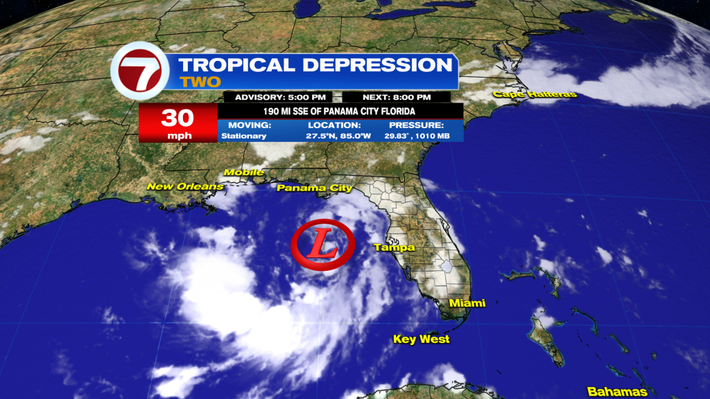
Tropical Depression Two formed in the Gulf of America this morning. As of the 5pm Advisory it packs winds of 30 MPH and is stationary.
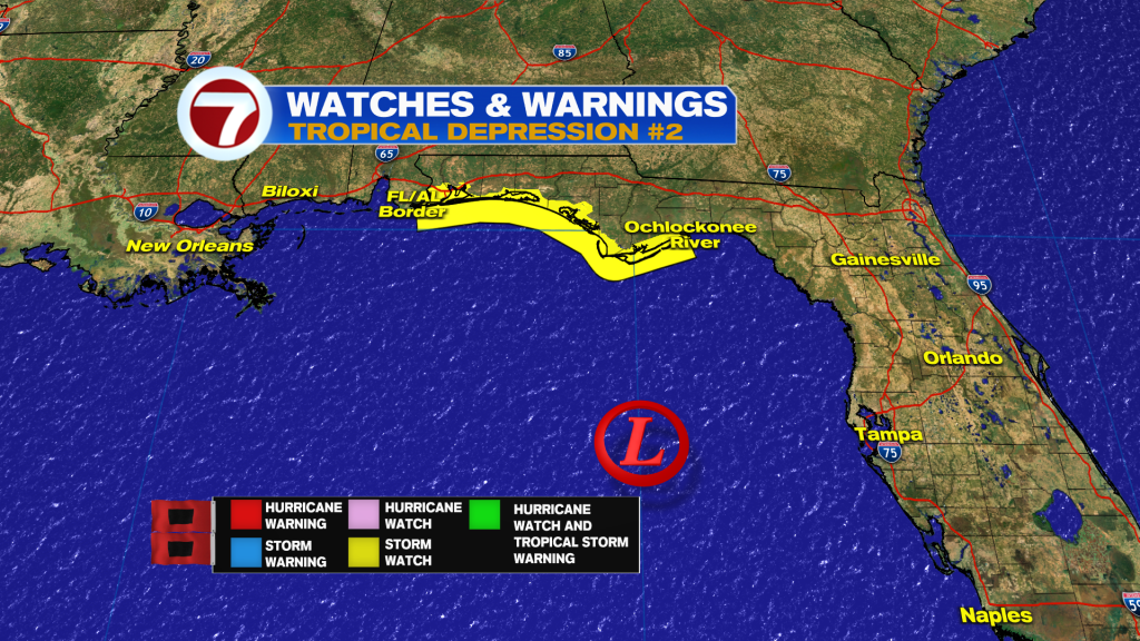
A tropical storm watch is in effect from the Florida Panhandle to the Alabama/Florida border.
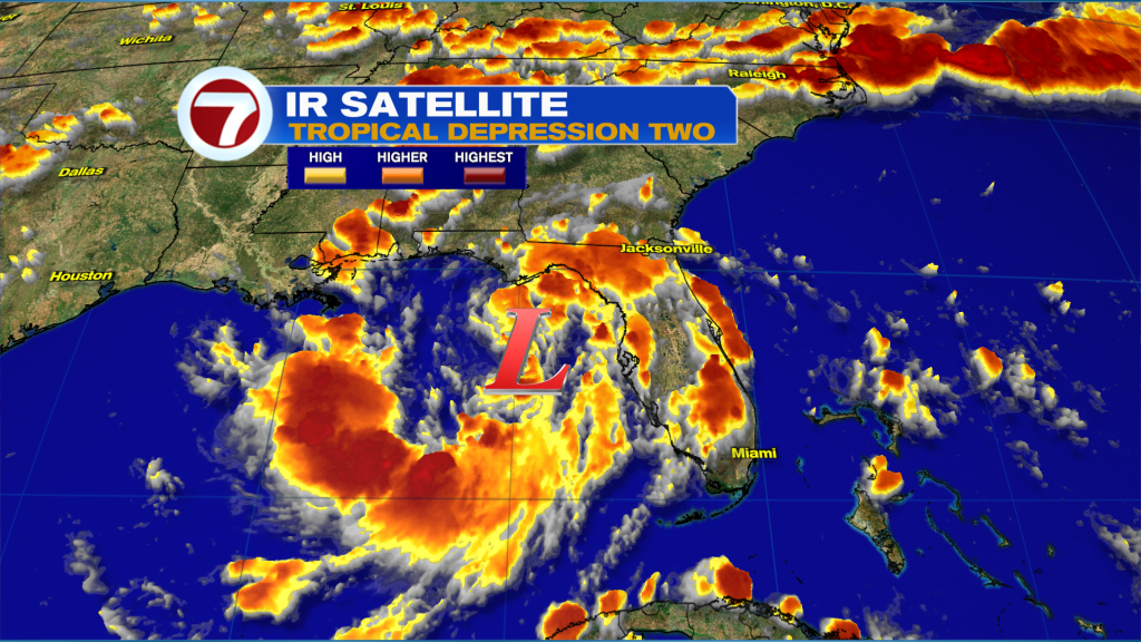
Looking at it on satellite, it is a fairly large system with rain bands extending from South Florida to the Louisiana/Mississippi border. TD2 is currently fighting some dry air and northerly wind shear.
The shear is expected to lessen a bit over the next few days which will allow for some strengthening into Tropical Storm Bertha. A slow westward track paralleling the northern Gulf Coast is expected — with a landfall in Louisiana or Texas forecasted later this week. The Gulf is near-record warm and I wouldn’t rule out this becoming a hurricane if it takes a more southerly track.