

South Florida’s brief taste of fall is officially over! Heat and humidity are back, along with increasing rain chances as we head toward the weekend.
Hot and Humid Through Friday
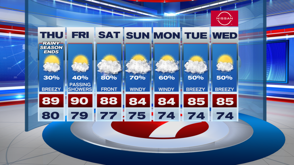
Expect a mix of sunshine and clouds today with scattered showers and a few thunderstorms. Along the East Coast, showers are most likely late morning through midday, while Southwest Florida will see more activity during the afternoon and evening.
Highs will reach the upper 80’s to low 90’s, but the humidity will make it feel like 100–105 degrees today and Friday. Moderate to major HeatRisk is expected, which is unusual for this time of year.
Friday brings another round of showers and storms, especially inland and across Southwest Florida. Some downpours could lead to localized flooding.
Saturday Looking Like the Wettest Day
An approaching front will bring a better chance for widespread rain and thunderstorms Saturday. Periods of heavy rainfall could cause localized flooding, although exact rainfall totals remain uncertain.
By Sunday, the front may stall nearby, allowing rain chances to gradually decrease in some areas.
Windy Pattern Ahead
As we head into early next week, stronger easterly winds will develop, bringing breezy to windy conditions and rougher seas. Rain should become less widespread.
Vivian Gonzalez
Meteorologist, AMS Certified
WSVN Channel 7