

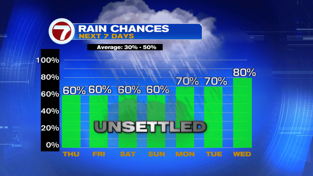
South Florida is entering a much wetter and more tropical weather pattern that could bring repeated rounds of heavy rain and thunderstorms through the weekend and possibly into early next week.
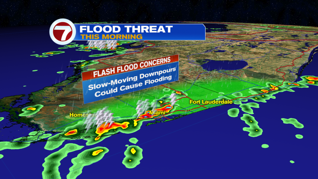
Today will feature warm, humid, and breezy conditions with scattered showers developing during the morning hours, especially along the East coast metro areas. As the afternoon progresses, rain and thunderstorm coverage will continue increasing across the region.
We are watching the potential for slow-moving storms today, meaning heavy rain could repeatedly move over the same locations. This increases the concern for street flooding, especially across the Eastern half of South Florida where the Weather Prediction Center has highlighted a Marginal Risk for excessive rainfall.
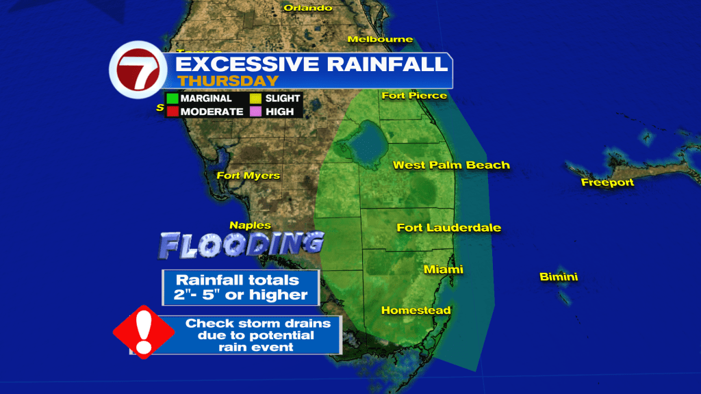
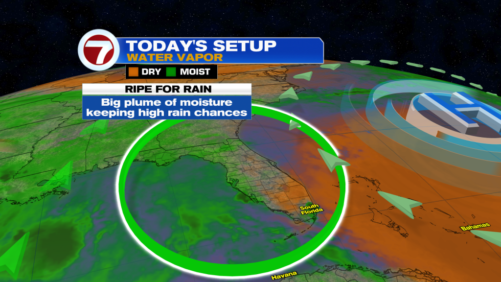
The overall weather setup is becoming more favorable for widespread tropical moisture to stream Northward from the Caribbean and Gulf waters into Florida. That moisture surge will continue fueling numerous showers and thunderstorms through Friday and into the weekend.
Even with the increasing rain chances, temperatures will remain hot and humid with highs near 90 degrees and heat index values climbing into the low 100’s during any breaks of sunshine.
The unsettled weather pattern is expected to continue through the weekend with daily rounds of showers and thunderstorms likely across South Florida.
Have a wonderful day South Florida and make it a safe one!
Vivian Gonzalez
Meteorologist, AMS Certified
WSVN Channel 7