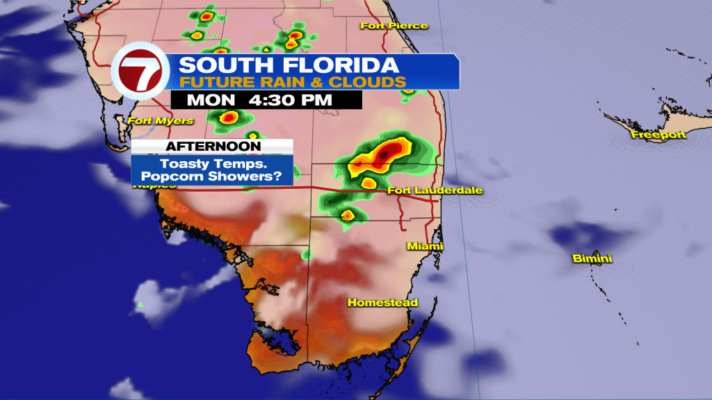
South Florida is in for another hot and steamy day with temperatures climbing into the upper 80’s and low 90’s this afternoon. When combined with the humidity, it will feel closer to 100 degrees in many areas, so if you have outdoor plans, make sure to stay hydrated and take breaks from the heat.
While much of the morning should stay quiet, scattered storms are expected to develop later this afternoon and evening, especially across interior areas, around Lake Okeechobee, and eventually drifting toward the metro areas. A few storms could become strong, producing gusty winds, heavy downpours, frequent lightning, and localized flooding.
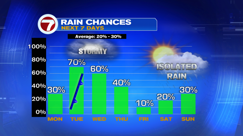
Rain and storm chances increase even more on Tuesday as a front slowly approaches the region. Numerous showers and storms are expected by the afternoon and evening, particularly across the east coast metro and interior sections of South Florida. Slow-moving storms could produce heavy rainfall and lead to ponding on roads and localized urban flooding.
The unsettled weather pattern is expected to continue through the middle of the week before drier conditions gradually return heading into the weekend. Despite the rain chances, temperatures will stay above average with highs remaining in the upper 80’s and low 90’s each day.
Have a wonderful day South Florida and make it a safe one!
Vivian Gonzalez
Meteorologist, AMS Certified
WSVN Channel 7