

We’ve been feeling fine so far this week, across all of south Florida. Temperatures have turned more pleasant behind a recent passing Front.
Wednesday may have even felt slightly “cool-ish” with morning temperatures as low as they’ve been since last fall! Readings were consistently in the mid to upper 60’s.
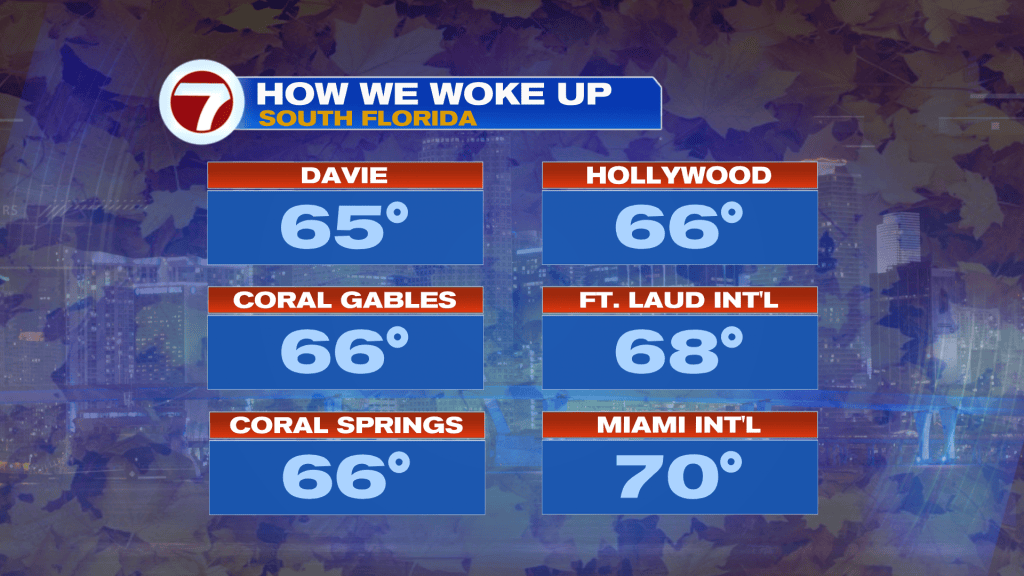
Into Thursday, we’ll have similar temperatures as the day begins. Mid to upper 60’s will be possible for inland locations while metro and coastal areas start the day around 70-degrees.
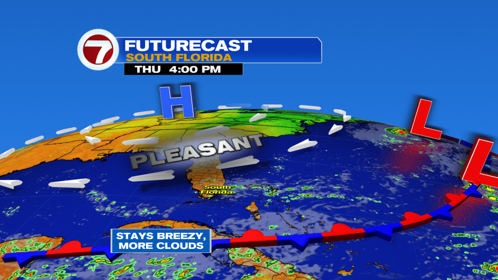
Here’s the setup (Thursday) with the very same weather features holding in place. That includes a stalled Front to our south and huge High Pressure region spanning north. That will still allow for breezy weather with more clouds drawn in by the end of the day. Also, forecast maps, as shown above, show scattered showers pivoting in. Any rain will tend to be short-lived and mostly light. That will change by the weekend, though.
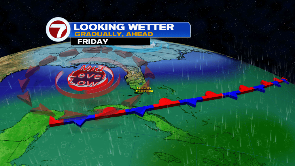
Beginning Friday our weather will take a turn. We’re expecting a non-tropical Low Pressure area to steer moisture back into south Florida. Depending on how it evolves, and it’s overall position, we may see heavy rain and potential flooding.
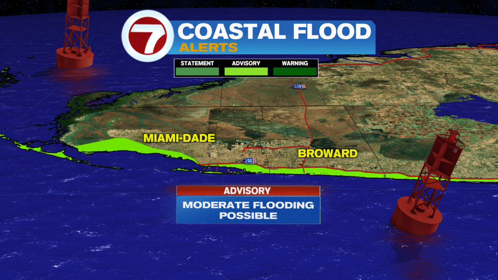
Even without the Low forming, we’d be facing Coastal Flood Alerts. It’s not because of rain potential but due to higher high tides. Remember, Water levels are higher in autumn and the strongest King Tides of the season come due to the gravitational pull. This ramps upon the Full Moon phase (early next week). Coastal flooding is possible along the Broward and Miami-Dade coast where there’s a Coastal Flood Advisory in effect. It doesn’t stop there.
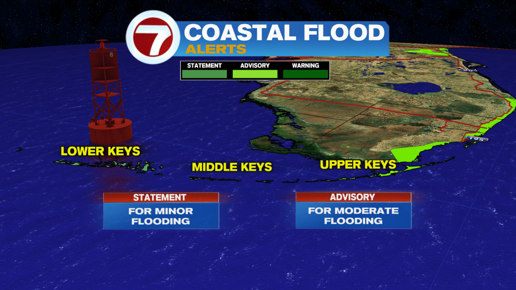
The Upper Florida Keys also have a Coastal Flood Advisory, while the Middle and Lower Keys have a Flood Statement warning of minor flooding around high tide cycles. As we experienced in September, these water issues will be most problematic around 2 hours before the peaking high tide and 2 hours following peak high tide.
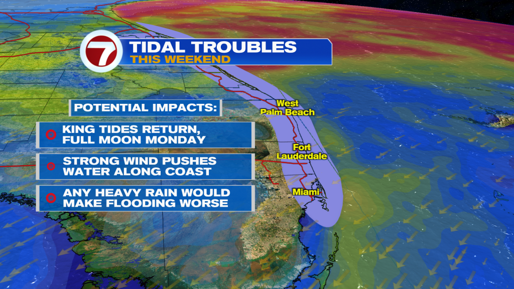
Tidal issues may be made worse over the weekend. The reason? Times of heavy rain are back in the forecast. While there’s uncertainty in the magnitude, data suggests widespread amounts of 2 – 4 inches with isolated higher tallies (potentially over 8 inches). That could lead to major flooding in spots. Continue to monitor the forecast and expect these marine hazards. Lastly, this will not be a weekend to venture into the water. According to the National Weather Service, there will be life-threatening surf with dangerous rip currents.