

Saharan Dust has moved over the region and it’s creating dry and hazy conditions across south Florida. Here’s a look at the dust layer captured on satellite Wednesday afternoon.
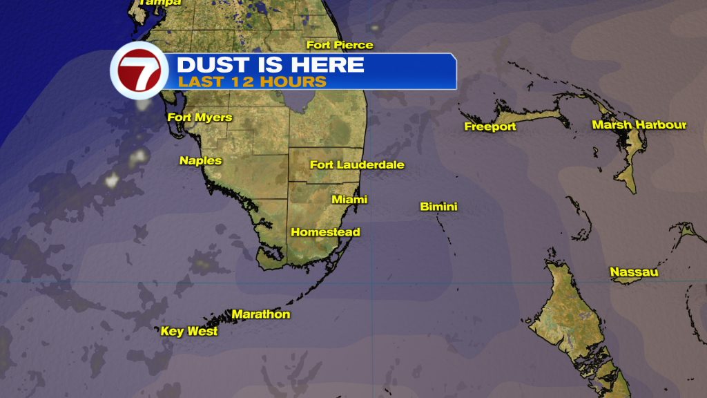
To get a better grasp on the extent of the dust plume, here’s a big and wide view of the dust as it covers Cuba and the Bahamas with the polluting particles as they stay suspended in the air.
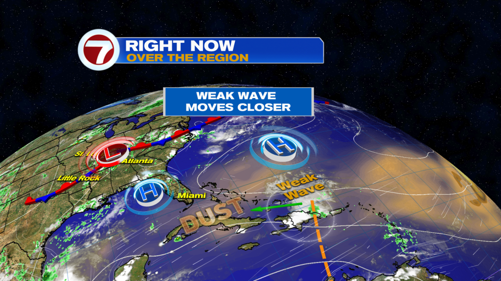
Much Deeper into the Atlantic there’s a larger Area of Dust, divided by a weak tropical wave. The disturbance won’t have the ability to strengthen into a tropical system and may struggle to even hold together (as a wave) upon moving on. It’s being directed along the periphery of High Pressure and making for a persistent onshore flow.
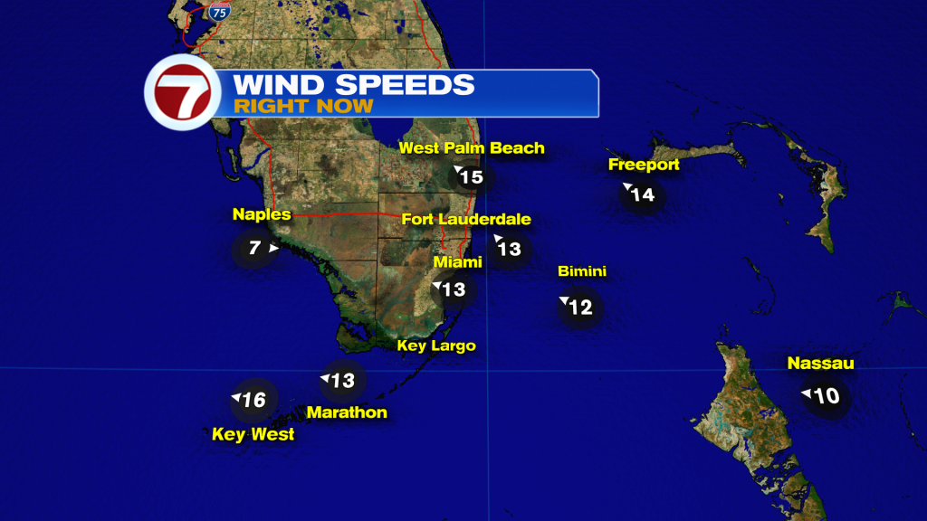
The main difference compared to recent days? The stronger breeze from the east-southeast. These bigger winds will attempt to take the edge off strong summer heat and humidity (but that’s a tall order). At most, a little relief can be noticed near beach locations.
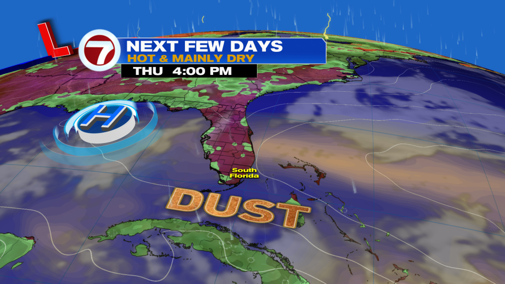
This dust remains dominant for Thursday with mainly dry conditions. The aforementioned wave will still be too far east to trigger rain, at least yet. Hazy sun should be expected with a tropical-feeling breeze, at times.
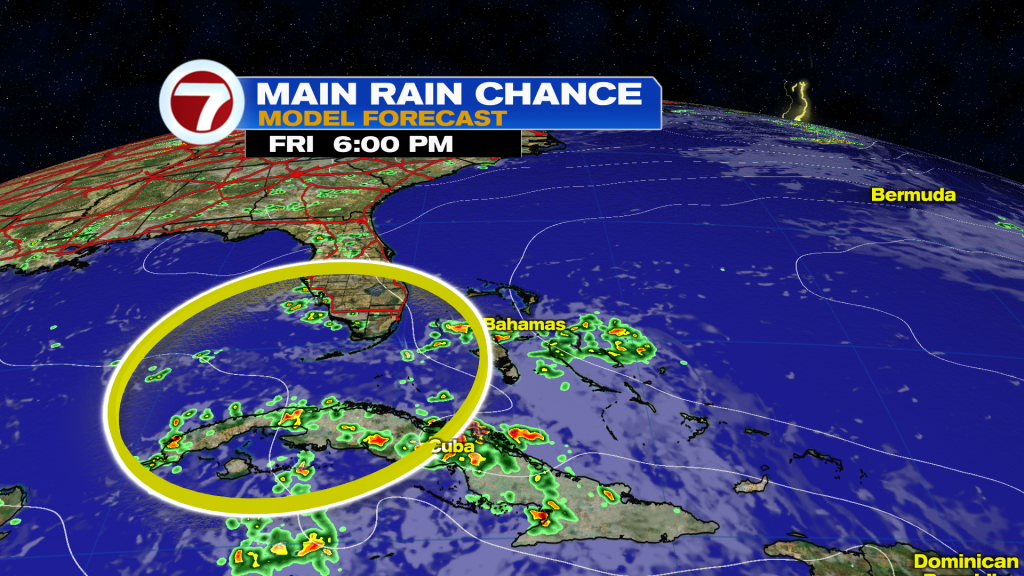
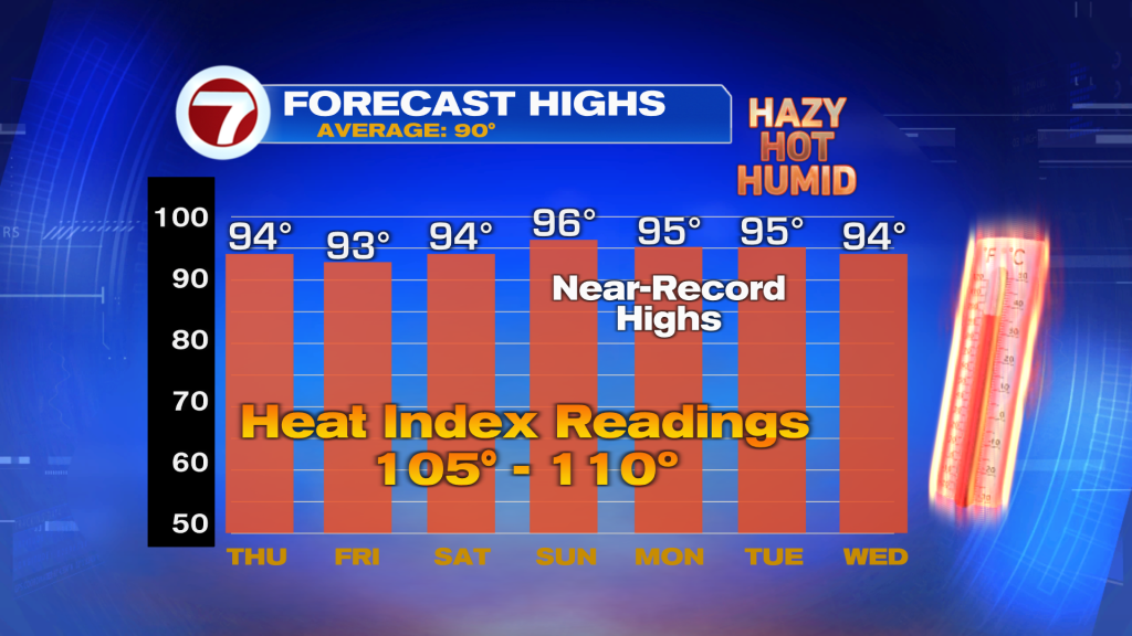
There’s at least a slight chance for rain showers (scattered, at best) as the wave attempts to head west into our vicinity, on Friday. Mostly broken rain bands will tend to struggle due to surrounding Dust. Once the “wrinkle” moves by, it’s back into a Dry and Hot pattern with a more pronounced haze. High temperatures are even forecast to come close to records for the start of next week!
Copyright 2026 Sunbeam Television Corp. All rights reserved. This material may not be published, broadcast, rewritten or redistributed.