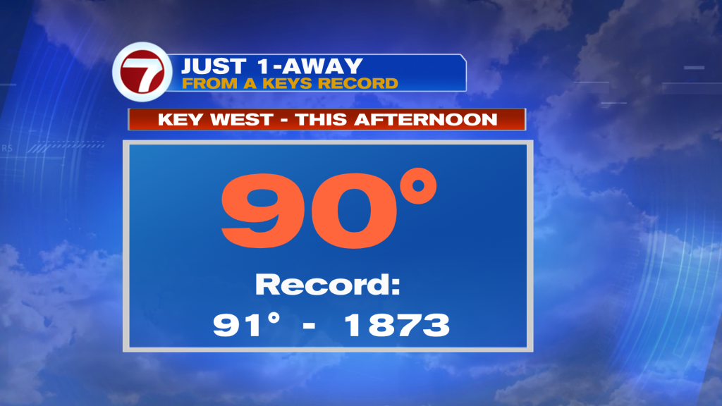
The calendar says May but upcoming weather suggests summertime. As the week continues, so will come higher temperatures. For the time being, though, it’s only “slightly warm” for most of south Florida. One notable exception (Tuesday) was Key West. That’s where we came very close to a record, in the books since 1873! The official high was 90-degrees in the Lower Keys (just one degree shy of matching the record mark)!
Mainland south Florida (also) saw the return of strong sunshine. Clearing came as a weak Frontal boundary was dissipating to our south.
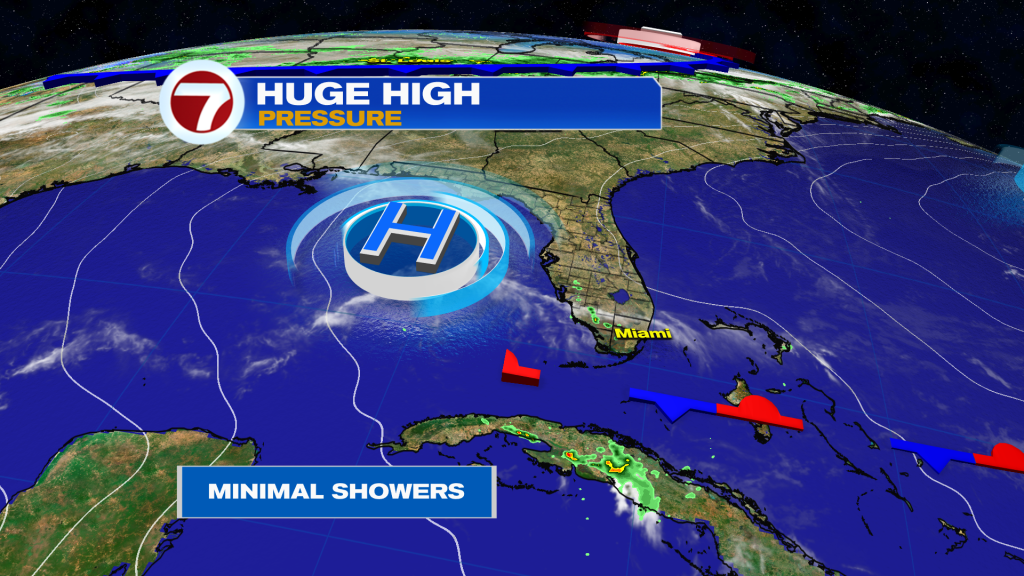
High Pressure is now in command of our weather and it expands from the Eastern Gulf through the western Atlantic waters. That will make for quiet conditions as the midweek continues.
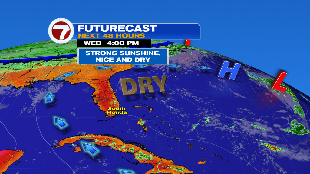
Here’s a glance (above) of the Wednesday weather map. The Atlantic High Pressure center will be the dominant one while winds flow around it, arriving from the southeast. With abundant sunshine, temperatures will easily elevate into the upper 80’s. It’ll be the precursor to hotter air ahead for the end of the week!
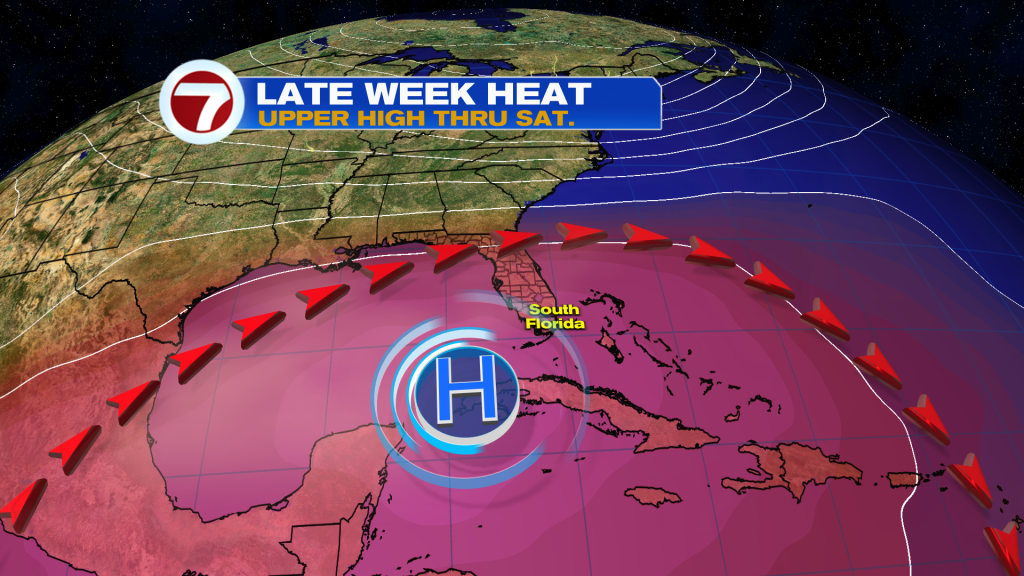
A big “hot dome” is forecast to expand across south Florida. Shaping up will be the most significant heat of the year, so far. Also, record temperatures will likely be challenged, for some spots, beginning Friday.
Copyright 2026 Sunbeam Television Corp. All rights reserved. This material may not be published, broadcast, rewritten or redistributed.