Wet weather is back but arriving in “different doses” than earlier in the week. Instead of storms forming virtually over us during the afternoon, current rain bands are more sporadic (and spread out).
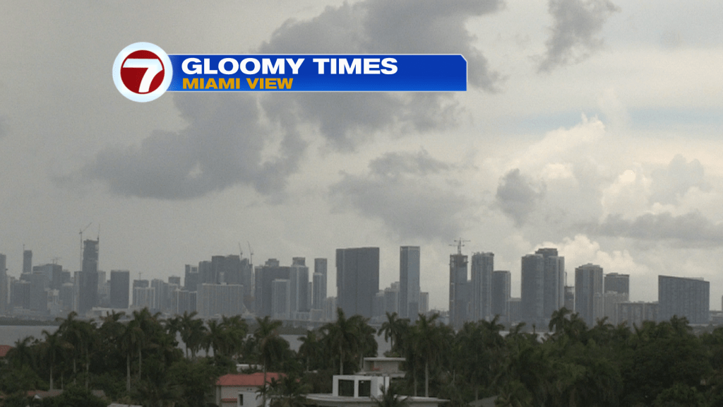
Despite bigger breaks between downpours, cloud cover remains stubborn across south Florida. Wednesday was an overcast day and gloomy as confirmed by our tower camera and the satellite view, shown below.
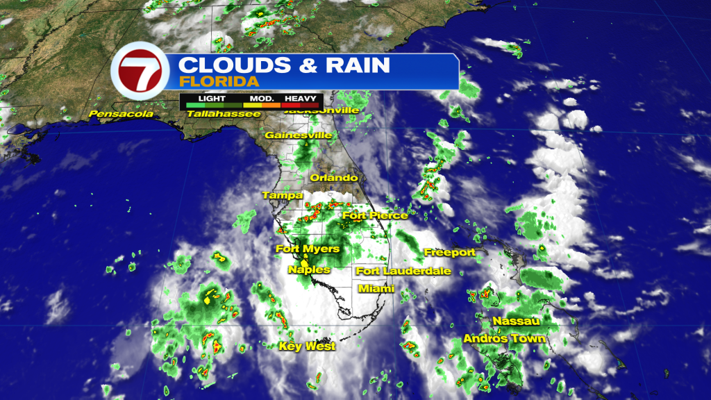
The occasionally wet and unsettled weather is largely due to lingering tropical moisture holding from the eastern Gulf waters to the western Atlantic Ocean.
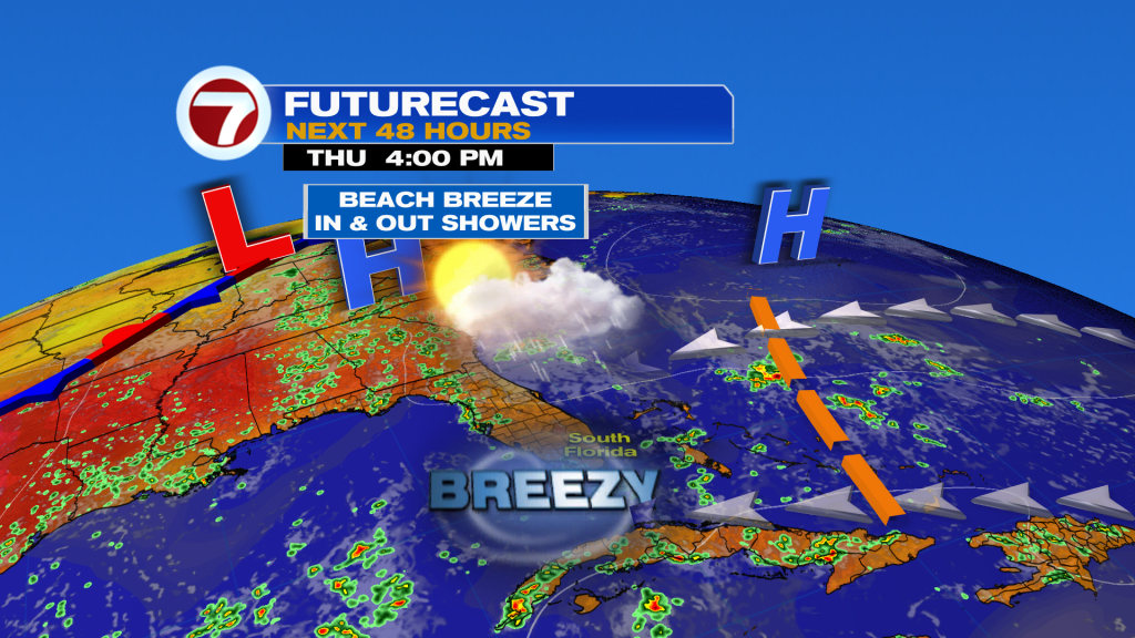
High Pressure has been building back but it’s centered quite far north (over Bermuda). It’s getting stronger, though, and that’s helping stir up the winds and waves.
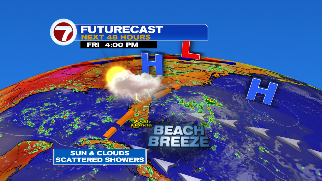
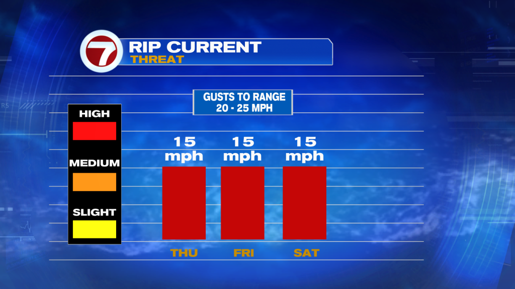
With a continued easterly flow, both Thursday and Friday look breezy and damp. As for the extent of the rain, keep in mind these bands will be pushed along faster (in this flow) lessening accumulation to some extent. Also, there’s 1-thing to watch “soon”. It’s a disturbance that could arrive Friday with bigger developing rains. Forecast models aren’t conclusive whether this “Friday feature” will be very impactful for south Florida. Some guidance is shifting most wet weather north, while other models show heavy, enhanced rain reaching us for at least part of the day. Regardless, beach conditions won’t greatly improve as dangerous Rip Currents remain a high risk through Saturday.
Along with the gusty breeze and occasional downpours, let’s examine the tropics which often “heat up” in August, then peak in September. At the current time, there are only weak tropical waves with no development expected over the next 7 days. There’s still a good amount of Saharan Dust extending over the Atlantic Ocean, as referenced in the big tropical view below.
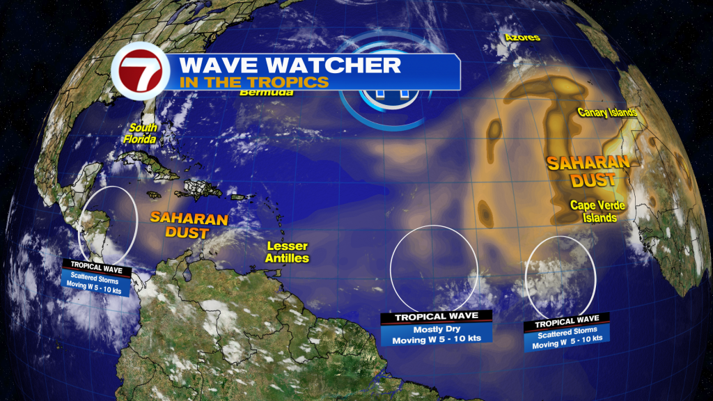
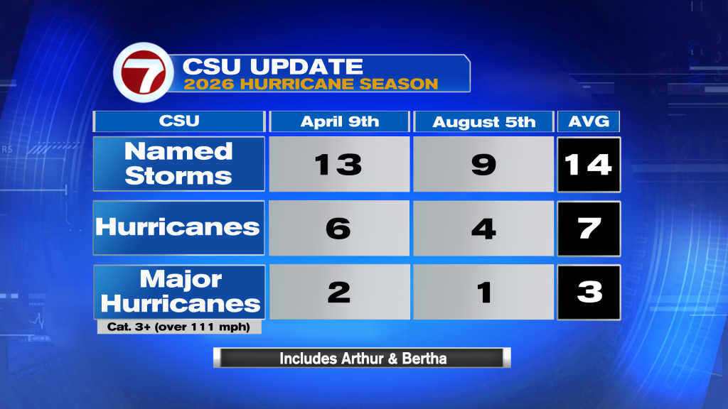
The continued presence of Saharan Dust is one of the main reasons we’re seeing quiet tropical conditions. Even as the dust gradually breaks, there could be other obstacles for future development. Remember though, there’s a long way to go this Hurricane Season (which doesn’t end until November 30)! On Wednesday (August 5th) Colorado State University updated their forecast for the remainder of the season. The update calls for even fewer tropical storms and hurricanes than their previous forecast, prior to the season officially beginning. They’re forecasting a total of 9 named storms with 4 of them becoming hurricanes. Of those 4 hurricanes, they see one of them becoming “major” at Category 3 strength or stronger.