(WSVN) - A hot and humid stretch of weather continues for South Florida but it will turn even hotter this week with feels-like temperatures surging into the triple digits most — if not all — of this middle week of June.
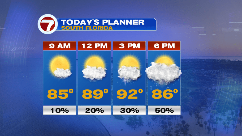
Winds will take on more of a southerly component much of this week as fronts remain well to our north, opening up the flow for these higher temperatures. Highs all week long are forecast to be in the 90s, with the hottest of air occurring early to mid week. That’s when temperatures will reach the mid 90s for many locations.
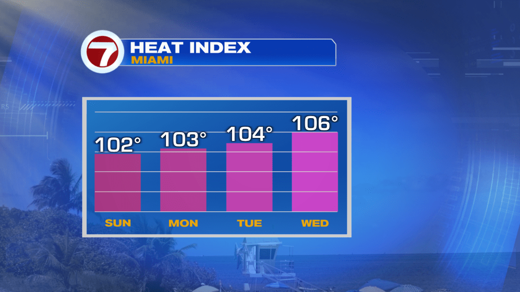
Feels-like temperatures will also turn higher as the week progresses, with readings around 100F this Sunday but rising up to around 105F by Wednesday and potentially remaining around that level for the rest of the week.
The somewhat good news is that some brief, cooling storms will be possible early week.
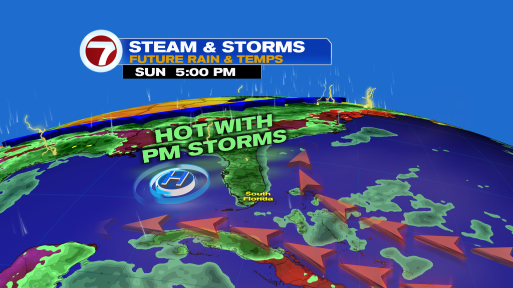
Expect sunshine to gradually give way to more clouds by the end of the day Sunday. Spotty showers will start to form midday near or west of the metro, with scattered showers and storms possible, especially late in the day.
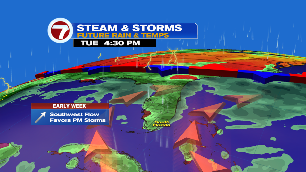
Winds veer more out the southwest — opposed to south today — for Monday and Tuesday, favoring scattered, afternoon storms across much of the metro.
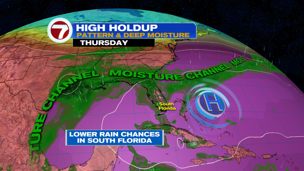
Later in the week, though, some drier air creeps in from the south as the moisture channel gets nudged farther north. This will result in lower rain chances, which is and has been a theme across much of the Caribbean and Atlantic.
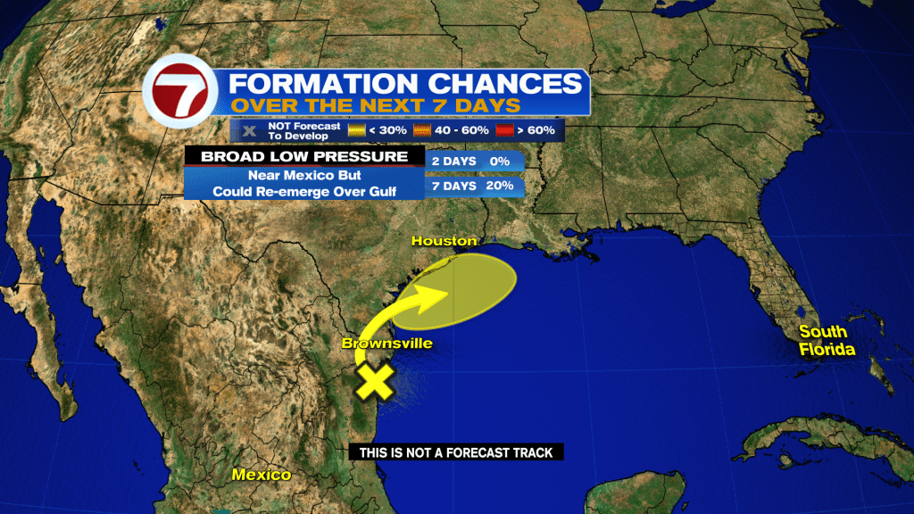
Tropical update
A broad area of low pressure maintains a low, 20% chance of development over the next 7 days. It’s currently along the coast of eastern Mexico but could re-emerge over the northwestern Gulf by mid next week. This is not a concern to South Florida.
Copyright 2026 Sunbeam Television Corp. All rights reserved. This material may not be published, broadcast, rewritten or redistributed.