

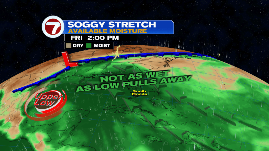
(WSVN) - A very wet and stormy Thursday across South Florida is starting to come to an end, as of this writing at 2PM.
A widespread 1-3 inches of rain fell across the area, which led to some flooding as it coincided with the higher than normal, high tide cycle.

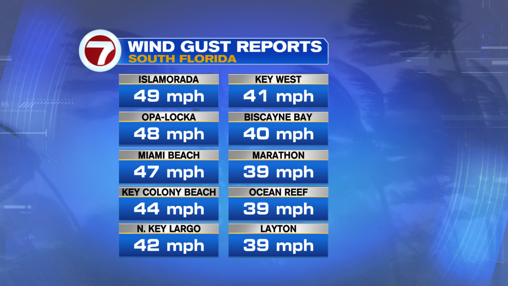
That also came with a burst of strong, gusty winds during the late-morning hours, with numerous 40-50 mph gusts reports.
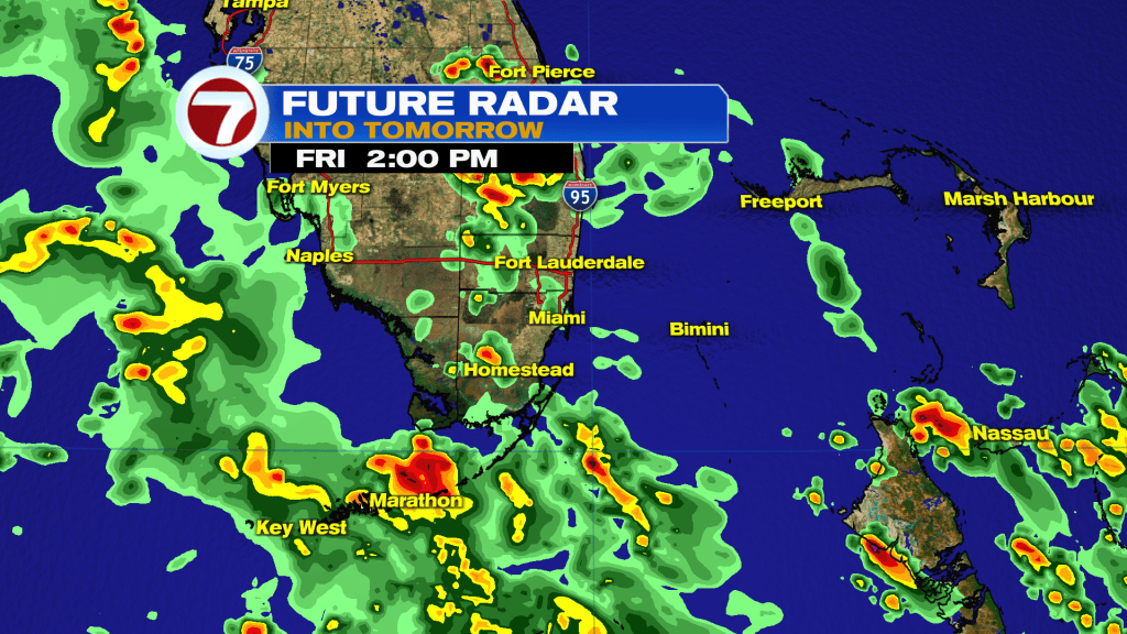
Looking ahead to tonight, the clouds and the onshore breeze will hold as we continue with damp conditions. Isolated to widely scattered, passing showers and storms can be expected but we’re not looking at a widespread rain.
The same can be said for our Friday as the upper level low, which was the primary driver for the rain Thursday, starts to pull away and high pressure begins to build back in.
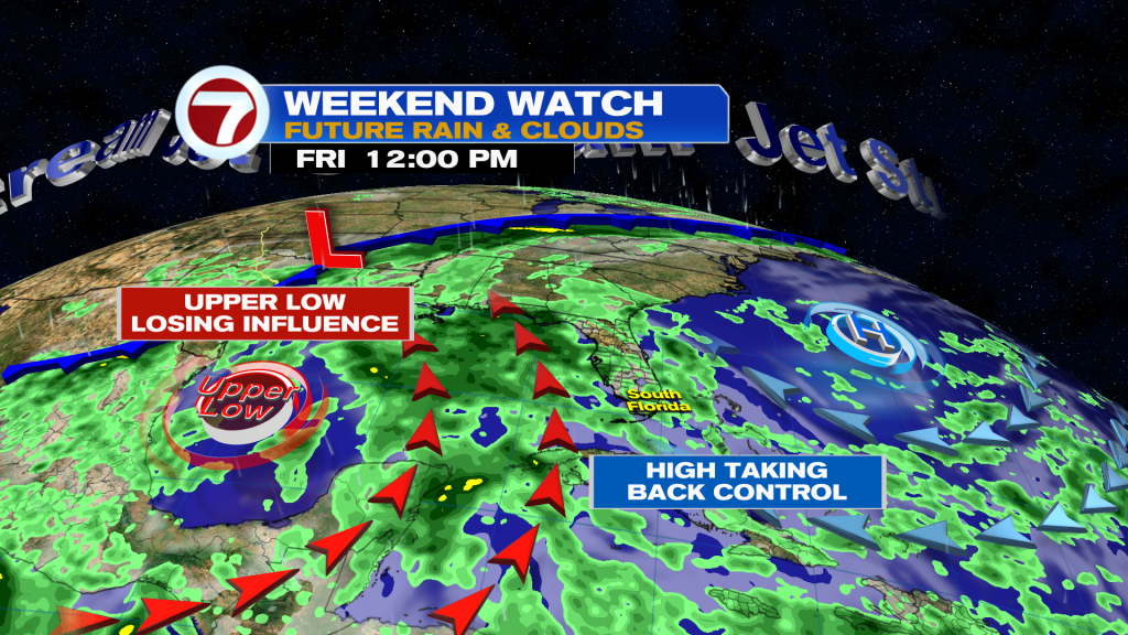
This will result in fewer showers and storms for the weekend.
With that said, occasional passing storms and downpours are still expected on Friday. Otherwise, skies will remain mostly cloudy.
A bit more sunshine should return for the weekend as the breeze gradually settles down. This will result in hot and steamy conditions with only isolated shower and storm chances both Saturday and Sunday. The highest odds for rain will be focused near the west coast of the state.
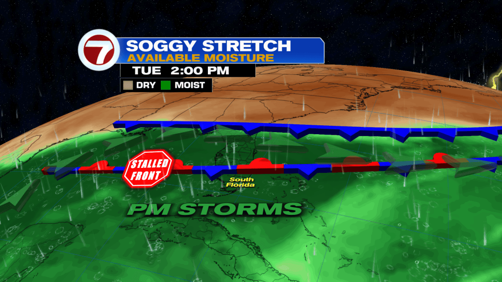
Higher rain chances do return next week, however, as a series of fronts reach and stall across Florida, resulting in the daily risk for afternoon thunderstorms.
Tropical update
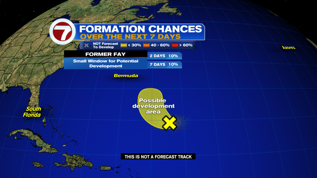
On this first day of October, there are no active systems to track but the National Hurricane Center is watching the remnants of Fay — again — well southeast of Bermuda for a low chance of re-development.
Copyright 2026 Sunbeam Television Corp. All rights reserved. This material may not be published, broadcast, rewritten or redistributed.