Happy Saturday, South Florida!
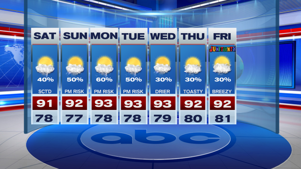
The weekend looks very warm & summerlike with highs in the lower 90s and a chance of storms.
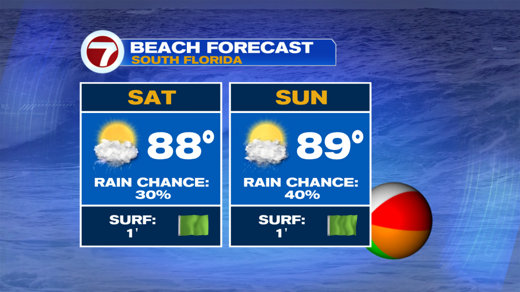
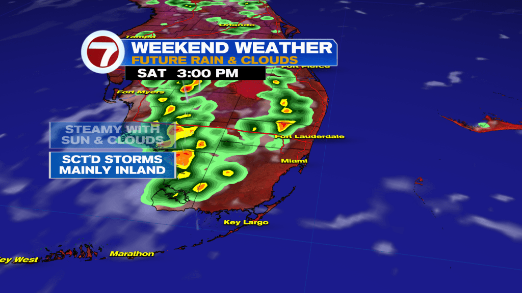
As for today, the highest coverage for storms looks to be in our inland zones over the Everglades and into SW Florida. But you can never rule out an isolated storm or two on our side of the coast as well. Otherwise, it will be steamy with the heat index back in the triples.
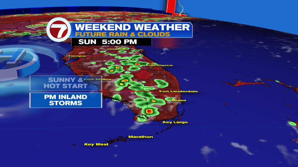
As for Sunday, there will be a little bit of a higher chance of storms on our coast late in the afternoon as winds veer more westerly.
Looking ahead, we see a bit of a drying trend with generally lower rain chances next week. I’m seeing only daily isolated storm chances with highs in the lower-90s.
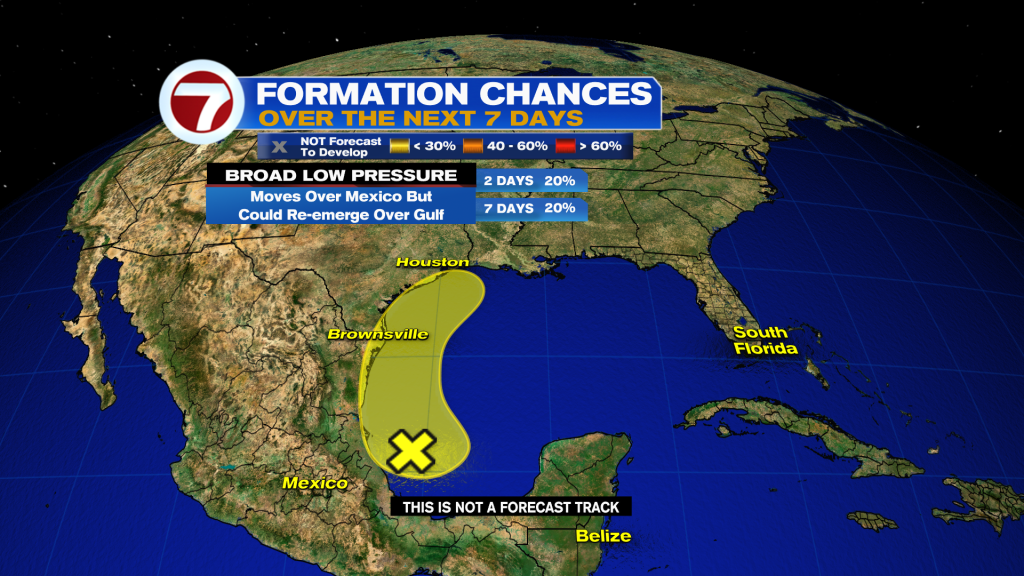
TROPICAL UPDATE – The National Hurricane Center is monitoring a disturbance in the western Gulf. There is a 20% chance of a depression forming offshore the Texas or Louisiana coastline before moving inland midweek next week. Regardless of development, the disturbance will bring a heavy rain threat to the northern Gulf Coast as moisture interacts with an old frontal boundary. The first name on the list is Arthur.