Happy Sunday, South Florida!
Your Sunday is looking soggy with scattered storms expected today. Storms will start along the sea-breeze closer to the coast in the morning into midday, before the best chances shift inland in the afternoon. A few could be strong with gusty winds of 40-50 mph, small hail, frequent lighting, and heavy downpours.
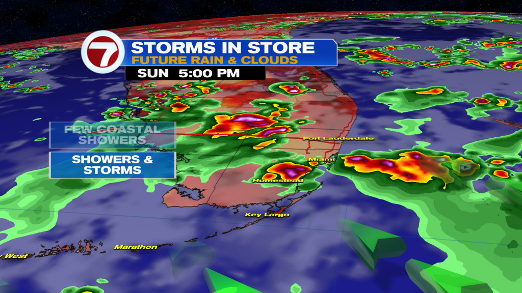
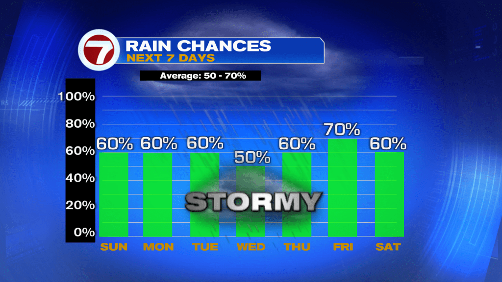
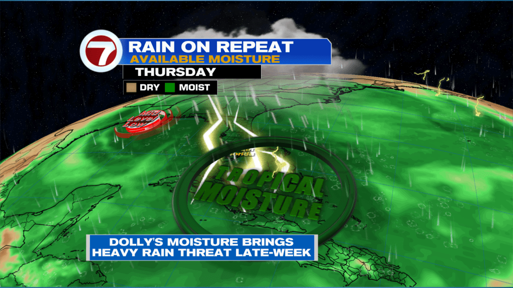
Storms aren’t going anywhere heading into the work week. A daily dose of showers and storms are expected each afternoon. Storm chances will stay high through the end of the week as moisture associated with the remnants of Dolly push across the state.
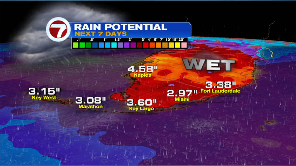
Once it’s all said and done South Florida should pick up on average 1-3” of rain this week, though isolated totals could end up much higher.
TROPICAL UPDATE:
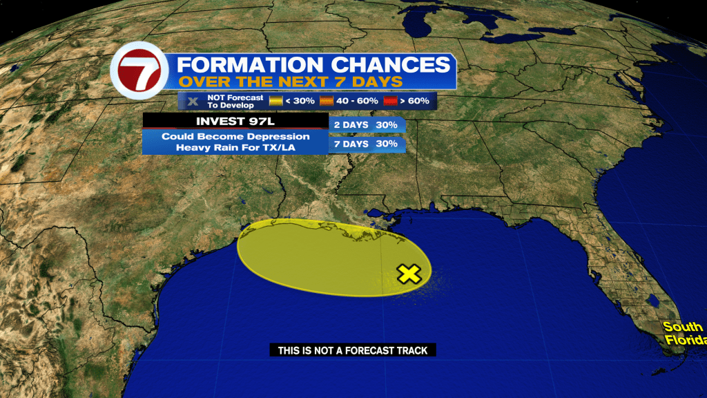
I’m monitoring two areas in the tropics — the remnants of Dolly in the Atlantic and a weak disturbance over the northern Gulf.
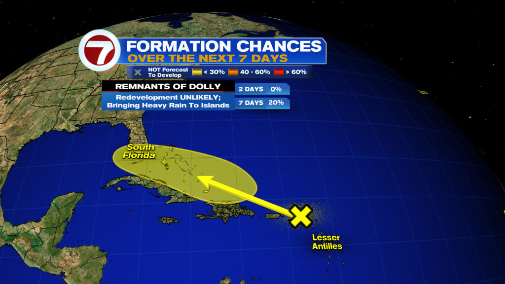
The remnants of Dolly remain disorganized by dry air and wind shear as it passes near the Leeward Islands. I’m not expecting Dolly to do much in the short-term. However, we need to keep an eye on Dolly’s remnants once it enters the Bahamas Tuesday into Wednesday, where it will encounter lower wind shear and very warm water temperatures. The National Hurricane Center calls for a low chance of redevelopment. However, it’s the peak of hurricane season and we have to closely watch every disturbance that comes into our backyard. Either way, Dolly’s remnants will help keep our rain chances high through the end of the week.
Meanwhile, a weak area of low pressure labeled Invest 97L has a low chance of becoming a depression in the northern Gulf this week. Regardless of development, it will bring higher rain chances to Louisiana and Texas over the next several days. Next name is Edouard.