(WSVN) - Changes are on the way this weekend as both temperatures and rain chances rise in South Florida, making it feel a lot like June.
High pressure near Florida and over the Gulf waters will usher in hotter and lighter winds to the region. This lack of a breeze will make it feel even worse with widespread feels-like temps in the upper 90s to around 100F both afternoons this weekend.
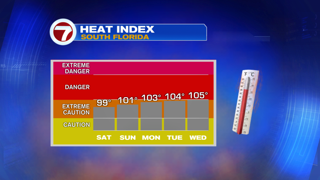
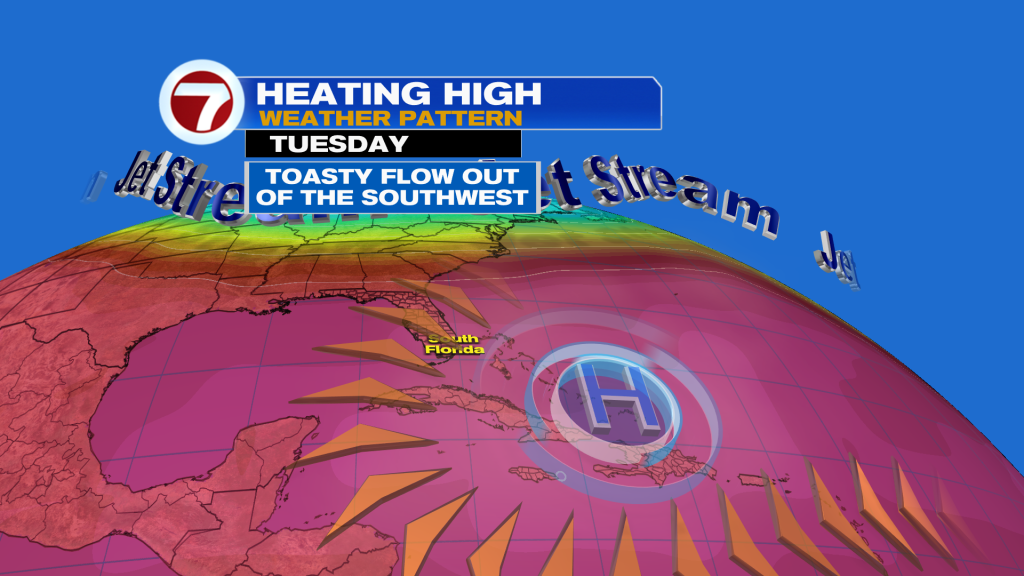
As a dome of high pressure builds in over the southwest Atlantic throughout next week — leading to a southwest wind flow — that will cause those heat index readings to increase some more.
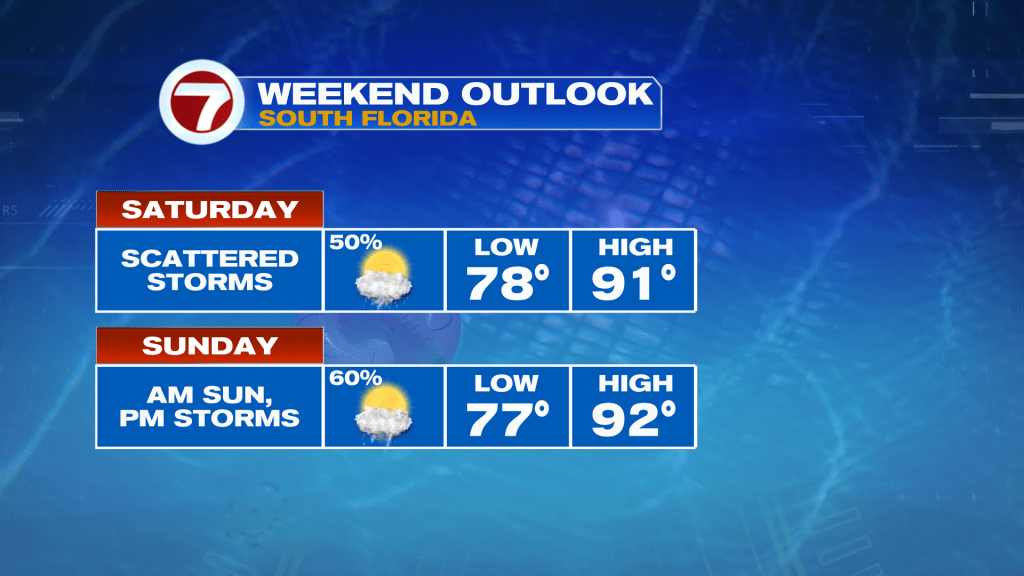
Along with the heat will come with the risk for storms, with the highest of chances occurring this weekend and early next week. With that said, lots of dry time is still in store.
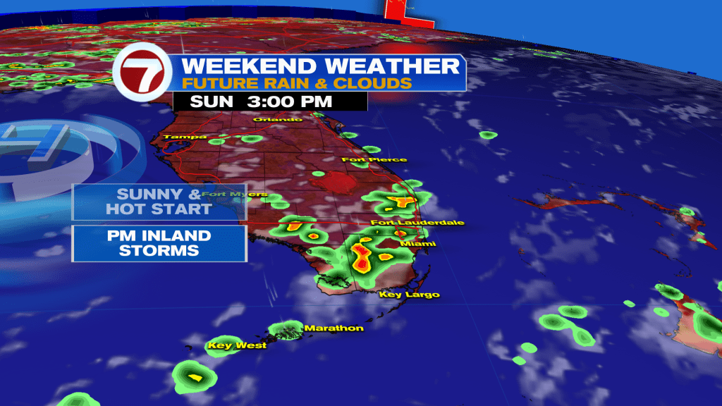
On Saturday, expect a mix of sun and clouds during the morning and midday hours. Clouds will then increase throughout the afternoon as scattered showers and storms develop.
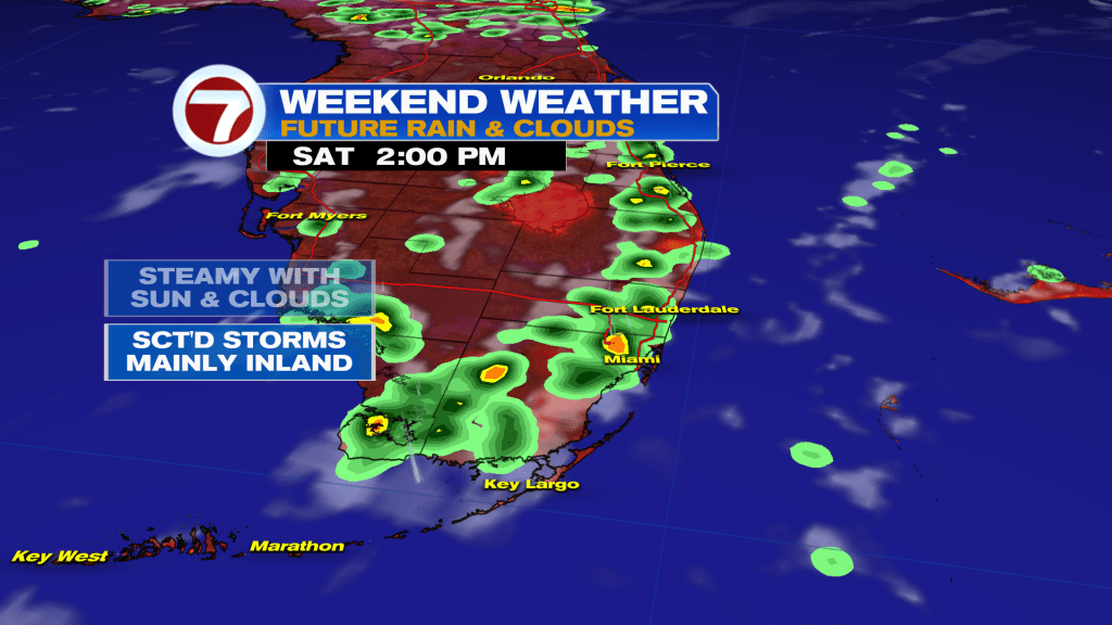
Given a northerly steering flow, that will favor the highest rain chances inland. Therefore, the closer you are to the coast, the more likely you are to be dry.
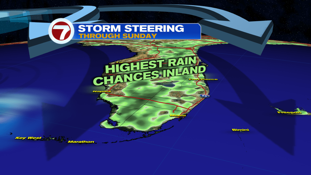
That changes Sunday into early next week, however, as those steering winds take on more of a westerly component. That will favor afternoon, scattered storms across much of the Miami-Dade and Broward metro and coastal locations.
Rain chances are poised to lower later in the week as some drier air (for rain) returns.
Tropical update
A broad area of low pressure has a low, 20% chance of development over the western Gulf waters.
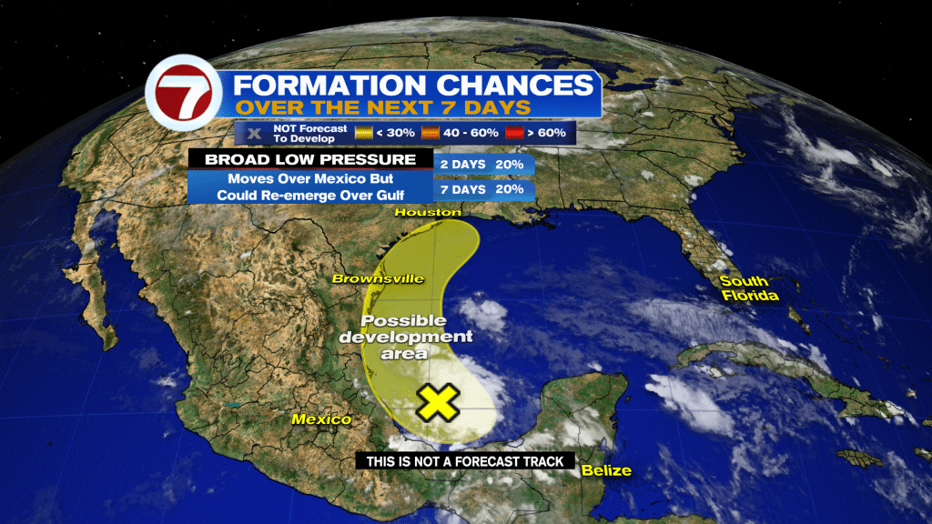
It is forecast to move over Mexico this weekend, then could re-emerge over the Gulf near Texas early next week. Regardless, areas of heavy rain and flooding will be a concern for this part of the world.
Copyright 2026 Sunbeam Television Corp. All rights reserved. This material may not be published, broadcast, rewritten or redistributed.