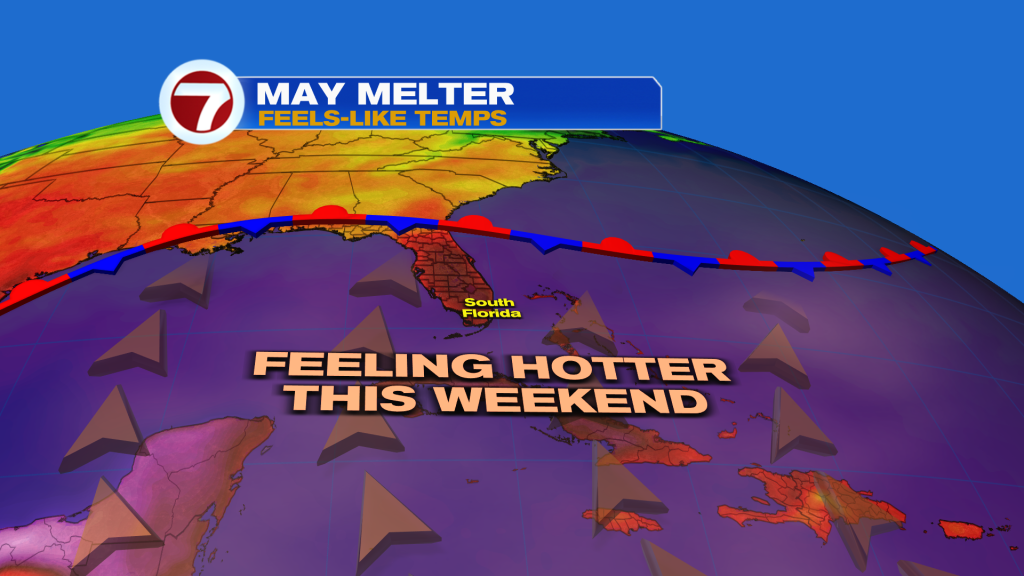
After a brief reprieve early this week, the heat is back on, reminding us that the hotter half of the year is starting to begin across South Florida.
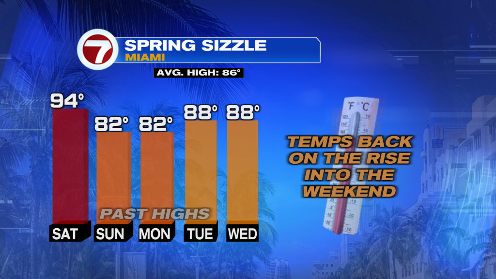
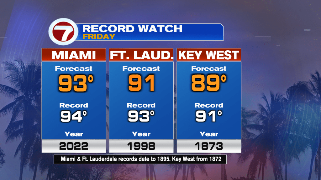
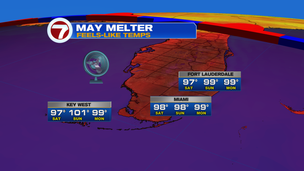
Record heat will be possible again on Friday with forecast highs in the low to mid 90s for the region while feels-like temps reach the mid to upper 90s.
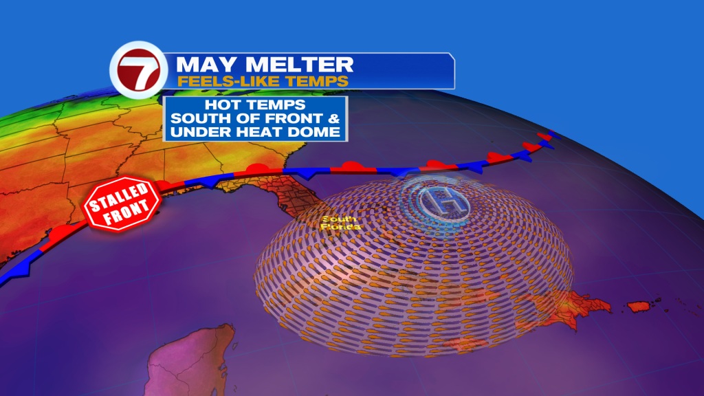
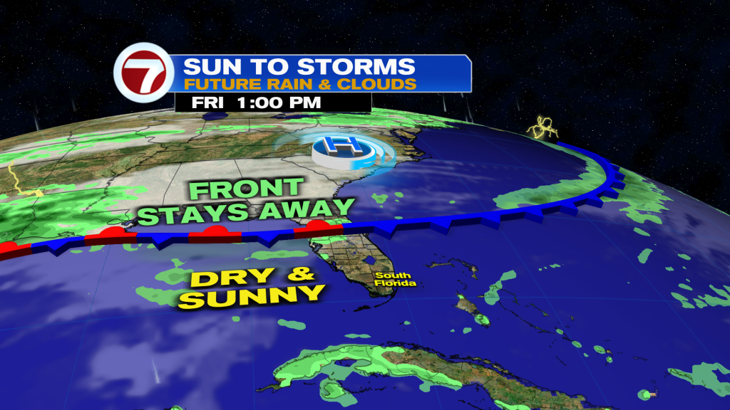
The culprit for these hot, above average temperatures is a southerly wind and a heat dome on top of the region. This pattern will remain in place through at least Sunday before a front arrives early next week.
What’s also helping is all the sunshine. Expect to see lots of it Friday into Saturday with near-0% rain chances.
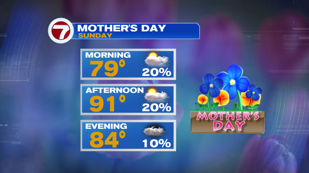
By Sunday — for Mother’s Day — clouds will become more present — mainly in the upper levels, which will act as a filter to the sunshine. Despite that, humidity levels will be even higher, translating to feels-like temperatures up to around 100F!
Besides a spotty shower or two, Mother’s Day should remain quiet.
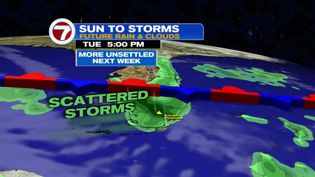
It will stay hot and humid on Monday but a front will approach, stalling out across the area on Tuesday. This will lead to “not as hot” temperatures by mid next week but it will definitely still feel very warm.
At the same time, moisture levels for rain will increase with this front’s arrival. Therefore, scattered showers and storms will be possible starting Monday and lasting into at least mid next week.
Copyright 2026 Sunbeam Television Corp. All rights reserved. This material may not be published, broadcast, rewritten or redistributed.