Happy Monday, South Florida!
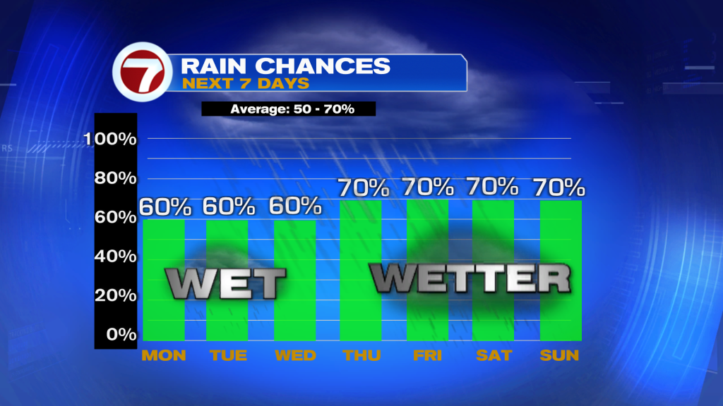
The big story this week is the rain! We start off the week with somewhat typical showers and storms, but rain chances will climb even higher late week as the remnants from Dolly bring extra moisture to Florida.
Starting off with today, we will see showers and storms start along the coast in the morning and then become more widespread in the afternoon. A few storms could be strong with heavy rain, gusty winds of 50 mph, and frequent lightning being the main threats.
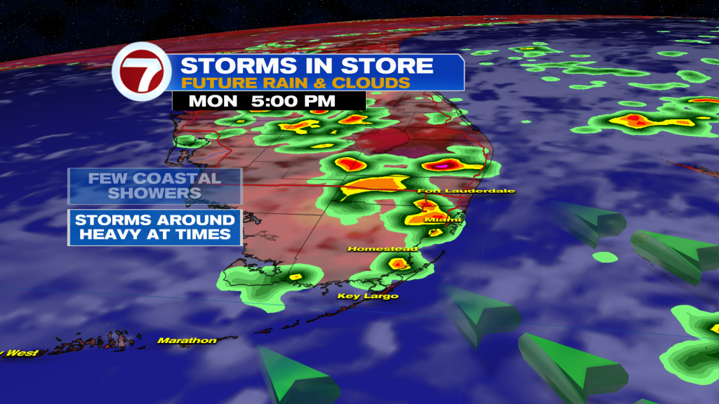
The higher rain chances today are being enhanced by a lurking low in the mid-levels of the atmosphere.
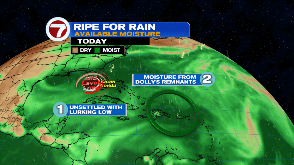
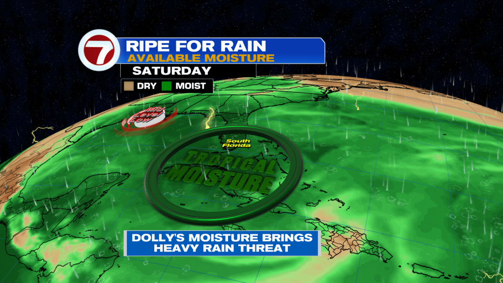
By Thursday into Friday the moisture associated with Dolly’s remnants will bring even higher rain chances to South Florida. Higher rain chances look to continue into Labor Day Weekend.
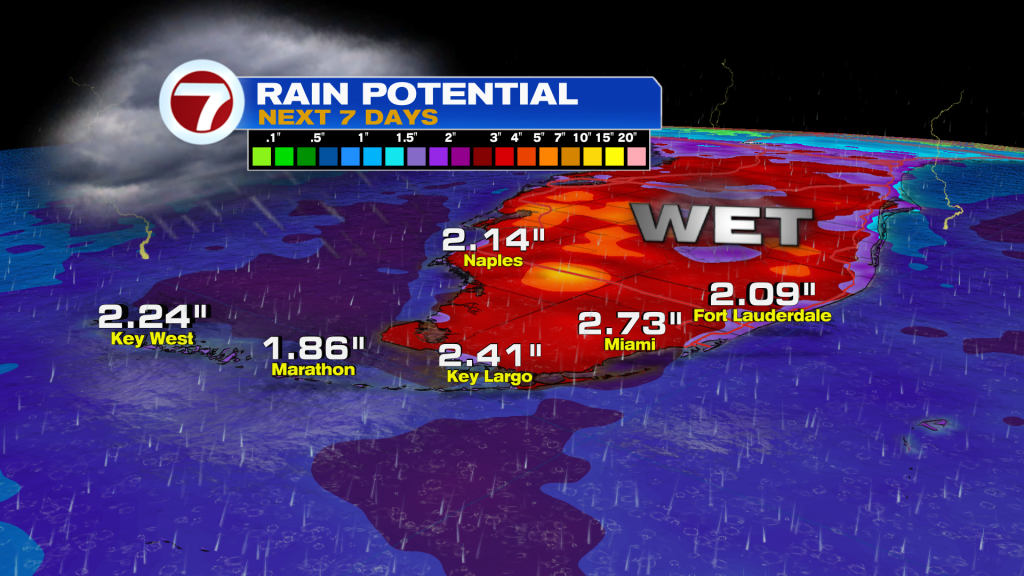
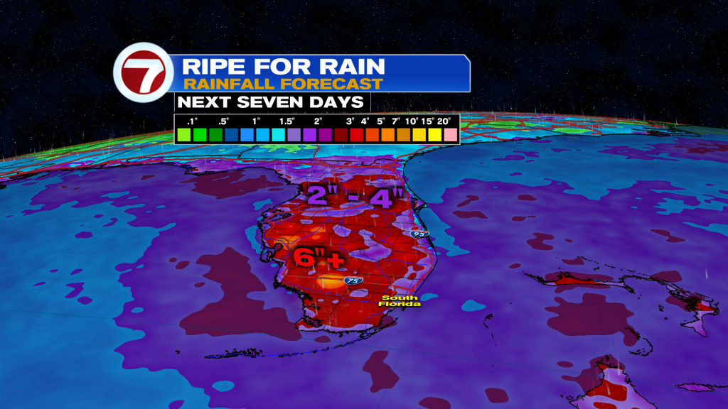
Flooding could become a concern any day, with widespread rainfall totals of 2 – 4″ forecast over the next seven days. Isolated totals much higher than that are possible.
TROPICAL UPDATE:
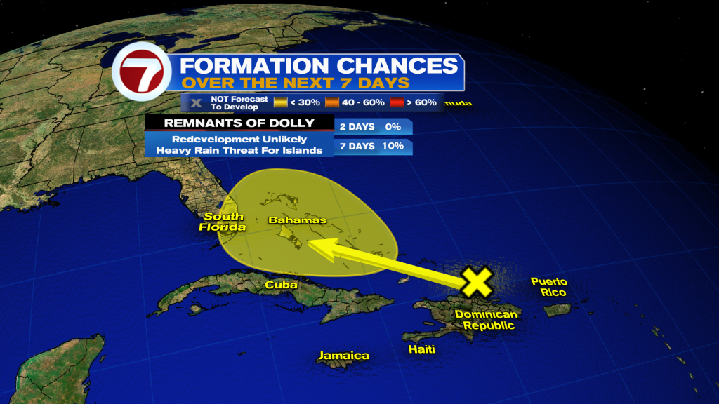
We’re watching two areas in the tropics — the remnants of Dolly and Invest 97L in the Gulf.
The remnants of Dolly has been our focus since it’s what will impact us here in South Florida. The good news is that redevelopment is not expected, with the National Hurricane Center only calling for a low chance of Dolly becoming a storm again. It’s worth mentioning all of the models have dropped the idea of redevelopment. However, it is the peak of hurricane season so we have to watch every disturbance that comes in our backyard. We’ll keep an eye on it but either way the moisture from Dolly will bring us a heavy rain threat the second half of this week. We do need the rain so it’s not the worst thing in the world.
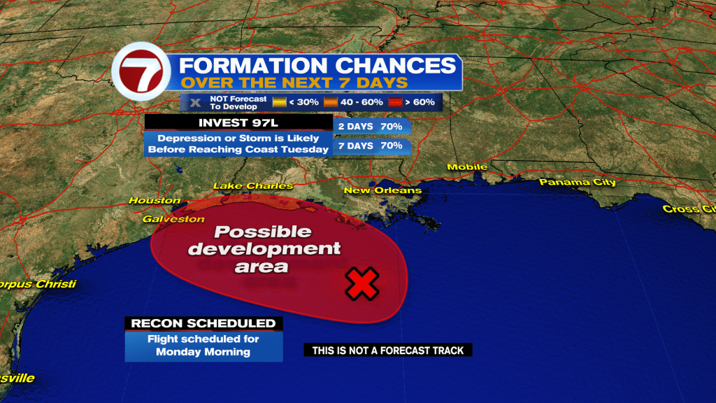
Meanwhile in the Gulf, Invest 97L is on the verge of becoming a tropical storm in the Gulf. It looks very well organized on satellite with plenty of storms and spin near its center. The National Hurricane Center gives it a high chance of development and is likely to issue tropical storm watches and warnings for Louisiana and Texas later this morning. Hurricane Hunters are scheduled to investigate it today. Either way, landfall is expected in SE Texas or SW Louisiana on Tuesday.