South Florida will enjoy another day of relatively quiet weather as drier air remains in place across the region.
Most areas will stay dry today, with only isolated showers developing across the interior and Southwest Florida during the afternoon. Temperatures will climb into the upper 80’s and low 90’s, while heat index values could reach the low to mid 100’s across Southwest Florida.
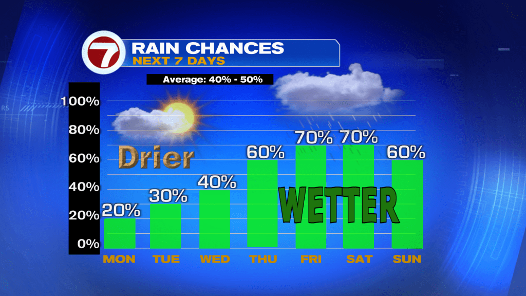
The dry stretch won’t last much longer.
Moisture gradually returns Tuesday and Wednesday, bringing a few more afternoon showers and storms, mainly inland and along the Gulf Coast.
By late week and into the weekend, forecast confidence continues to increase that a wetter pattern will develop across South Florida. Models show deep tropical moisture moving back into the region, leading to more widespread showers and storms from Thursday through the weekend.
While rainfall amounts remain uncertain this far out, rain chances are expected to climb into the 60 to 80 percent range, with periods of heavy rain possible.
For now, enjoy the sunshine and lower rain chances before South Florida’s Summer-like pattern returns later this week.
Have a wonderful day South Florida and make it a safe one!
Vivian Gonzalez
Meteorologist, AMS Certified
WSVN Channel 7