Related
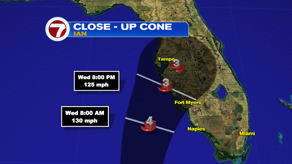
Ian’s forecast track has shifted more to the East in line with model guidance and now expected to make landfall sooner around the West-Central coast of Florida between Tampa and Ft. Myers by Thursday.
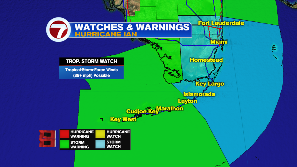
If Ian tracks close to Southwest Florida near Ft. Myers, Tropical Storm conditions could spread into inland areas of Broward and Miami-Dade. Therefore, a Tropical Storm Watch was issue for Broward, Miami-Dade & the Upper Florida Keys.
Tropical Storm Watch recap: Broward and Miami-Dade, including the Upper Florida Keys are under a Tropical Storm Watch.
The Tropical Storm Watch that was in effect for the Middle Florida Keys was upgraded to a Tropical Storm Warning. This afternoon Tropical Storm conditions with wind over 39 mph expected along with heavy rainfall.
Also, Tropical Storm Warning in effect for the Middle to Lower Florida Keys.
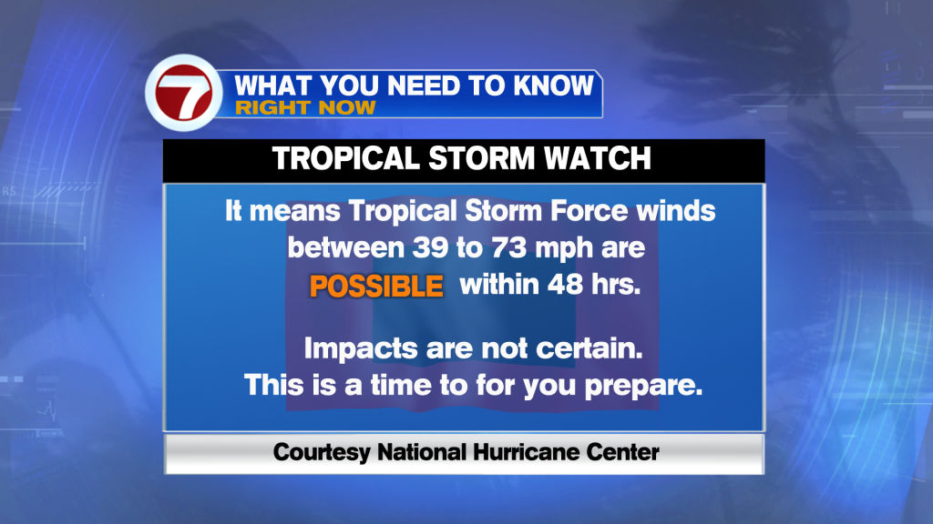
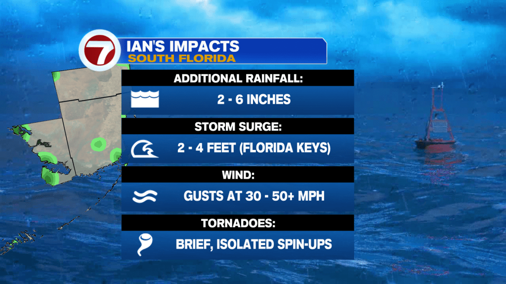
There is the potential for the center of Hurricane Ian to track closer to southwest Florida, which could bring the potential for tropical-storm-force winds to inland Miami-Dade and Broward forecasts. Across the metro, we aren’t expected sustained, 39+ mph winds but gusts could reach 30-40+ mph.
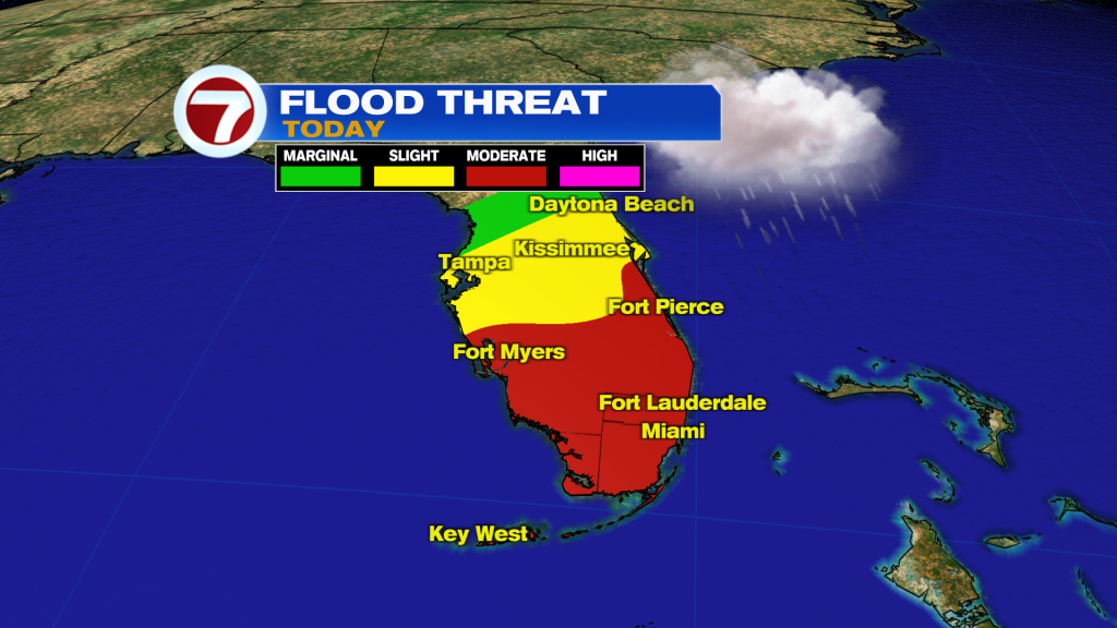
In addition to the wind, flooding from heavy rainfall will be possible today into tomorrow. The Weather Prediction Center has placed South Florida in a level 3 of 4 risk for flash flooding today.
Lastly, isolated tornadoes will be possible and 2-4 feet of storm surge across the Florida Keys.
Vivian Gonzalez
Meteorologist, AMS Certified
WSVN Channel 7
Copyright 2024 Sunbeam Television Corp. All rights reserved. This material may not be published, broadcast, rewritten or redistributed.